Saturday, October 31, 2015

Great Smoky Mountains National Park: Hyatt Ridge, Enloe Creek, Beech Gap II Lolipop Hike

My plans for this overcast Halloween was to head back over to Great Smoky Mountains National Park and finish hiking the trails off of the Straight Fork Road. I woke up early and made the drive over to the Blue Ridge Parkway. I turned off the parkway and onto the dirt Bunches Creek Road for a twisting descent through the Qualla Boundary and down to the trailhead on the Straight Fork Road. My car was the first to pull into the trailhead parking area on this overcast Saturday.

I hit the Hyatt Ridge Trail
with a steady ascent through the mostly bare trees.
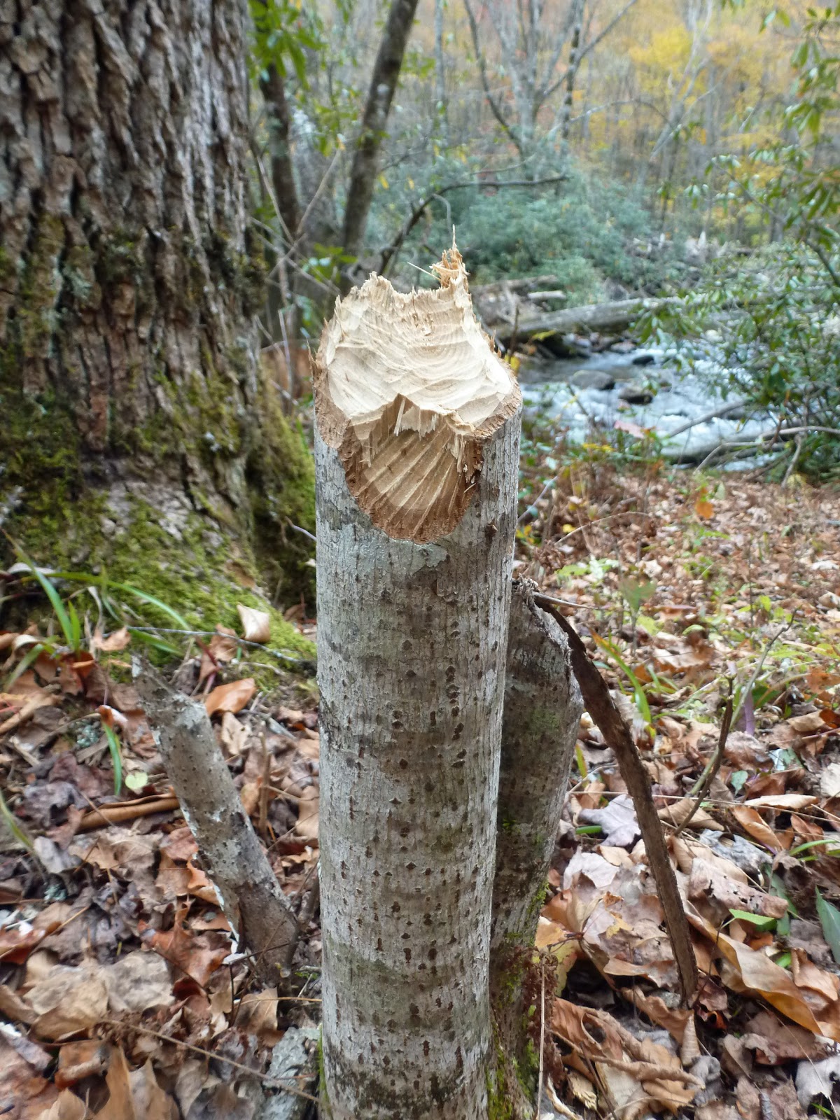
Leaf litter was thick on the treadway. This time of the year there are not many wildflowers to photograph and so I steadily climbed without stopping very often to take photos. The one thing that I did stop to photograph on this first section of the Hyatt Ridge Trail was a wasp nest on the trail.
Luckily there were no wasps to bother me.

When I had reached the junction with the Enloe Creek Trail,
I turned left and started a pretty steep descent. Soon I could hear the cascading water of Raven Fork far below. When I had reached the stream I found a very sturdy steel bridge spanning the stream with some beautiful cascades nearby.
I crossed the bridge
and admired the view of the thundering Raven Fork
before beginning a long ascent. The trail sometimes strayed far from its namesake Enloe Creek, but at other times approached it very closely.
There was one un-bridged crossing of Enloe Creek. It was easy enough to rock hop in the low water level of the fall.
There were still a few blooming wildflowers along the trail; asters and goldenrods.
There were also a few interesting fungi decorating the trailside.

I reached the junction with the Hughes Ridge Trail
and turned around. It was a pretty quick descent back to the Raven Fork Bridge. Then it was a steep climb, in colorful but slippery leaf litter,
back up to Hyatt Ridge Trail. I turned left onto Hyatt Ridge Trail and intermittently ascended and descended. There were a few large trees scattered along the side of the trail. None of the trees were state champions, but they were still impressive. This big oak was one of the more impressive trees.
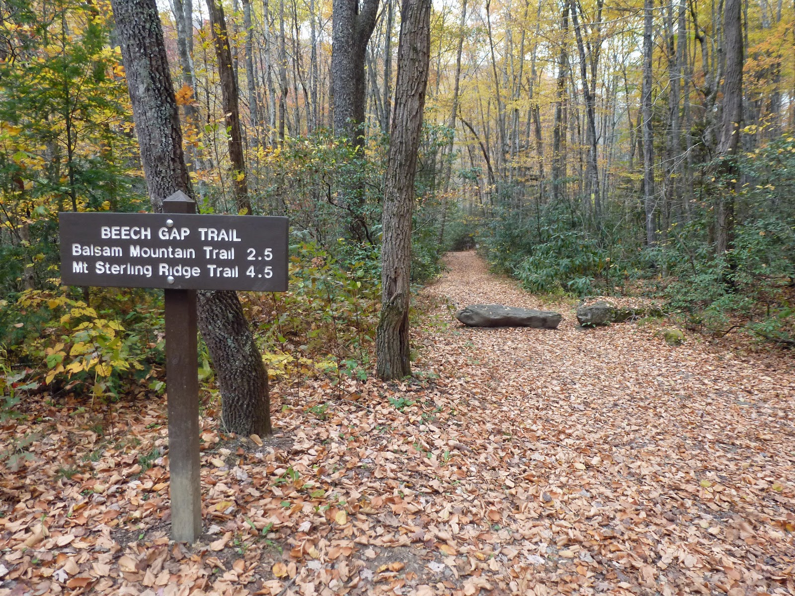
At the junction with Beech Gap Trail,
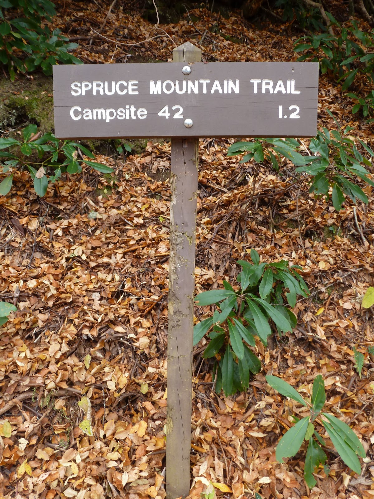
I continued on Hyatt Ridge to check out McGee Springs at Campsite 44. The campsite was pleasant, the springs were not as impressive as I had been led to believe. Resting in the spring water I found an empty can of Budweiser.
Come on people, it's called #Find Your Park, not Trash Your Park. I crushed the offending can and placed it my pack for safe transport home. Then I turned around and headed back to Beech Gap Trail.

It was a really quick descent down the Beech Gap Trail. In less than an hour I found myself at the Straight Fork Road
for the last leg of my hike: a road walk.
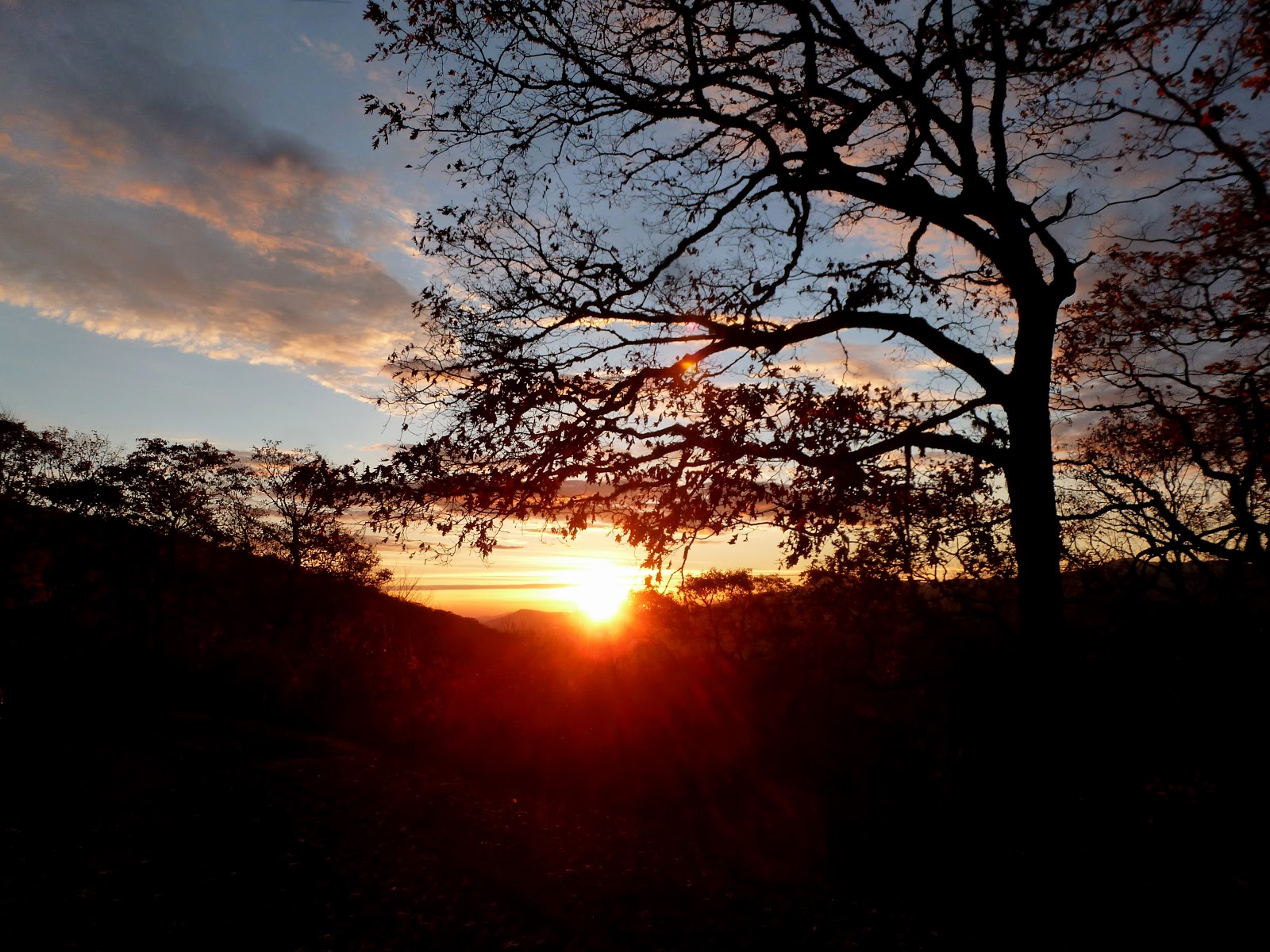
The road walk was not that bad. Surprisingly , not one car passed me as I made my way back to the car. Last week this road had been really busy. I guess Halloween has kept a lot of visitors at home. The road walk offered me lots of chances to view the pretty Straight Fork.
I also found an interesting improved spring alongside the road.
Finally, this "woolly worm" crossed my path.
I'm not sure what this coloration means for predicting winter weather though.

Happy Halloween!

Just a few photos from one of the creepiest looking cemeteries in Greeneville: Mount Bethel Cemetery.
The cemetery is in pretty bad shape. The last time I visited there were a lot of beer cans strewn about and even a hypodermic needle lying within the open Robinson mausoleum. It is really a shame because there are some prominent members of the Greeneville community and several veterans buried in the cemetery.

Wednesday, October 28, 2015

Photo of the Day: The Rainbow

Okay, I realize this photo is not from the mountains, or some other adventurous location. It was taken in my front yard. Still, I just had to capture and an image of the most vibrant rainbow I've ever seen. What this photo also shows is how badly I need a new camera. Despite my best Photoshopping efforts, the dust and other debris in my lens is very visible.

Saturday, October 24, 2015

Waterfalls of the Cherokee Indian Qualla Boundary

After my three short hikes in the Great Smoky Mountains National Park, I had to pass through the Cherokee Indian Qualla Boundary (Cherokee Reservation). There were two waterfalls shown on my map that are located on the Qualla Boundary. Both waterfalls happened to be on my route home and so I stopped at both of them.

The first I stopped at was Mingo Falls.
There is a short, but steep walk up some stairs to visit Mingo Falls, which at 120 feet tall is one of the highest in the Southern Appalachians. The falls were impressive. The graffiti and trash along the trail, not so much. It does give one an idea of what many of the attractions in Great Smoky Mountains National Park would look like if they had not been protected by the National Park Service.

After my visit to Mingo Falls, I made my way through Cherokee and then east towards Maggie Valley. Right alongside US-19 is Soco Falls.
Just like Mingo Falls, Soco Falls is very impressive, a double waterfall really. There is a somewhat maintained trail that leads to a viewing platform which offers a nice view. For the more adventurous, there is a set of ropes rigged that one can use like a handrail to descend down to the base of the falls.
Just like at Mingo Falls, there is quite a bit of garbage strewn about. Still a visit is worthwhile, especially since the falls are right off the road.

Great Smoky Mountains National Park: Beech Gap I Trail

This would be the last of the three short hikes I had planned for the day, a five mile round-trip hike on the upper section of the Beech Gap Trail. It was again a long, bumpy drive on the Balsam Mountain Road. I was relieved to get out of the car and stretch my legs.
From the trailhead at the Straight Fork Road, the Beech Gap Trail follows an old railroad grade for a short distance before making a sharp right turn and ascending towards its namesake Beech Gap. I decided to see where the railroad grade led and followed it to Straight Fork
where the water cascaded down towards Raven Fork. There was evidence that a beaver took up residence in the area.

After a quick exploration of the railroad grade, I returned to the Beech Gap Trail and started the long, unrelenting ascent. The autumn colors were amazing along this trail,
which was lower in elevation than the other two I had hiked this morning. I slowly made my way higher and higher until I had reached my destination, the junction with the Balsam Mountain Trail.
I then turned around and started to make my way back to the car.

The descent went pretty quickly.
I had to be careful though, as there were lots of loose rocks hidden under the fallen leaves that could have easily turned an ankle. There were a few wildflowers still in bloom along the trail. Mostly asters,
with some white snakeroot mixed in. I stopped for a snack at a tree with mushrooms growing out of it
and soon after was back at the car for the drive through Cherokee and back to Greeneville.

Great Smoky Mountains National Park: Spruce Mountain Trail

Hike number two for the day. After my hike on the Flat Creek Trail, I made the drive along the slow, bumpy, Balsam Mountain Road over to the trailhead for the Spruce Mountain Trail. There's not much parking at the trailhead, just a wide spot in the road. There were already two cars parked there when I arrived, so I had to squeeze in a bit, but I fit the car off the road and hit the trail.

There's not a whole lot to the Spruce Mountain Trail. It's only a mile long with a pretty steep ascent. I had the fall colors to enjoy as I huffed and puffed my way to the end of the trail.
At the trail's official end, I decided to continue on to campsite #42.
There is a sign where the Poll's Gap Trail used to connect.
Apparently, the trail was badly eroded. The sign says the closure is temporary, but there does not appear to be any effort to reopen it. On the return trip back to the car I met up with a couple from nearby Waynesville who were out enjoying this fine fall day.
I enjoyed talking to them as we made our way back to our cars.

Great Smoky Mountains National Park: Flat Creek Trail

This morning I made the drive down through Maggie Valley, North Carolina, up to the Blue Ridge Parkway and into Great Smoky Mountains National Park via the Heintooga Ridge Road. My goal for the day was to hike three short trails off of the Balsam Mountain/Straight Fork Road. I hit the Blue Ridge Parkway just as the sun was rising.
Unfortunately, the sunny sky would not last very long. Still, the beautiful autumn colors more than made up for the lack of sunny skies.

Shortly after entering Great Smoky Mountains National Park, I encountered a bull elk with his harem right along the side of the road.
After passing the elk it was a quick drive over to the lower trailhead of the Flat Creek Trail.
The hike began with a descent through the colorful forest.
Then the trail started a long, gradual ascent. I had read that there was once a side trail that led to Flat Creek Falls. I kept my eyes peeled for the old trail and found it at a trail sign.
The trail did not seem to be is bad shape as I had expected it to be. I followed it to Flat Creek and a set of cascades above the falls.
When I made my way down the trail to see the bottom of the falls I found out why the trail had been closed. It had eroded away and the only way to continue down was to slide down steep rock slabs. For once in my life I used good judgement and decided not to risk sliding down the slabs. I made my way back to the main trail.

I continued my ascent along the Flat Creek Trail which made its way through a rather grassy open forest,
evidence of past logging operations. Soon I arrived at the Heintooga Picnic Area. There is a really awesome overlook at the back of the picnic area.
From the overlook it was evident that most of the leaves at the higher elevations had fallen off the trees and that he sky was clouding over. I explored the picnic area a bit, used the restroom and admired the rustic picnic tables.
I made my way past a set of old, now-closed restrooms
and back to the Flat Creek Trail for the descent back to my car.