Finally, a day without a high chance of rain in the forecast. We've been getting a deluge lately, after a very dry June. I decided to take advantage of the favorable forecast by heading over to the Smokies for a hike. I parked the car at the Noland Divide Trailhead and began my hike with a walk along the Clingmans Dome Road.
There were some views through the clouds off to the side of the road
and I even got to see some wildlife in the form of a snail crossing the road.
I was headed over to the Forney Ridge Trail which I had hiked just a few weeks ago. This time I would be walking a loop in the opposite direction from the one I did then.
It was cool and refreshing to walk through the mist and spruce/fir forest at the beginning of the trail.
There were lots of wildflowers in bloom, including purple fringed orchis,
Turk's cap lily,
Indian pipe,
and some assorted others,
including trillium, which is no longer in bloom, but which has its bright red fruit.
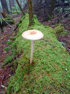
There were also lots of mushrooms.
Soon I had made it to Andrews Bald.
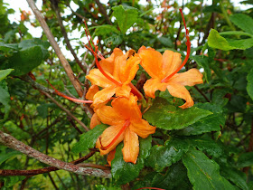
The scene was much different today than it had been a few weeks ago. There were very few flame azalea still in bloom,
and the clouds gave the area a much different feel. I found a few blueberry bushes, but unfortunately the fruit looks to not be ready for another few weeks.
I made my way back into the woods and down the narrow, overgrown Forney Ridge Trail. I would hike through sun dappled areas for a bit and then back into the fog and clouds.
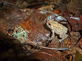
There were lots of toads out and about.
Soon I made it to the junction with the Springhouse Branch Trail where I turned left.
A horse trail, it was very muddy with lots of areas where horses had post-holed up to a foot deep into the muck. As I approached the Noland Creek Trail, I started to see evidence of former habitations. There were fence posts, rock piles, walls and even a partially intact chimney.
I stopped to eat a snack at Campsite 64, which lies at the junction of the Noland Creek and Springhouse Branch Trails. Some butterflies provided me with company.
Then I moved on.
The Noland Creek Trail closely followed its cascading namesake.
There was a trail crew out working on a new log bridge across the creek.
I was allowed to cross it and was told that I was one of the first to set foot on it. On the other side of the bridge was an unmarked trail junction. I opted to head past some building ruins and up a hill. The trail led to an old cemetery.
There were quite a few graves and the soil on top of each appeared to be freshly mounded. I guess it is a local tradition. I then retraced my steps back to the main trail and followed alongside Noland Creek.
I took the Noland Creek Trail to a four-way intersection and turned onto the Noland Divide Trail. I was starting to run out of energy by this time. There was some huge fungi
here and there along to the side of the trail. Soon, I found myself on an old road and passed an acid precipitation monitoring tower.
Shortly after passing the tower I was back at my car on the Clingmans Dome Road.


Great pics! I especially love the ones of the animals. :)
ReplyDelete