Originally we had planned on taking the canoe out for one last paddle. It was pretty chilly this morning though, and so instead we opted to try hiking at some ski trails on the Fort Frances side of the international border. After crossing the bridge Sierra got to spend some of her Tooth Fairy money at Betty's. Then we got lunch at the Harbourage, before heading across the Noden Causeway to trailhead.
We didn't know much about the trail system here, so I was afraid that it would be a swampy mess. However, it turns out that the club maintains a hiking trail and that's where we started.
Right off the bat we saw a curious squirrel.
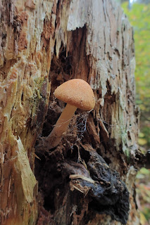
There were mushrooms everywhere!
The trail led to a photogenic beaver pond.
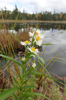
There was a picnic table there. Had we known we probably would have brought a picnic lunch with us. There was some aster blooming near the pond's edge.
After a short break at the beaver pond we moved on
passing a huge cairn.
Eventually the trail split. We took the branch to the right and shortly after intersected a ski trail. The ski trail was relatively dry and we hiked it
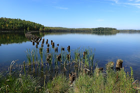
with a few views through the trees out to Rainy Lake. We stopped to rest on a big flat rock
and then hiked the ski trail back to the car.
It was an interesting hike and a place we hope to return to once snow covers the ground. They have both ski trail and snowshoe trails, so if nothing else we may come back to snowshoe.
Friday, September 29, 2017
Thursday, September 28, 2017
Superior National Forest: Herriman Lake Trail
Little Vermillion Lake and Dovre Lake Loop
I've been wanting to go for a longer hike for a while now, and today was finally my chance. I made the drive down to Crane Lake and over to the trailhead for the Herriman Lake Trails. Today I would hike the remaining sections of trail that I had not hiked here yet.I hit the trail which was wet as I had expected. I made quick time along the section of trail I had hiked in my previous visits to the area and soon enough I had crossed over the Echo River on the sturdy footbridge there. The trail crossed near to a beaver pond
and then I soon passed two guys who had spent the night at Knute Lake. Soon after I crossed into the Boundary Waters Canoe Area Wilderness
and headed in to the campsite at Knute Lake to take a break and eat a snack. Knute Lake is a very pleasant spot. I wouldn't mind spending a night there at some point.
Shortly after leaving Knute Lake I found the trail the leads to Little Vermillion Lake. It ascended to a rocky ridge where the trail was marked with cairns.
Colorful mushrooms
and maple leaves decorated the trail here and there.
There were even a few wildflowers in bloom,
including a seemingly confused bunchberry.
Soon I found myself at Little Vermillion Lake.
Despite its name, it is a fairly large lake. There is a nice beach there that I think would make a good place to swim in warm weather.
After some time relaxing on a rock at Little Vermillion Lake, it was time to move on. I backtracked to the junction with the Dovre Lake Trail
and made my way north. This section of trail seems to see lighter traffic than other sections of the Herriman Lake System. There were lots of green clubmosses along the footpath.
I passed a few glacial erratics along the trail
and a few beaver ponds as well.
Soon I found myself at the pretty Dovre Lake.
It was convenient timing given that I had to use the bathroom.
As nice as the view was, it did not look like a good place to camp as there is not really a flat place to set up a tent. I relaxed near the fire pit and ate a snack and then made my way back to the car. It had been a nice hike, and best of all I did not get rained on.
Friday, September 22, 2017
Superior National Forest: Bug Creek Trail
If I could give one piece of advice on hiking the Bug Creek Trail it would be: "don't bother". I know it sounds harsh, but there just wasn't much to like about this trail that appears to have not gotten any maintenance in some time. We had high hopes for the Bug Creek Trail. Literature that I read on the Superior National Forest website made the trail seem like a good place to hike with children, and a good place to look for birds.
We arrived to find an overgrown trailhead
and muddy parking area. I was hoping there would be a picnic table to eat lunch at, but no luck so we sat in the back of the car and ate.
After lunch we made our way over to the trailhead. While it was quite overgrown, at least there were some blooming wildflowers to admire.
We made our way down the first section of trail, hoping it might be less overgrown. Instead it was overgrown and muddy.
We were able to follow a short spur to an overlook of the wetland there.
Few birds were sighted though. We attempted to follow the longer spur of the trail, but it was muddy, overgrown, and with lots of blowdowns to climb over. We gave up where a small bridge had been washed away.
At least we got to admire some nice fall color at Elephant Lake!
We also made the drive into Orr to hike the short Bog Boardwalk and play at the playground overlooking Pelican Lake. It wasn't a complete failure.
Friday, September 8, 2017
Voyageurs National Park: Paddling Sullivan Bay
Today's paddle will most likely be last time we take the canoe out this year. Fall paddling in northern Minnesota, with cold water and days that are often windy, is not really made for 4 or 5 year-olds. With calm winds forecast for today, we decided to head down to Ash River and explore Sullivan Bay.
We visited the visitor center and ate lunch before putting the canoe in the water at the very nice paddle access. Then we were off. We headed east on Kabetogama Lake before heading upstream on the Ash River. Soon enough we had paddled into Sullivan Bay and found the very nice overlook at the end of the Sullivan Bay Trail.
The view is much different from down on the water! We paddled around an island and explored a few coves on the bay.
In one cove there were a lot of lily pads,
and even some wild rice.
We explored a little bit further up the river and then turned around to take advantage of the wind at our backs.
Dragonflies flew around us.
It was a quick paddle through the narrows on the river
and back to the canoe access. We even saw a pair of otters playing in the water near the access point!
Friday, September 1, 2017
Kay-Nah-Chi-Wah-Nung Historical Centre (Manitou Mounds)
Since my days off have changed, Noelle and I decided that today would make a great day to head across the border and check out the Kay-Nah-Chi-Wah-Nung mounds along the Rainy River. We've seen the mounds before; from across the river at Franz Jevne State Park, but we've always wanted to get a closer view.
It was a long, uneventful drive to the historical centre. We arrived to find an empty parking lot, ate a quick snack, and then headed inside to explore. There was a pair of sturgeon in an aquarium that we watched for a bit.
Then we checked out some of the other exhibits inside,
before heading outside on the trails.
There were some wildflowers in bloom like gentian,
asters,
sneeze weed,
black-eyed Susan,
goldenrod
and others.
We passed by a cemetery that I believe was part of a mission.
The side trails all had animal names and included the Ojibwe name.
There were a few big bur oak trees along the trail
and we saw some deer on our walk.
To be honest, we hadn't planned on walking all the way to the end of the trail, but to see the mounds we had to walk that far. We arrived at a distant overlook of one of the major mounds
and decided that since we had come that far, we might as well walk to the end of the trail. There was a plaque marking the historic site
and a trail that meandered through the prairie
by another large mound
with views of the Rainy River.
It was a fairly quick walk back to the car.
Sierra was tired though, so I had to carry her on my shoulders about a third of the way back. It was an interesting visit.
It was a long, uneventful drive to the historical centre. We arrived to find an empty parking lot, ate a quick snack, and then headed inside to explore. There was a pair of sturgeon in an aquarium that we watched for a bit.
Then we checked out some of the other exhibits inside,
before heading outside on the trails.
asters,
sneeze weed,
black-eyed Susan,
goldenrod
and others.
We passed by a cemetery that I believe was part of a mission.
The side trails all had animal names and included the Ojibwe name.
There were a few big bur oak trees along the trail
and we saw some deer on our walk.
To be honest, we hadn't planned on walking all the way to the end of the trail, but to see the mounds we had to walk that far. We arrived at a distant overlook of one of the major mounds
and decided that since we had come that far, we might as well walk to the end of the trail. There was a plaque marking the historic site
and a trail that meandered through the prairie
by another large mound
with views of the Rainy River.
It was a fairly quick walk back to the car.
Sierra was tired though, so I had to carry her on my shoulders about a third of the way back. It was an interesting visit.


