This morning we packed up our campsite at Bird's Hill Provincial Park and headed to the other side of Winnipeg to check out Fort Whyte Alive, a nature center and preserve. The first thing that you notice when you drive in is prairie dogs.
Sierra enjoyed watching them immensely! After checking out the prairie dogs for a few minutes, we went inside the Alloway Reception Centre where we learned a little bit more about the site to plan our visit. We headed from there to the Interpretive Centre, where they have an interesting burrowing owl exhibit and then out into the natural part of the site. We walked past a Canada goose nesting
and over to some boardwalks that cross wetlands.
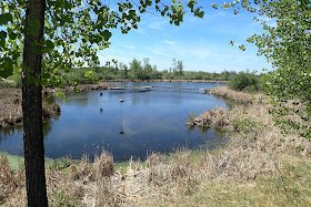
We saw a few ducks and turtles in the wetlands,
but not much else.
We were getting hungry at this point, and so we went back to the car to get ourselves some lunch before we returned to the trails. We would be hiking the Carolyn Sifton Trail. It started at a sod house.
It was nice and cool inside
and the volunteer there talked to us for a bit and showed us a book about life in a soddy. Then we continued on
to the bison overlook and then the Family Treehouse.
The bison were a bit closer to the treehouse,
so we got a decent view of them from the top. Sierra explored a "shelter" made out of tree branches for a bit
and then we returned to the car for the long drive back into the US.
Monday, May 28, 2018
Saturday, May 26, 2018
Winnipeg Goldeyes vs. Sioux Falls Canaries at Shaw Park
Our first baseball game outside of the United States! After our stop at the Centre of Canda, we drove to Bird's Hill Provincial Park where we checked into our campsite and set up camp. Then we drove into The Forks, parked the car, bought our tickets for the night's game
and then headed over to the Market at the Forks to eat dinner and kill some time before the start of the game.
Shaw Park is a really nice, modern baseball stadium.
Our seats were along the third base line
and offered a nice view of the Canadian Museum for Human Rights
and a partial view of the Louis Riel Bridge. The game itself was pretty exciting as well. We left after the top of the ninth inning because Sierra was getting pretty tired.
The Canaries had taken a 6 to 5 lead at that point and that's the way the game ended.
The Centre of Canada
We were originally going to make a trip down to the Twin Cities for the Memorial Day weekend. However, it was forecast to be hot, really hot for the 3 days (temps in the mid 90s F) and so we opted to head north instead to Winnipeg to see a baseball game and check out the zoo. On the drive into town we noticed the Centre of Canada alongside the Trans-Canada Highway and we just had to stop to take a look.
Sunday, May 20, 2018
Superior Hiking Trail: Wild Valley Road to Wisconsin Border
What a wonderful day to get out into the woods of northern Minnesota. We ate breakfast in Carlton, said goodbye to the friends we camped with and then headed out for the southernmost section of the Superior Hiking Trail and the Wild Valley Road Trailhead. We parked the car, had our photo taken at the trailhead sign,
and then headed into the beautiful spring woods.
Blooming wildflowers included bloodroot,
trout lily,
trillium,
wild ginger
and anemone.
At one point Noelle found a large vertebrae on the trail.
Eventually we made a short road walk
and then headed back into the woods,
traveling parallel to a set of railroad tracks for a bit. Soon enough we were at the unmarked Wisconsin border
and the end of the Superior Hiking Trail.
We turned around and started to make our way back to the car,
enjoying the lively spring scene, wonderful weather and splendid company.
Sunday, May 13, 2018
Superior National Forest: Big Moose Trail
With another day of beautiful spring weather forecast for today, I awoke early and hit the road, headed for the Echo Trail and Big Moose Trail in Superior National Forest. I've really grown to love the Echo Trail. There are lots of interesting lakes that I hope to paddle this summer and quite a few hiking trails as well.
After a stop for gas and a coffee, I had made it to the trailhead just as another vehicle pulled in. I would not have the trail all to myself on this day, but it turned out to be okay. The folks I was sharing with were nice people who even offered some tips about where to take a break at the end of the trail.
The hiking turned out to be very easy. The were not many blowdowns to navigate around and though there were a few wet spots, the trail was mostly dry. The first wildflowers of spring were blooming: trailing arbutus,
bellwort
and violets.
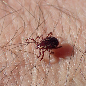
I didn't see much in the way of wildlife and what I did see was mostly unwelcome: ticks!
I passed a beaver meadow
and then entered into the Boundary Waters Canoe Area Wilderness.
Shortly thereafter I found myself at Big Moose Lake.
It is a beautiful spot at the end of the trail, but there is an even better spot at a campsite that you can follow an unofficial trail to reach. I ate a snack there and admired the view.
I even spied a pair of red crossbills flying around and landing on the campsite's fire grate.
After about 20 minutes I was read for the return hike.
I passed by several glacial erratics off to the side of the trail.
I was back to my car in a no time at all, so on the way back to International Falls I did a little bit of exploring. I checked out Meander Lake (Looks like a great place to camp and paddle the canoe!) and the Little Indian Sioux River
before heading to Astrid Lake to hike the section of trail I had missed on my hike there 2 weeks ago.
Monday, May 7, 2018
Superior National Forest: Norway Trail
With a forecast of warm temperatures and clear skies, I set off for another hike along the Echo Trail in the Superior National Forest. Today my destination would be the Norway Trail, just east of my last hike at Astrid Lake.
I pulled up to the north trailhead of the Norway Trail and hit the trail, immediately crossing a small stream on a wooden bridge. Next came a long section of climbing over and through blown down trees and shrubs that almost constantly blocked the trail.
I considered giving up on my hike due to all the blowdowns, but instead persevered and continued making slow progress south.
Many of the trees have catkins on them now and dealing with the blow downs at least gave me an opportunity to observe them up close.
Just like last week's hike, there was a lot of evidence of moose along the trail. There were piles of scat pellets here and there,
and even a tree scraped of its outer bark.
Eventually the blow downs seemed to become less numerous and thus the hiking became easier. I crossed a stream on a beaver dam and made my way through a wetland.
Most sections of the trail seemed very well built. Perhaps the Norway Trail dates back to the CCC-era?
The trail joined a lightly-traveled forest road for a section (with a sign pointing to a helipad)
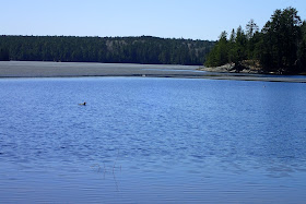
and then headed into the Boundary Waters Canoe Area Wilderness. I was hoping for a beautiful view at the end of the trail at the North Arm of Trout Lake. It ended up not being the most scenic spot. The lake was still partially iced-over, but a pair of loons swam and dove on the ice-free section.
The most beautiful spot on the trail ended up being a beaver pond a short bushwhack off of the trail.
I ate a snack at the edge of a partially-drained beaver pond
and then retraced my steps back to the road.
I would walk the road back to my car.
I just didn't want to deal with all the blow downs again. It was pretty easy walking on the road and there was even some nice scenery here and there.
Still, after 16 miles of walking and temperatures in the 80s, I was relieved when I made it back to the car for the drive back to International Falls.


