Friday, December 30, 2022

Hawkeye Point: The Highest Natural Point in Iowa

We left Wisconsin today, hoping to beat a possible storm that could make our travel more difficult. As we passed through southwest Minnesota, I opted to take a break at Hawkeye Point, the highest natural point in the state of Iowa. It just a few miles south of the Minnesota border. Noelle and I have been to Hawkeye Point before. 


We visited in April of 2002 on our way to our seasonal park ranger jobs at Wind Cave National Park in the Black Hills. At that time the location was private property. Since then, the site has been bought by Osceola County and made into a park.

We arrived to find the driveway snow-covered. The snow didn't seem too deep though, and so I drove through it to get closer to the highpoint. Upon turning the car around, I got it stuck in a snow drift and I had to use my feet to dig the front wheels out and push while Noelle had the car in reverse. After about 10 minutes we got her out. We found a better place to park and got out to stand at the highpoint and take some photos. 


There is a really cool looking mosaic at the highpoint, but unfortunately it was covered with snow today. Besides the highpoint itself, there is a barn museum,


and an observation stand from which you can view the surrounding, relatively flat, Iowa landscape.


One of the cool things about our last visit was that the owner of the site greeted us and gave us a free keychain. 


I still had that keychain until just a few years ago, when it basically disintegrated. Interestingly, for a $1 donation, you can still get a keychain at the site. 


That's exactly what Noelle and I did before leaving the site for the rest of our drive back to Nebraska. 


Thursday, December 29, 2022

A Winter Hike up Sugar Loaf Bluff

We've been in Wisconsin, visiting with family for the holidays. It's been exceptionally cold since we got here, and I've got a bad case of cabin fever. Noelle and I decided to get out and go for a short hike over in Winona, Minnesota at Sugar Loaf Bluff. We've hiked Sugar Loaf before, during MEA Weekend in 2018.

It was a nice drive across the Mississippi River and into Minnesota. It has warmed up substantially since a few days ago and a lot of the snow that had piled up and drifted on the sides of the roads has melted away. Still, I knew we would be hiking in the snow and so at the start of the hike Noelle and I each donned one of the microspikes from my pair. The trail is short, but fairly steep. Soon enough, we were approaching the trail's namesake: Sugar Loaf Bluff.


Near the base of the cliff, there's a nice view looking out over the city of Winona and the Mississippi River. We paused here for a quick break,


and then ascended the last section to the base of the Sugar Loaf.


At the base of the Sugar Loaf, there are trails that lead to views on the north and south sides. We enjoyed the vantage from both,


and then started the descent back down to the car. Along the way, I noticed a small natural window that I had overlooked on the way up.


It was a quick (and slippery) descent back down to the car and our trip to Aldi for a little shopping.

Wednesday, November 23, 2022

The Grunwald Christmas Tree Adventure 2022

Today, Noelle, Sierra, Rosie and I grabbed the hand saw and tie down straps and made the drive up to the Nebraska National Forest just south of Chadron. We stopped to use the restroom at Chadron State Park and then headed into the forest just east of the Pine Ridge Job Corps. We followed the road there through mostly grassy areas until we found a nice hillside covered with ponderosa pines of about the right size near to where the Pine Ridge Trail crosses the road. We scoured the hillside there for just the right tree for about 30 minutes 


when I spotted her high on a ridge: the perfect tree!


We cut the tree down,


then I dragged it down to the road, got the car and we strapped it to the roof for the drive home. 


Along the way we stopped in Alliance for an early dinner.

Tuesday, November 22, 2022

Horsetooth Rock via Soderberg Trailhead

Today I wanted to get up into the mountains again. Relatively nice weather was in the forecast and so I made the drive south into Colorado and through Fort Collins to Horsetooth Mountain Open Space. This time I decided to start a hike from the Soderberg Trailhead which is closer to the reservoir than the trailhead we used for the Horsetooth Mountain Loop and Horsetooth Falls hikes.

I parked in a mostly empty parking lot, paid the fee and then hit the trail, the Swan Johnson Trail. The trail starts at the site of the Soderberg Homestead and there are a few historic buildings there.


Just after passing the historic buildings, the trail passes through a meadow area 


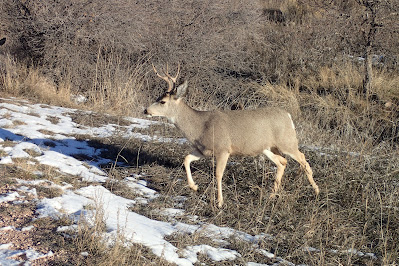
and there was a group of mule deer grazing there. They showed absolutely no fear of me and I could literally have reached out and touched a few of them.


I followed Swan Johnson to a rough road known as the Towers Trail. It's a pretty steep climb up the road to a cluster of communications towers. At points along the road there are some really nice views.


I followed the Towers Trail up to the Loggers Trail, where I detoured for a short loop. I rejoined the Towers Trail for a bit and then took the Herrington Trail to Spring Creek Trail. Spring Creek Trail ascended up through a meadow. There were plenty of great views up to Horsetooth Rock.


Spring Creek rejoins the Towers Trail for a last, steep climb up to the towers. 


From there is an amazing view of the high mountains to the west, including the most conspicuous mountains around, Longs Peak and Mount Meeker. 


From the towers, I made my way over to the Horsetooth Rock Trail and carefully made my way up the rock, made slick in places, by ice and snow. I enjoyed the view from the summit for a bit 


and eventually started to make my way down. On the way down I took the West Ridge Trail to the Towers Trail and followed that trail/road all the way back down to the parking lot.

Tuesday, November 8, 2022

Nebraska's Devil's Den Canyon

Almost a year ago, Rosie and I hiked Gilbert-Baker Wildlife Management Area in a search for Devil's Den, a deep and narrow canyon. While I was able to locate the canyon during that visit, I couldn't convince Rosie to make the steep climb down into it. I vowed to return in the future to explore the canyon. Well, today was the day for my second attempt at Devil's Den. I made the drive up to Harrison and parked at the trailhead near the pleasant looking campground. Then I hit the trail, 


following a two-track road. The road heads north towards a fence line. From there I roughly followed the fence west.

The fence line zigs and zags a bit. 


I followed it to the base of some bluffs, then followed the base of the bluffs southwest. There were lots of great views to the south end of the ridge.

Eventually, I picked up another road that roughly followed the base of the bluffs. I followed this road until I came to an area where the road passes the mouth of a small canyon. I headed up this canyon on another road. Again, the views were impressive. 

At one point while I was taking a break, I noticed a high, rocky promontory that appeared that I might be able to climb. I decided to go for it and scrambled up to this point above Devil's Den. The views from this point were excellent. 


After a few minutes on my little peak, I decided it was high time to find the Devil's Den. I carefully descended from the summit and returned to the top of the ridge where the road was. From there I found a faint path that followed the edge of a small canyon, the upper reaches of the Devil's Den. It took a little while, but eventually I found a way to descend into the canyon. At first, I wasn't sure if I was in the right place. I headed up-canyon and the walls started to become more perpendicular. I spotted some graffiti and knew I must be getting close. 


The next thing I knew, I was in Devil's Den. 


I explored the scene a bit. There was a lot of graffiti, which surprised me. I didn't think a place so remote would be so disrespected.


After about a half hour, I realized it was time to head out. I made the steep climb out of the canyon and took one last look.


Then, I made it back to the road for the walk back to the car. Since I've got the best route down, it was a quick walk. The views to the north were pretty spectacular!

Tuesday, November 1, 2022

Roosevelt National Forest: Crosier Mountain from Glen Haven

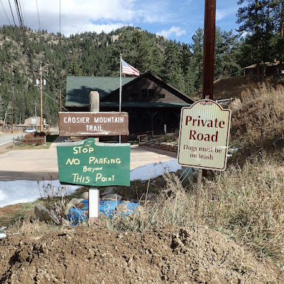
 This morning I made the long drive from Gering to the small mountain town of Glen Haven, Colorado. I started the drive at 5:20 a.m. and made it to the trailhead for today's hike almost exactly 3 hours later. I parked along the road across from the Glen Haven Town Hall, 


and then hit the trail. The trail starts up a driveway, past a few homes.


After a short time, the route leaves the driveway and follows an actual singletrack trail.


Almost immediately, views open up to the high peaks to the west.


Scattered throughout the lower stretches of the trail are slash piles. 


It looks like they are reducing fuels to lower the risk of wildfire.

Soon enough the trail climbs to the top of a low ridge where the Crosier Mountain Trail intersects with a trail that leads to the H-G Ranch.


Opposite the trail that leads to the ranch is another, unofficial trail that leads up to Knapp's Knob. I thought about hiking to Knapp's Knob on the way back to the car, but I was too tired to make the attempt late in the day. After reaching the ridge, the trail descends slightly to a small stream, then ascends up towards Piper Meadows. There are lots of great views along the way.


Piper Meadows looks like a great place to see elk, but unfortunately, I didn't see any. The trail entered back into some woods and started climbing. As I climbed, I could see evidence of elk: tracks and scat. I even heard elk bugling. I never did see any though. I left the meadow and headed back into the woods, climbing steadily. Soon enough, I was at the junction with the Crosier Mountain Rainbow Trail.


From here on out I would be hiking trail that I've been on before. I would also be hiking on some snowy patches of snow.


From the junction with the Rainbow Trail, the path leads through thick forest of small trees.


Once I reached the Summit Trail, the climb started in earnest. 


Before I knew it, I was standing on the summit admiring the view west into Rocky Mountain National Park.


After about 20 minutes of admiring the view, it was time to turn around and head back down. The trip back offered lots of great views towards the high peaks.


I wandered Piper Meadows a bit to get a good photo of the view and ended up finding the skeletal remains of an elk.


From there it was a quick return to the car with more great views.


Once back at the car, I made the drive into Loveland to get a beer at Loveland Ale Works. Then, it was the long drive back home. A great hike, but too much driving.

Update of November 3, 2023:

After I had hiked nearby Triangle Mountain, I decided to head over to the nearby Crosier Mountain Glen Haven Trailhead 


to check out Knapp's Knob. It was a pretty easy hike, but I didn't really think there was much there worth the detour.


At least I had nice views of Triangle Mountain, which I had just climbed, on the way back to the trailhead.