
Tuesday, June 7, 2016
Photo of the Day: We've got a new tool for adventure!

Monday, June 6, 2016
Voyageurs National Park: Kab Ash East Loop and Park Highpoint
I took advantage of my day off today by heading out for a solo hike to the highest point in Voyageurs National Park. I hit the road at about 10 am and arrived at the trailhead for the Beaver Pond Overlook and Kab Ash Trail a little bit before 11 am. It was relatively cool and windy this morning, but the trees of the boreal forest blocked most of the wind and allowed me to hike in short sleeves.
As an added bonus there were virtually no bugs!
The section of the Kab Ash Trail that I hiked today is seldom hiked. In fact, judging by the copious amount of scat lining the trail, I would say it is used by wolves more often than people. There is not always a dirt treadway.
 Instead, the trail is often marked by flagging
 and cairns,
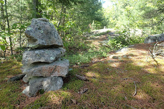 and less often by trail markers nailed into the trees.
 The trail followed close to the park boundary
 and passed by a survey benchmark,
 then climbed the wet slippery rock through scattered blueberry bushes
 to the vicinity of a communications tower.
 As I approached the tower, I knew to leave the official trail and bushwhack to the tower site where the highest point in Voyageurs National Park is located. I wandered around a bit and eventually found a cairn
with the summit register located inside.
 I signed the register and posed for a photo

 before heading back to the trail to complete the loop.
The second half of the hike was filled with wildflowers. There were lots of bunchberry,
 starflowers,
 Canada mayflower,
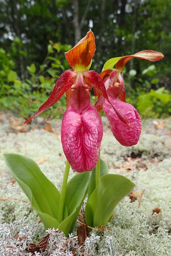
 and pink lady's slippers which are also known as moccasin flower.
 (I couldn't help but photograph each one I saw.)
 I also saw lots of blue bead lily or Clintonia, but only found one with flowers in bloom.
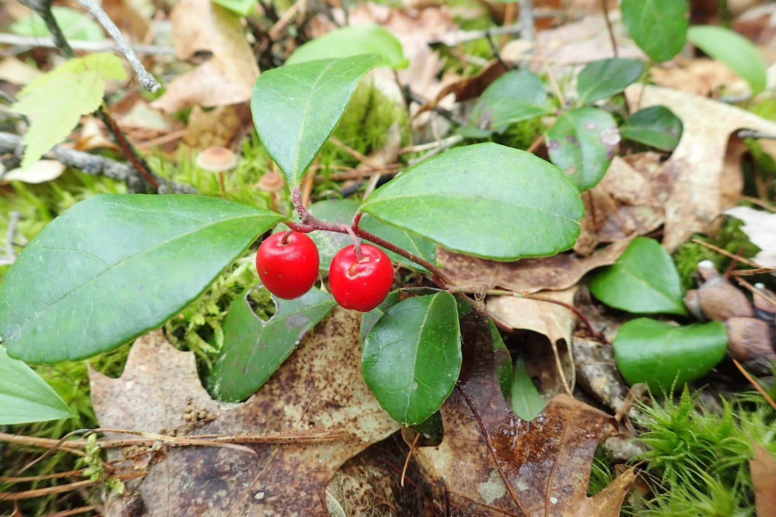
 Besides flowers, the wintergreen had berries on it.
 Soon enough I found a signpost marking the end of my loop. It had the Hike to Health rubbing plate on it.
 It was a short walk from that point back to my car.
As an added bonus there were virtually no bugs!
The section of the Kab Ash Trail that I hiked today is seldom hiked. In fact, judging by the copious amount of scat lining the trail, I would say it is used by wolves more often than people. There is not always a dirt treadway.


with the summit register located inside.


The second half of the hike was filled with wildflowers. There were lots of bunchberry,



Monday, May 30, 2016
Orr Bog Walk
While roadtripping around Koochiching County to explore more of our new home area, we made an unplanned detour to Highway 53 just south of Orr. Since we were in the neighborhood, we decided to take a walk on the Orr Bog Walk.
 We hit the boardwalk
 with bugspray in my pocket, just in case. I'm glad we brought it, as it was quite buggy with lots of mosquitoes.
Because it was so buggy, we did not spend a whole lot of time exploring and did not see any carnivorous plants. We did see some marsh marigold in bloom,
 some wild calla,
 and Labrador tea.
 We also saw a few frogs
 on submerged portions of the boardwalk along the Pelican River.
 Perhaps we will return at a different time of the year to see what's in bloom.


Because it was so buggy, we did not spend a whole lot of time exploring and did not see any carnivorous plants. We did see some marsh marigold in bloom,


Search for the Grunwald Access
Once Noelle and I knew we would be moving to International Falls, Noelle requested information from the Chamber of Commerce. A few weeks later a packet of information arrived, including a glossy map of recreational opportunities in Koochiching County. As I perused the map, one item stood out. It was a canoe landing on the Big Fork River called the Grunwald Access.
 Since our last name is Grunwald, I knew then that when we arrived in northern Minnesota we would have to find the Grunwald Access. Today was the day of our search.
We started the day's adventure with a stop in Ranier to have our picture taken with Big Vic the Voyageur.
 After that we moved through town and finally started to make our way south at Pelland,. We drove US 71 down to Big Falls where we stopped to check out the Big Falls of the Big Fork River.

 We also had a picnic in the pleasant park there before turning our attention to the Grunwald Access. One would think that since the canoe landing is marked prominently on our map, that it would be easy to find. We turned off onto Highway 6 and drove past the area where we believed the landing should be three times without any success. We even drove down an old two track road until we reached a gate with "No Trespassing" signs. A visit to the Grunwald Access was just not in the cards for today.
Unsuccessful at our attempt to visit the Grunwald Access, we moved on to the Little American Falls. We followed a set of wooden stairs out of a picnic area and down to a viewing spot overlooking the Big Fork River.
 On the way back to the car, Sierra found some dandelions in seed and a few wishes.
 After our quick visit to Little American Falls we moved south out of Koochiching County and into Itasca County and the small town of Effie. The first thing to greet us in Effie was this clever piece of of political folk art.
 No matter what your political persuasion, I think we all feel the way the creator of this piece felt at some times. Effie must be known for its mosquitoes, because mosquito sculptures were all around town on the cafe and near the welcome sign as well.
 Nothing like a mosquito sculpture to make the tourists feel welcome!
We got gas and ice cream in Effie
 before moving on east, and then north. We quickly stopped to admire the Church of Saints Peter and Paul.
It's a Russian Orthodox church built from 1915 through 1918 by Russian immigrant homesteaders.
 It is now listed on the National Register of Historic Places. From the church we moved east into St. Louis County and over to Orr, where we walked the short Bog Walk. We then headed north through my town of Ericsburg
 and then home. It was a long day and even though we were unsuccessful in finding the Grunwald Access, it was nice to see more of the area in which we now live.

We started the day's adventure with a stop in Ranier to have our picture taken with Big Vic the Voyageur.


Unsuccessful at our attempt to visit the Grunwald Access, we moved on to the Little American Falls. We followed a set of wooden stairs out of a picnic area and down to a viewing spot overlooking the Big Fork River.


We got gas and ice cream in Effie

It's a Russian Orthodox church built from 1915 through 1918 by Russian immigrant homesteaders.


Friday, May 27, 2016
Franz Jevne State Park
Today Noelle, Sierra and I made last minute plans to head over to our nearest state park: Franz Jevne State Park. We arrived at the park just in time for lunch, and so we started our visit with a picnic along the banks of the Rainy River.
 As we ate, we admired the proliferation of wildflowers in bloom nearby, including nodding trillium, bellwort, lots of violets,

 and others.
After lunch we headed to the campground and started a hike of the Hiking Club Trail
near campsite 15.
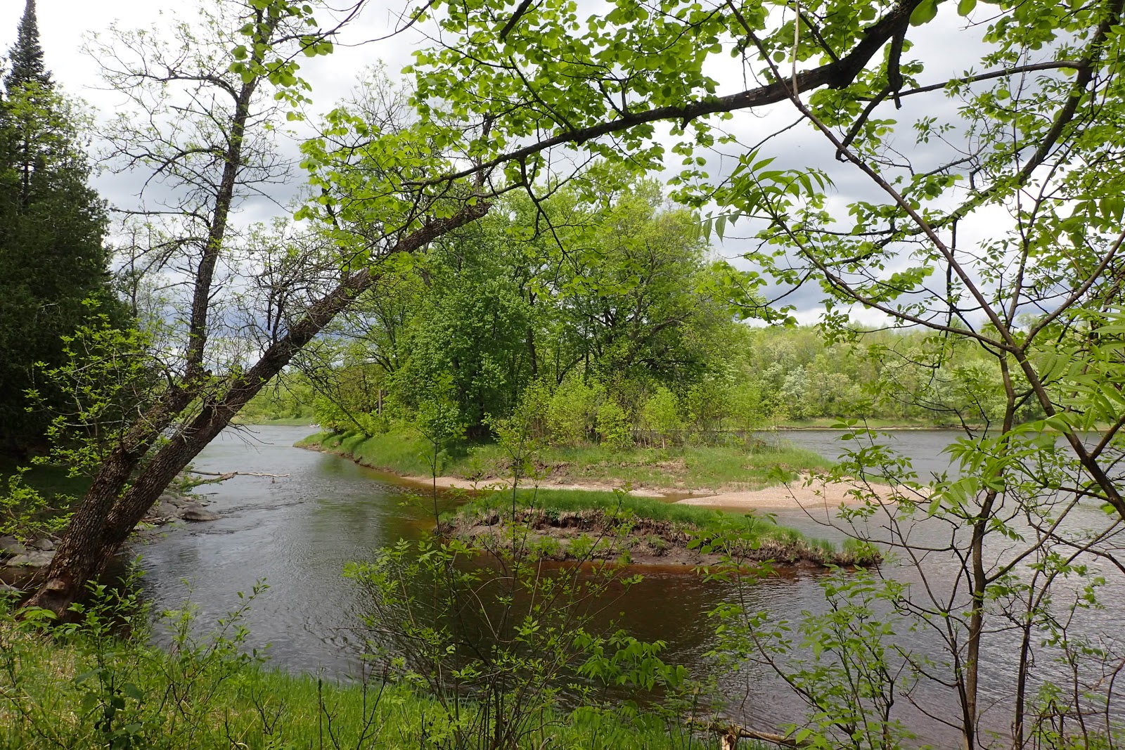
 The trail led down to the banks of the Rainy River where we found a few boundary markers.
 Due to the middle of the river being the international boundary, the markers are placed on land on the American side of the boundary with the understanding that the actual boundary is measured a set distance from the marker. From the trail we spied an intriguing island in the river that I'm guessing is American.
 We saw a yellow lady's slipper in bloom,
 along with some bunchberry.
 We also saw a few frogs

 which Sierra appreciated. Soon enough we got the Hiking Club password and turned around to head back to the car.
 It was a pleasant visit to Minnesota's smallest state park.


After lunch we headed to the campground and started a hike of the Hiking Club Trail
near campsite 15.




Sunday, May 22, 2016
Photo of the Day: Magnolia Warbler
This poor little bird crashed into one of the large picture windows of our rental home. It stayed on the ground panting for a bit, but after a while we noticed it was gone. Hopefully, it's doing okay and fully recovered from its crash.


Subscribe to:
Posts (Atom)