Friday, May 10, 2024

Pine Ridge Trail: Coffee Mill Trailhead to Roberts Loop

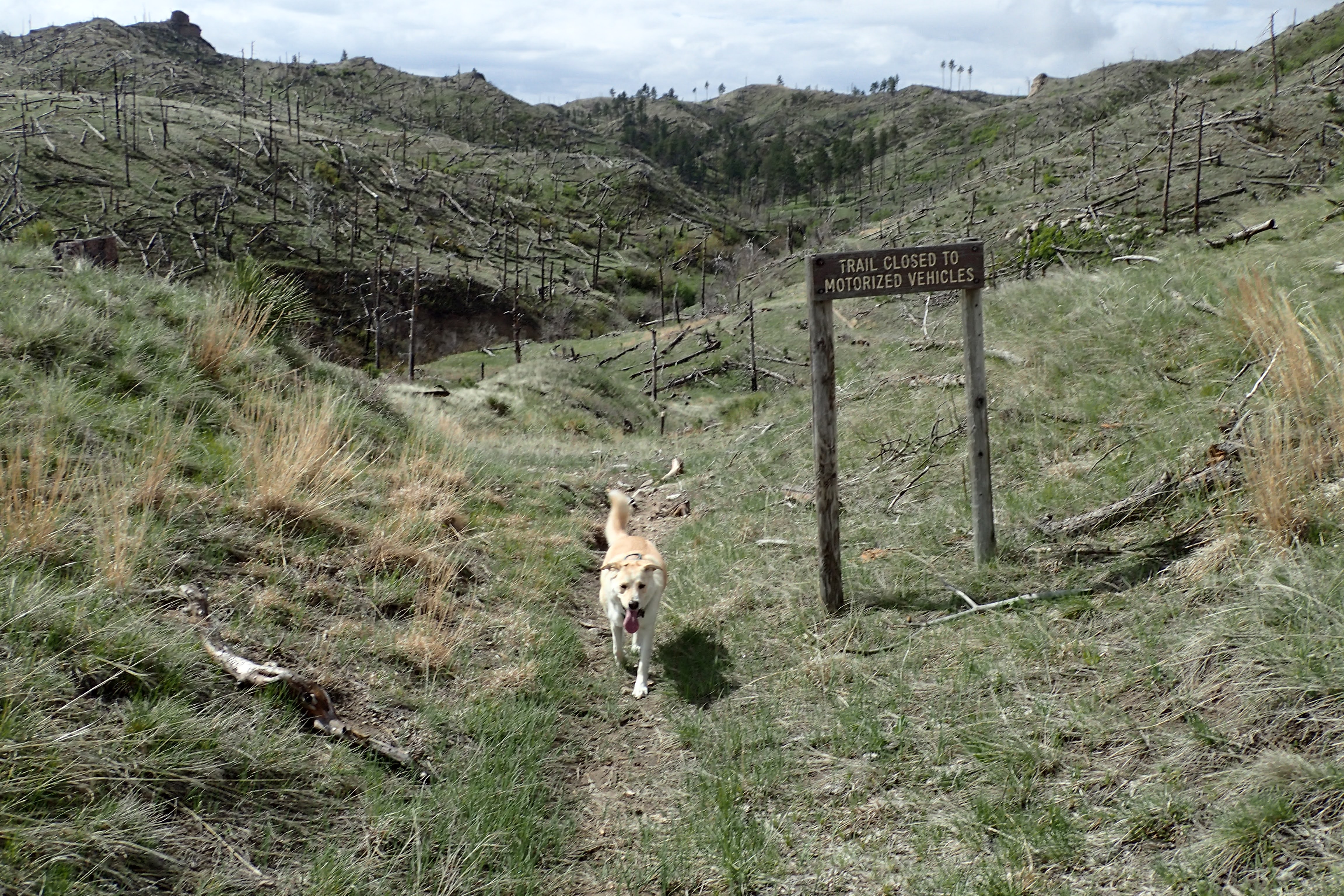
I had the day off today and the weather was forecasted to be beautiful. I packed my day pack, grabbed Rosie and we drove north to the Pine Ridge to hike a section of Nebraska's Pine Ridge Trail. We arrived at the trailhead, off of the muddy Deadhorse Road and hit the trail.


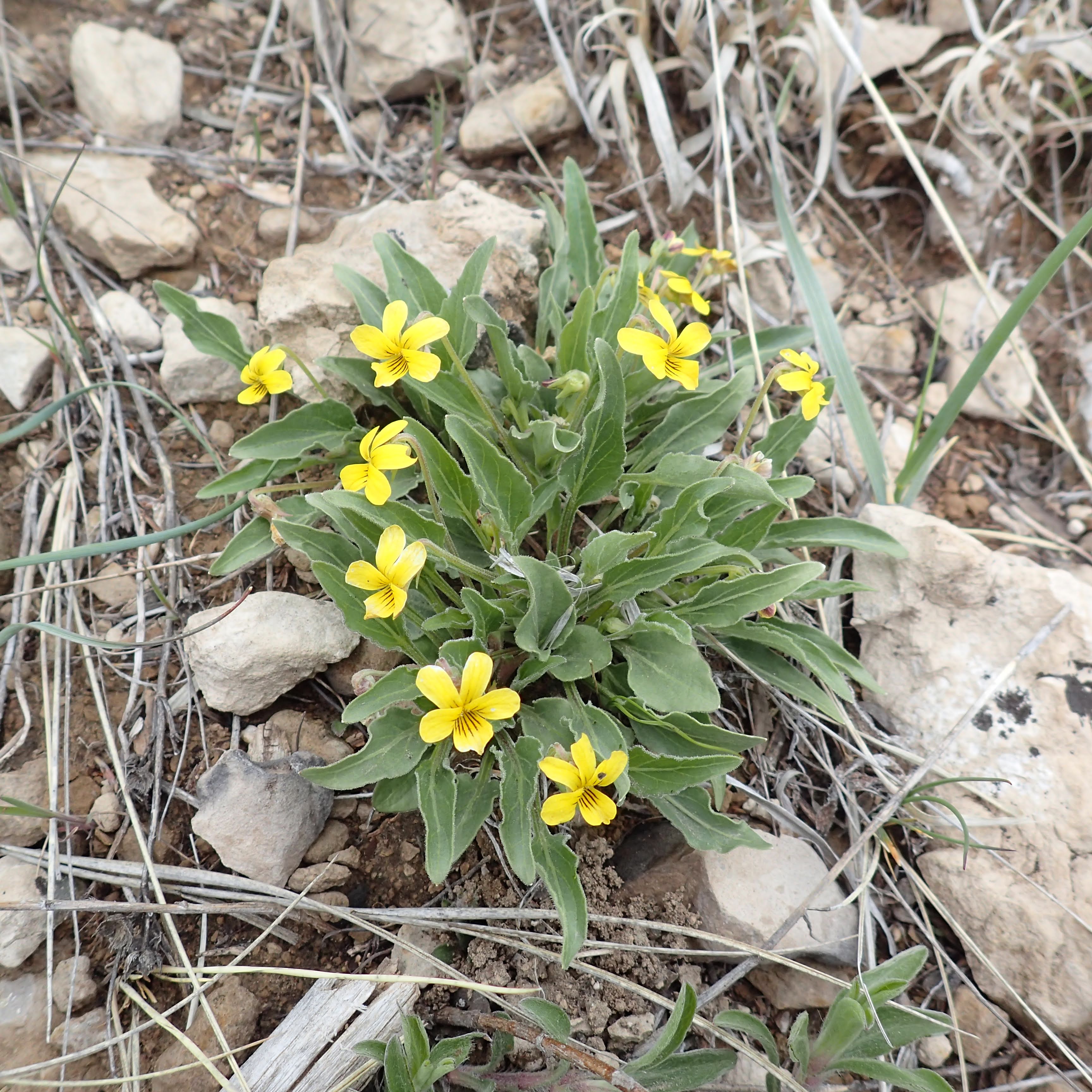
 The prairie grasses are really starting to green up and the early season wildflowers are blooming!

False dandelion

Unfortunately, the ticks are also out. We found over 30 on Rosie!

The trail traverses some really interesting terrain. There are rugged ridges and valleys with streams flowing through them. We really enjoyed the scenery of the green hills.


We took a few breaks along the way to relax and take in the scenery.


Blooming flowers included:

Prairie golden pea

Death camas

Oregon grape

Star lily

Hood's phlox

Nutall's violet

At the top of one of the ridges, we followed a two-track road for a bit,


before dropping down into another valley.


As we ascended out of this valley, we entered the Pine Ridge National Recreation Area.


Parts of the trail in the recreation area were difficult to follow as many of the posts marking the trail were lying on the ground. 


After losing the way for a short time, we continued our ascent with more great views.


Soon we reached the Roberts Loop, which we had hiked a while back.


This would be our turnaround point. We hiked through the same beautiful scenery back to the car.


Wednesday, April 24, 2024

Vedauwoo Natural History Site

A beautiful day to be out on the trails. Rosie and I headed down to Cheyenne to check out an area I had read about, but never before visited. Vedauwoo Natural History Site which is owned and managed by Laramie County School District and Laramie County Community College. I had read about it on the website/blog "Away From the Grind" and they refer to this spot as Area 242.  

It was an uneventful drive southwest into Cheyenne, though the wind blew the car around a little bit. After fueling up in town, we made the drive to this spot, located just outside of Curt Gowdy State Park. There is a gated road that leads into the natural area. We parked in a wide spot near the gate (making sure not to block it) and then hit the trail by passing through a stile. 


The road/trail branches twice. Each time we took the left fork.


The views from the road were very nice, featuring scattered pines and distant views of the type of rock formations that the Vedauwoo area is known for.

At the point where road ended at a turnaround, we followed the sign posted there down to a small pond.


Rosie and I enjoyed the view of the pond and then headed through a lovely picnic area, 

on the trail signed for the waterfall.


Along the way we passed an old stone structure,
and lots of blooming pasqueflower.


We made our way down to Crow Creek and of course Rosie had to wade in for a bit.

Besides pasqueflower, there was lots of other early blooming flowers to be seen.


We eventually made our way to the waterfall, really more of a cascade. It was pleasant, nonetheless. 

The trail continued past the waterfall and got a little more rugged and difficult to follow. It passed through diverse habitats including riparian areas near the water, open fields and dry, cactus studded barrens. 


We crossed the creek on a small, wood bridge and then climbed steeply out of the little canyon we had descended. Once back up on the prairie edge, we passed through an education area, followed a road for a bit, and then made our way back to the pond for the final ascent back to the car.


I had planned on checking out the High Plains Arboretum today also. However, upon arrival I noticed that pets are not allowed. Instead we headed into town where I got lunch at Weitzel's Wings

and a beer at Blue Raven Brewery.


Thursday, April 18, 2024

Guernsey State Park: Red Cliff and Round Top Mountain

Not the best weather forecast for my days off. Still, I wanted to get out for a hike. I decided to take Rosie out to Guernsey State Park to hike some trails I've noticed, but can't find much information about: The Red Cliff Trail and the Red Cloud Trail. 

After a couple of stops in Torrington for gas and the Bread Doctor, we arrived in the park and parked near the dam for the start of the Red Cliff Trail.


The trail starts along the spillway for the dam, heads into a wooded area and soon reaches a junction with a trail that leads to the museum.


At this point I wanted to continue on the Red Cliff Trail, but it was rerouted to a detour.


I found the detour to be confusing (in retrospect I think I just needed to follow the small flags that had been placed) and so ended up following a road past a small decrepit building,


what I think are the stables that were built by the CCC,


and an area where the park seems to dump old picnic tables and other stuff. Soon, a set of stairs descended to what was labeled as "Round Top Mtn" Trail. I followed this trail through pleasant prairie scenery.


This trail intersected with a two-track road. 


There was no sign indicating which way the trail continued and so I followed the road for a bit, passing early-blooming wildflowers 


and scattered chunks of chert.


At a point where the trail appeared to peter out, I turned around to head back in the opposite direction. I passed the junction with the trail I had followed and took this road to another road that ascended a small mountain, what I suspect is Round Top Mountain. Rosie and I followed the road up the mountain.

There were great views down to the reservoir.

The summit area was relatively flat. There was a solitary picnic table there and more great views.


After a very brief stop on the summit, we started to make our way back down. About 2/3 of the way down I noticed a trail that left the road and so we followed it to the CCC Museum. From there we took another trail to the lower parking area, followed a gravel road for a bit and then traveled cross-country to our original trail. Here, I decided to hike through the closure to see what we had missed. We followed the Red Cliff Trail down into a ravine where a large tree had fallen (probably the reason for the closure), ascended the other side and followed the cliff above the free-flowing North Platte River below the dam. The views from there were awesome!


We even caught a view of a large group of pelicans soaring in the air above the reservoir 

and scared a juvenile bald eagle off its perch on a power pole. Then we returned to the car.

Next, I decided we would figure out where the Red Cloud Trail goes. I parked just off the road and Rosie and I started hiking.

It turns out the Red Cloud Trail doesn't go very far. It led maybe 1/4 mile through a ravine 

and up to a gravel road. I'm guessing it's just a way for the cabin owners who have summer homes along the gravel road to be able to walk down to the water.