Today Noelle and I had my parents as babysitters and so we took advantage of the situation and went out for a hiking "date". This was only the 5th time we've been out together alone since Sierra was born 26 months ago. We decided to head over to Rocky Fork, an area of land which has only recently been opened to the public. It was private property until purchased by some conservation buyers and has been transferred to both the State of Tennessee and the US Forest Service.
We made the drive through Greene and Washington Counties and entered Unicoi County. We drove I-26 to the exit for the Tennessee Visitor Center and Rest Area and then headed off into the Rocky Fork area. We parked at a gate near an old home site where only a chimney remains,
and hiked on a closed, gravel road along Rocky Fork.
The area is really beautiful and we particularly the small waterfalls and cascades on Rocky Fork.
Eventually our route veered away from the main stream and we followed an old road that was a bit overgrown but occasionally marked by flagging tape. Sometimes the old road followed the bed of a small stream, and so the walk through this section tended to be muddy. Soon enough the old road left the stream and crested a saddle. It was at this saddle that our route followed the ridgeline up and up to our destination. Close to the end of the ascent we saw a bear, just a little one and it seems to have been alone. Unfortunately, I did not get a photo of the little guy.
After seeing the bear, it was just a short, but steep,
walk up to the summit of Whitehouse Mountain. We enjoyed the view from the summit which included nearby I-26 into NorthCarolina and down into the "Valley Beautiful".
We ate a snack there
and took a photo of the two of us
before heading back down the mountain.
Friday, December 19, 2014
Monday, December 15, 2014
Ijams Nature Center: Jo's Grove and Secret Pond Trail
With Mom and Dad in town we decided to head over to Knoxville for the day. Our first stop was the always amazing Ijams Nature Center. We checked out the exhibits inside and then headed over to the nature play area which they call Jo's Grove.
There is a construction project of some sort going on at Jo's Grove, but enough of the area is still open that we were able to explore it a bit and Sierra had a fun time going inside the cabin
and some of the artistic structures there.
After playing, we headed over to the Secret Pond Trail. We hiked the short trail,
not knowing what it led to. It turns out that it led to an unimpressive old stock pond that whose waters were covered with a thin green coating of duck weed. There was a chimney nearby, along with a bench that Pop-Pop used to rest his aching knees.
After a short rest,
we returned to the car and then drove into Knoxville for dinner at Tupelo Honey Cafe and a walk around downtown.
Monday, December 8, 2014
Great Smoky Mountains National Park: Mount LeConte via Trillium Gap Trail
I've had a bit of cold lately. However, when I awoke this morning I was feeling a bit better and decided it would be okay to go for a hike today. I headed over to the Smokies so that I could add over 100 miles of new trail miles hiked in the park for 2014. Before today's hike I was just under 100 miles at 99.2 for the year. I drove to the Cherokee Orchard Trailhead where I found my car was the first to be parked in the lot for the day. I hit the trail hiking on the lower reaches of the Trillium Gap Trail
which very closely parallel the Roaring Fork Motor Nature Trail.
Eventually the trail stops paralleling the road and becomes a wide, well-trodden path that hundreds of hikers use every day in the spring, summer, and fall to reach Grotto Falls. On this particular day, I had the trail all to myself though. I soon found myself approaching Grotto Falls.
The trail actually goes behind the falls and is a pretty little cascade.
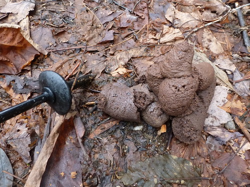
I decided not to stop near the cold spray of the falls and continued on my ascent up Mount LeConte. I saw some sign of bear in the form of a huge pile of scat.
No bears would be seen on this day, however.
As I ascended higher, limited views opened up through the leafless trees.
I started to see icicles along the trail
and there were even a few areas where water that had run across the trail had frozen.
Still, there was no need for traction devices. I knew I was near the lodge area when I saw a "No Horses" sign.
Sure enough I was soon in the lodge complex. LeConte Lodge is mostly abandoned right now. The only person up there is the winter caretaker, the lodge is not open to guests in the winter. The dining hall was boarded up and the date sign did not show today's date.
I stopped to use the one unlocked restroom, took a last look back
and then began my descent on the Rainbow Falls Trail which I had ascended a few weeks ago.
It was a fast descent. I saw one other hiker high up on the mountain. He was wearing a running singlet and running shorts while I was bundled up with my fleece and mittens. He told me he had seen a large bear a mile down the trail, but the bear never did show himself to me. I stopped briefly at Rainbow Falls
before making the rest of the trip down to the car. Altogether, the hike was about 14.5 miles with 8 miles of new trail to add to make a total of 107.2 for the year.
Friday, December 5, 2014
Andrew Johnson National Historic Site: Holiday Open House
Here are some images of the Andrew Johnson Homestead and Visitor Center decked out for the holidays. Hope you enjoy!
Saturday, November 29, 2014
The Grunwald's 2014 Christmas Tree Adventure
Today was the day for the Grunwald's annual Christmas Tree hunting trip. This year's adventure was a little bit different than that of previous years though. We went back to Frosty Mountain Tree Farm where we had gone last year. However, this year we went to lunch before headed to the tree farm and our lunch spot was very appropriate. We ate at the Choo Choo Cafe in Erwin, TN.
It is a furniture store where you sit amongst the furniture displays. The food was pretty good, but the highlight of the place is the train and Christmas town displays which we all really enjoyed looking at.
After eating we made the short drive to the tree farm where we bought a nice specimen of Fraser Fir.
It was a good day for tree hunting as it was warm, yet there was still a little bit of snow in shady areas.
We've already got the tree set up in the living room and Sierra is really excited about it. She even got to put on some new ornaments and they're Thomas ones!
Today was a great start to our Christmas holiday season.
Monday, November 24, 2014
Boston National Historical Park and the Freedom Trail
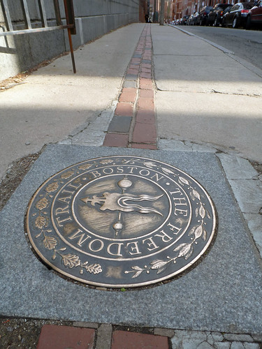
Over the course of my 4 days in Boston, I spent most of my time (when not at my conference) exploring town on the Freedom Trail. Heck, the trail passed right in front of the hotel I stayed in. For those of you who aren't familiar with the Freedom Trail, it's a 2.5 mile long trail, marked with a red line,
that meanders through downtown Boston and Charlestown passing 16 historic sites. What an interesting way to hike and experience history at the same time! Here is my experience with it as I hiked parts of it on 3 different occasions.
The Freedom Trail starts in historic Boston Common, a short walk from my hotel, the Omni Parker House.
Boston Common itself was established in 1634 and is the oldest public park in the United States. The trail heads north to the Massachusetts State House,
then back south before leaving Boston Common and passing Park Street Church.
Park Street Church is an attractive structure dating to 1809 and is the site where William Lloyd Garrison gave his first anti-slavery speech. Perhaps even more interesting though, is the adjacent Granary Burying Ground.
The Granary Burying Ground contained some of the most ornate (and perhaps creepy) old, carved headstones that I've seen in any cemetery.
It is most significant though as the burial site of such famous patriots as John Hancock,
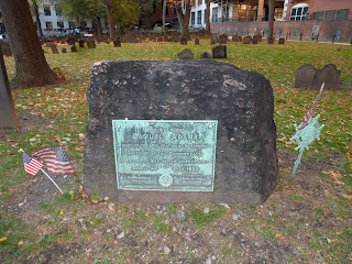
Samuel Adams,
Paul Revere,
Robert Treat Paine (a signer of the Declaration of Independence).
Mother Goose
and Benjamin Franklin's parents
are buried in the Granary Burying Ground as well. From the Granary Burying Ground the trail continues on Tremont Street to King's Chapel.
When I visited the King's Chapel site on Monday, it was raining hard, and so I did not spend much time exploring it or the adjacent burying ground. The cemetery there contains the grave of Massachusetts' first governor John Winthrop and Winthrop's grave is said to have inspired Nathaniel Hawthorne to write The Scarlet Letter. From The King's Chapel the trail turns onto Schools Street and passes the site of the first public school in America. Today the Old City Hall stands there, along with a nice statue of Benjamin Franklin.
The trail continues on to the Old Corner Bookstore which was a meeting place for such writers as Hawthorne, Longfellow, Emerson, and Dickens. Today it houses a Chipotle and on Thursday I stopped in to eat a burrito just like Charles Dickens would do if he were alive today.
From the historic Chipotle restaurant, the heads across the street to the Old South Meeting House.
When I stopped by on Sunday, they were having their yearly Thanksgiving service inside and so I did not get an opportunity to see the exhibits inside. It was at a meeting in this location that the ideas that hatched the Boston Tea Party were first discussed. From the meeting house the trail follows Washington Street to the Old State House.
The Old State House is, perhaps, one of the most recognizable historic landmarks in Boston. It houses a subway station and a museum. When I visited on Sunday I discovered the museum to cost a whopping $10. I felt the admission was a bit pricey, and so I headed back outside. I'm glad I did, because I got to see some history going on outside the building right before my very eyes. Located on the building are a gilded, gold lion and unicorn which are symbols of the British monarchy. The existing statues are replicas of the originals that burned in 1776. The replicas themselves, however,date from 1882 and were recently restored. I got to see the restored unicorn lifted using a crane and hoisted over the Old State House to be set back in place on top of the building.
After leaving the Old State House the Freedom Trail heads over to Faneuil Hall
and the large marketplace there. On Saturday night I attended the tree lighting ceremony here. The Hall itself houses the Great Hall
which seems to be a meeting space used for ceremonies and also house the National Park Service visitor center for Boston National Historical Park.From Faneuil Hall the Freedom Trail weaves through the streets of the North End. Interestingly I saw a Highland Brewing sticker on a post along the trail.
It was a little reminder of my current home in the southeast.
After passing a plethora of Italian restaurants the trail finally arrives at another historic site, this time the Paul Revere House.
I paid to go into the house and was pleased with my self-guided tour of the small home. I than headed back out onto the street for the walk to Old North Church.
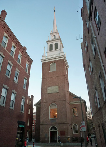
Again I paid to see the interior of the Old North Church
which is the site from which the two lanterns were hung to warn the patriots of the advancing British. From the church
there the trail heads up Hull Street to the Copp's Hill Burying Ground.
Copp's Hill is another old cemetery, though it is not as interesting as the Granary Burying Ground. Still, I enjoyed seeing all the old headstones.
From Copp's Hill the Freedom Trail crosses the Charles River into Charlestown.
In Charlestown is the interesting Bunker Hill Monument which I visited twice. My first visit was at night which was peaceful and quiet.
My second visit was during the day
and allowed me an opportunity to go inside
and climb the nearly 300 stairs to the top. The top was a bit small and crowded, so after snapping a quick photo looking back towards downtown Boston
I headed back down and then over to the Charlestown Navy Yard.
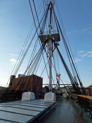
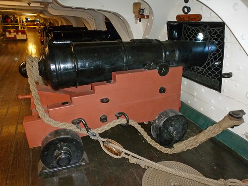
The highlight of the Navy Yard is the USS Constitution,
or Old Ironsides, as she is affectionately known.
However, there is a lot more to the Navy Yard than the Constitution. There is the interesting Commandant's House,
the USS Cassin Young,
and all the structures associated with a shipyard
including the dry dock
and this interesting advertisement.
I thoroughly enjoyed my time "hiking" the Freedom Trail. My only regret is that I did not have enough time to fully explore its sites. I guess that just means I will have to head back to Boston at some point to explore again. Hopefully, Noelle and Sierra will be able to visit with me in the future!
Subscribe to:
Posts (Atom)


