Sunday, March 19, 2023

Gateway Natural Area: Overlook Trail and Water Treatment Plant Road

 After lunch at the Colorado Room, we were all ready to burn some calories with another short hike. We had never taken Mom T up the Poudre Canyon before, so I thought it would be fun to make the short drive out to Gateway Natural Area to hike the short Overlook Trail, which we had skipped during our previous visit. 

It's a short trail, but it's also quite steep. The trail starts ascending immediately,


offering views of the surrounding mountains right off the bat. 


The trail makes a loop as you approach the top of the ridge. We opted to take the western part of the loop. There were some icy stretches on this part of the loop since it doesn't seem to get much sun. Still, Mom and everyone else safely negotiated the ice up to the end of the trail and a really nice overlook of the surrounding mountains, 


with a view down to the Cache la Poudre and Highway 14.


After a few minutes relaxing at the overlook, we started our descent back down the trail.


This time we took the east side of the loop.


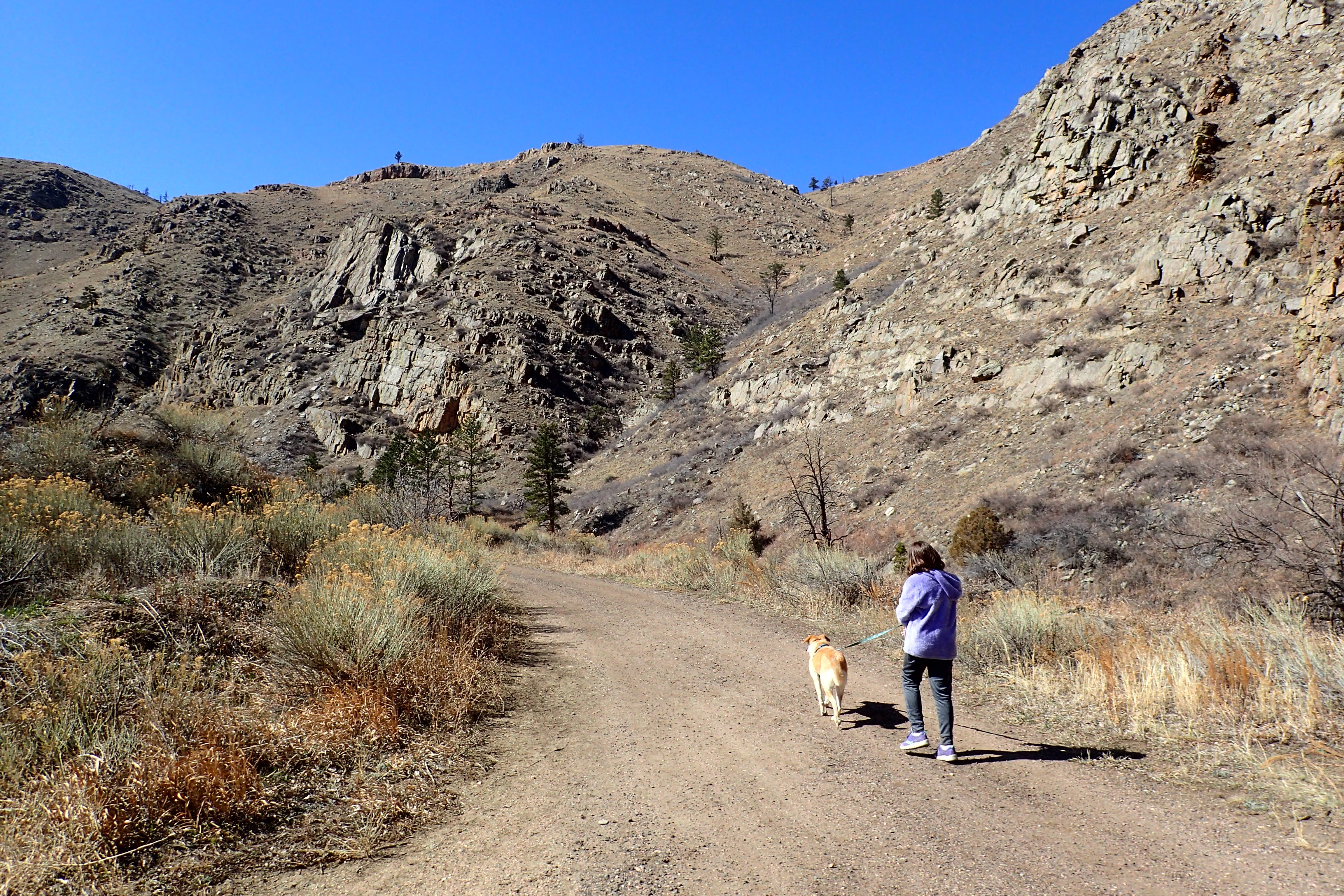
Once we had made it back down to the bottom, we were in the mood to walk a little further, and so we decided to walk the gravel road that paralleled the river and cuts through the old water treatment plant.


 It is a very scenic, old road.


At one point, Noelle caught a glimpse of a herd of bighorn sheep up on the mountainside high above. I tried to take a decent photo, but they were too far away for me to get a decent photo.


We walked to the end of the road, which leads to a dam. Then, we started back towards the parking lot.


We drove out of the Poudre Canyon and over to Odell Brewing, where we ended our visit to Fort Collins with some beers. 


Riverbend Ponds Natural Area

I've been wanting to get down to Fort Collins for a day of hiking, eating and exploring for a couple months now. Today Noelle, Sierra, Mom T, Rosie and I finally made the trip down into Colorado. We arrived at the northern Riverbend Ponds parking area off of Timberline Road. 


We immediately hit the trail passing by some of the namesake ponds, water-filled remnants of sand mines.


 Parts of the trail system that we chose passed between two different ponds on a narrow dirt path.


Looking west across some of the ponds were really nice views of the mountains, including Longs Peak and Mount Meeker which are quite the landmark in Northern Colorado.


The trails are easy, being relatively flat, with lots of great views.


We didn't see a whole lot of wildlife, just a few ducks and Canada geese. I would love to come back when there's more to be animals to be seen and the plants are green and flowering. Still, I think we all enjoyed stretching our legs on the trails here.


We made our way to the Prospect Street parking area and started back to the car. Along the way we took a side trip through a wetland on a wooden boardwalk.


By the time we made it back to the car, we were all hungry for lunch. We opted for the Colorado Room and were not disappointed by the delicious sliders.

A mural in the outdoor seating area at the Colorado Room


Sunday, March 12, 2023

Bead Mountain

Today Noelle, Sierra and I went for a short drive out to Bead Mountain Ranch to make the short hike up to the area's namesake Bead Mountain. When we arrived at the parking area, we were surprised to find another vehicle in the lot. This isn't a very popular area.

Anyway, we immediately started our hike. 


There's not a trail here, so we merely walked through some cattle pasture towards our objective.


On the northeast side of the "mountain" is a small area of eroded badlands. 


We hiked towards the badlands, then traversed the base past some boulders that have eroded out of the mountain.


Then, we made our way up the slope that led to the saddle between the two summits.


Looking back towards the parking area, were great views of Scotts Bluff.


Once we had reached the saddle, 


we opted to hike to the shorter western summit first. It was a pretty steep climb.


The western summit is covered with pipy concretions of limestone. 


There were great views in all directions. 

After a short time exploring, we made our way back to the saddle and started the ascent up to the eastern summit. 


Again, there were great views in all directions. 


This eastern summit is part of a long flat ridge that extends about 200 yards east. We followed the ridge and started to descend.


At the end of the ridge, we started our final descent down some steep loose slopes. We were all relieved when we had reached the flatter terrain at the base of the mountain. 


From here it was a short hike across the pastures back to the car. We ended our day with beers and lunch at Flyover.

Sunday, March 5, 2023

Rawhide Wildlife Habitat Management Area

Today, Noelle, Sierra and I headed west into Wyoming to hike at an area we have never explored before: the Rawhide Wildlife Habitat Management Area. It was an uneventful drive through Torrington and the area was easy to find; well signed turn-off on US 26. We found the parking area and hit the trail, which was muddy in some areas and icy in others.

It is honestly not the most interesting trail. Basically, it follows an old road down in the flood plain of the North Platte River. Once we crossed over a small stream on a footbridge, 


things got a little bit more interesting.

Here there's not much of a trail. We cut over towards the river and were rewarded with nice views.


We saw a bald eagle flying and lots of evidence of beavers.


After exploring the river area, we started to make our way back. I found part of a small animal skull.


Then, a little later I found most of a deer buck's skeleton.


We made our way back to the car 


and then drove into Torrington for lunch at the Broncho Bar.