Tuesday, May 23, 2017

Superior National Forest: Herriman Lake Trail

Herriman Lake Loop

I just needed to get out of the house. Even though the forecast called for rain, I decided to get out and go for a hike. My destination was the Herriman Lake Trail System in the Superior National Forest near Crane Lake. I saw three bald eagles on the drive to the trailhead and arrived ready to hike in the rain.

The trail was pretty swampy, like I had expected.
On the first short section of trail I found a deer skull in the leaves off to the side of the path.
I crossed the Echo River on a footbridge
and continued on a section of trail I had hiked last June. For a while, my path ran parallel to the Echo River.
There were lots of ferns unfurling their fronds
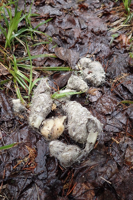
and a few scattered piles of wolf scat, unmistakable with large chunks of bone embedded in fur.
wolf scat
I soon came to a turn off for the Herriman Lake Loop
where, last time I had hiked on the Echo River Loop.

The trail ascended a ridge and then quickly descended to a beaver dam and pond.
On the other side of the dam the trail ascended another ridge
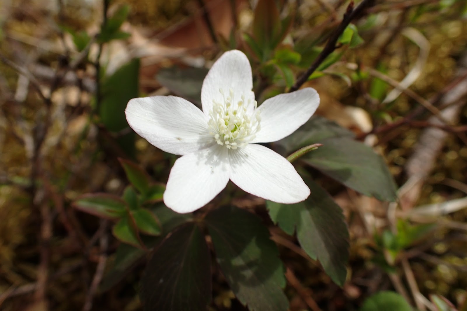
and followed that ridge for a pretty long distance. Along the way were lots of blooming wildflowers.
The trail entered the Boundary Waters Canoe Area Wilderness
and soon there were scattered views through the trees down to Herriman Lake. The map I printed off the Forest Service website showed a view point, but I never did catch a clear view of the lake.

I then descended off the ridge above Herriman Lake and down into the swampy lowlands,
filled with marsh marigold.
On the exposed rock ledges the trail was marked with cairns.
I spied a float plane overhead
and then made my way down to Knute Lake.
There is a nice secluded campsite on Knute Lake and I relaxed there and ate a snack. The view was beautiful and there was plenty of leatherleaf,
and blueberry
in bloom along the water's edge. Eventually, I parted ways with the serene scene at Knute Lake and made my way past a few more beaver ponds and meadows
to the trailhead and my car.

Monday, May 15, 2017

Superior National Forest: Echo Lake Campground Trail

After our exploration of the Vermilion Falls area, we were hungry for more. We had noticed a sign for the Echo Lake Campground on the way to the falls and decided to head over there to check it out before going home. We pulled into the campground and quickly discovered that there is a short trail there; the Echo Lake Campground Trail (not to be confused with the Echo Lake Hunter Trails).

We parked the car at a campsite and made our way up the trail.
The first section of trail was not very exciting, just a walk in the woods,
but as we made our way further along the trail it started to climb up a rock ridge and got much more interesting.
Like many of the trails in this area, the Echo Lake Campground Trail is marked with piles of rocks called cairns. However, the cairns on this trail are much larger
and more frequently placed
than the cairns typical on area trails. I guess this trail gets lots of use compared to those others, and the large cairns are a good way to make sure nobody gets lost. We followed cairns past blooming shrubs
and noticed that the blueberry bushes have flowers!
There were also violets
and anemone in bloom.

Soon the trail made its way to an exposed rock face with views over the surrounding forest.
We followed the rock face
to the most interesting part of the trail; a large glacial erratic perched on the rock.
Sierra and I had Noelle take our picture with the large rock and then we moved on. By this point Sierra had found a rock that interested her, with crystals visible on its face. Noelle convinced Sierra to leave the rock in the forest and Sierra obliged by adding it to one of the cairns.
Besides the wildflowers and large glacial erratic, we saw some wildlife. We saw a squirrel
and a snake.
Our first snake sighting in quite a while. There had been no views of Echo Lake from the hiking trail, so when we arrived back at the car we decided to head over to the lake to check it out. We walked a path down to a swim beach (and surprisingly a playground) and Sierra and I dipped our piggies in the water.
We saw some aquatic life in the as well, including a few dragonfly nymphs.
After about 20 minutes of playing in the water and sand, it was time to head back to the car for the drive back to International Falls. The day had been a wonderful family adventure!

Superior National Forest: Vermilion Falls and Portage Trail

Today forecast of warm temperatures meant that Noelle, Sierra and I just had to get outside to enjoy the weather. I decided on a trip down to the Crane Lake area so that we could visit Vermilion Falls. About a year ago we made a similar trip to the Vermilion River Gorge. However, after that hike we were tired, and so we skipped the side trip to the falls.

We picked up a sandwich for a picnic lunch and then made our way south. We drove through Buyck, but noticed the bikes on the signs were gone. Soon enough we found the turnoff for the road to Vermilion Falls. We pulled into the empty parking lot,
grabbed our picnic stuff and made our way to the falls. The falls were pretty impressive,
but it is difficult to get a really good view of them. We explored the them from various angles on the viewing platform
and rocks below.
We also checked out the view downstream.
Then we found a picnic table for our lunch.
As we ate, we noticed flowers blooming, including violets
and a shrub with white flowers.
After lunch we headed over to the portage trail
to check out a feature on the river know as "the Chute." On our walk to the Chute we saw more flowers; hepatica,
anemone,
bellwort, and white clusters of flowers we could not identify.
The ferns were in their "fiddlehead" stage.
We crossed the gravel road we had driven to the site near a bridge crossing the river. There were impressive views from the bridge
and a pair of bald eagles were perched in a tree nearby.

Soon, I noticed a sign alongside the river marking the start of the portage around the Chute.
The trail ascended above the river here
and towards the end of the portage there were views down to the cascading river.
We made our way to the end of the portage where the river slowed down and widened into a large eddy.
We turned around and retraced our steps back to the car at the picnic area.