Tuesday, December 31, 2013

Brew Beers Eve 2013

We've never really been big on celebrating New Year's Eve, but now that we have Sierra we have an added excuse to not go out. Instead we've elected to stay in and instead of drinking mass quantities of alcoholic beverages, we brewed mass quantities of alcoholic beverages.
This could become a New Year's Eve tradition. Tonight's brew is a Dry Stout in the style of Guinness.

Sunday, December 29, 2013

Friday, December 27, 2013

Thomas Wolfe Memorial

Noelle really wanted to get out of the house and I really wanted to go to Asheville. We had not been to Asheville since before Thanksgiving and were in need of an Asheville beer fix, plus I wanted to sell a pair of mitten shells at Second Gear. We made the drive into the city and ate lunch at the downtown location of Asheville Brewing and Pizza. The 828 Pale Ale was excellent!

Thomas Wolfe House
After lunch we made the walk over to the Thomas Wolfe Memorial to check out the house and learn more about the author who grew up in this boarding home in Asheville.
We bought our tickets and headed into the house for our tour. This was the first tour we've been on since Sierra learned to walk and it did not go so well. She, being the toddler she is, wanted to walk around and play and touch things. All of these actions were prohibited and so Sierra was not a happy girl.

We did make it through the full tour, but I must apologize to our guide and the other two visitors who were there to see the home. After guiding countless families (some with cranky toddlers) on cave and home tours, I now know how it feels to be on the other side of the equation. Needless to say, we will not be going on any house tours again anytime soon.

Wednesday, December 25, 2013

Merry Christmas from the Grunwalds

Santa was good to us all this year. Here are some photos of our family Christmas celebration.

Friday, December 20, 2013

Pisgah National Forest: Roundtop Ridge Trail to Rich Mountain Fire Tower

I finally got out of the house for some real adventure. I ate breakfast and packed up my stuff for the drive into Hot Springs for my hike up the Roundtop Ridge Trail to the Rich Mountain Fire Tower. As I approached Hot Springs, I turned off onto River Road. After just a short drive on River Road I turned right onto Reservoir and followed this dirt road until it dead-ended at a water tower.
I guess the tower is the reservoir that Reservoir Road is named for.

The trail was unmarked at its lowest reaches, but it was easy to follow as it lay in the bed of an old road. The old road closely paralleled a small creek with stone walls to protect the road from getting washed out in times of flood.
It then switchbacked away from the creek as it ascended. A short while later the road veered to the right where it ended at a cul-de-sac. The trail went straight however, and continued to ascend up to the top of the ridge.

This trail is appearantly an old section of the Appalachian Trail before it was rerouted some time ago. I didn't see a whole lot of evidence of the trail being the former AT, except for a few extremely faint white blazes barely showing a a couple trees.
At one point I saw an opossum laying in the leaf litter on the forest floor. It looked dead, but I figured it could just be "playing 'possum".
I decided if it was still here on my descent that I would officially declare it deceased.

Not much stands out from this trail. It was a mostly gentle ascent up the ridge to the Appalachian Trail. Once I reached the AT, I followed it north for a bit, before taking a spur trail to my destination for the hike: the Rich Mountain Fire Tower.
Rich Mountain Fire Tower
The fire tower is not as isolated as one might guess as there is a road that leads right to it. Due to the easy access the tower is covered in graffiti and a bit vandalized. I enjoyed the view from the cab of the tower for a bit
and then started my descent, passing a concrete foundation that I'm guessing was the location of the fire lookout's privy.

The descent went faster than the ascent.
The only difficulty was the slippery dead leaves that littered the trail. When I had returned to the site of the opossum, it was sadly still there. From the opossum it was a quick walk on the old road back to my car.

Saturday, December 7, 2013

Bottling Day!

After Sierra went to bed Noelle and I bottled the Pale Ale I brewed with my father about 3 weeks ago. Last time we tried bottling Sierra woke up and Noelle had to go take care of her. Luckily that did not happen this time and so the bottling went much smoother with two of us!

Doak House Museum: Christmas Open House

This morning Noelle, Sierra and I made the short drive over to Tusculum to check out the Christmas Open House at the Doak House Museum. We arrived just as a storyteller was finishing up her story. For the short portion of the story that we caught Sierra seemed very interested. After the story we went on a short tour of the home which was decorated in the typical fashion of the 1800s.
Doak House
Old College Building

Saturday, November 30, 2013

The Grunwald Family Christmas Tree 2013

The Grunwald's loaded up the old Family Truckster today and headed into the mountains of North Carolina to find the Griswold Grunwald Family Christmas tree 2013 edition. Since we now live back east, the $5 forest service permit is not an option. Instead, we would do our tree harvesting at a commercial establishment: Frosty Mountain Christmas Tree Farm which is in the Shelton Laurel area of North Carolina right on the Tennessee border. Yes it would be a good old fashioned family bonding experience right our of the movies!


We arrived with our saw and tie downs, but found out we would not need them. Due to insurance issues they do not allow customers to cut down their own tree. Instead they have a fancy chainsaw that they use to do it for you. They do give you a big tall PVC stick to measure your tree
and after acquiring our plastic stick we walked a short section of trail
to the forest of 6 foot tall Fraser Firs.
view from our tree
It didn't take long to find some really nice trees and we decided on a fine specimen after about 15 minutes.
Noelle Sierra in tree farm
After waving our plastic stick in the air and waiting for a bit,
a sawyer cam by and lopped the tree off its foundation. We then walked back to the headquarters where they delivered the tree by pickup truck and then baled it and tied it to the roof of the truckster. It was $30 for our beautiful specimen. More expensive than our previous trees in 2011 and 2012, but a much fuller tree.   

Friday, November 22, 2013

Pisgah National Forest: Green Ridge Trail

There was a 50/50 chance of rain today, but I decided to take a chance and head out for a hike anyway. Actually, my drive into the Shelton Laurel area had a dual purpose. Not only would I be hiking the Green Ridge Trail, but I would also be scoping out the Frosty Mountain Christmas Tree Farm.

I headed into North Carolina after dropping off the recyclables at the dump/recycling center. The drive was pleasant and before I knew it I was in the Big Creek section of Shelton Laurel. I had a little bit of trouble finding the trailhead for the Green Ridge Trail, but after backtracking and crossing a shallow creek I turned past an old sawmill and found the start of the trail. There was an old strangely outfitted truck there.
Was it used to drill wells? At first the trail was really just a gated road.
The road gently ascended along Dry Creek.
At the point where the old road made a nearly 180 degree turn, I saw a faint path continuing straight ahead. This was the yellow-blazed Green Ridge Trail.

I have to admit that the Green Ridge Trail  is not the most interesting trail I've ever hiked. I did see a small waterfall that is currently almost completely dry.
I'll bet that after a good heavy rain it flows pretty nicely though. Once past the dry waterfall the trail starts switchbacking steeply up the mountain to the top of a ridge. The combination of a steep trail and lots of dead, downed leaves made for some slippery hiking conditions. The fact that all the leaves were down did have a benefit though, it allowed for lots of distant views through the bare trees.
I even caught a glimpse of the Christmas Tree Farm.

Once the trail reached the ridge it leveled out a bit. The trail did, however, become less distinct. I saw a pair of hunters out with their three dogs. I'm not sure what season it is in North Carolina right now. Once I reached the Appalachian Trail I headed north for a bit.
I was worried about the lack of daylight though, as I had gotten a late start. I had originally intended to hike to the Flint Mountain Shelter, but decided against it as I did not want to hike in the dark.

The return hike was easy, but a bit treacherous due to the slippery leaves.
It got a bit dark and threatened to rain, but the worst I encountered was a few minutes of light drizzle. On the way I passed a possible cave.
It was difficult to tell if went very far. I'm guessing it does not as I don't think there is a whole lot of limestone in the area. Once I got back to the road section I was able to really move and soon found myself back at my car.

Monday, November 18, 2013

Bristol Motor Speedway in Lights 2013

With Mom and Dad in town, we decided to celebrate Christmas a little bit early by heading up to Bristol for the annual Speedway in Lights display. While none of us are NASCAR fans, we all enjoyed the display and were amazed by the size of the track. It just seems too small for racing cars on!

Sunday, November 17, 2013

Fermenting

Brewed some pale ale with my dad this afternoon. The wort is fermenting in the closet. It should be ready to bottle in 3 weeks. Looking forward to trying this Sierra Nevada Pale Ale clone!

Monday, November 11, 2013

Mount Mitchell State Park: Mount Hallback, Mount Gibbes and Mount Craig

The forecast was good for today's weather and I had off for Veteran's Day, so I decided to take advantage of the situation with one last 6,000 footer bagging day for 2013. I made the drive into North Carolina and over to Weaverville. Then I headed up to the Blue Ridge Parkway which I followed to Mount Mitchell State Park. I drove the road up to the parking lot near the summit of Mount Mitchell and prepared for my 9 mile hike. I donned my winter hat and mittens under the beautiful blue sky and headed out.

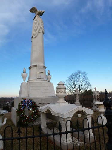
Interestingly, I wasn't quite sure where the trailhead for the hike actually was. I went to the end of the parking lot but only found an interesting CCC monument. Then I backtracked to the nature trail.

I followed the pleasant nature trail to the summit of Mount Mitchell,
but still did not find the Old Mitchell Trail. Finally on the way down the paved path from the summit of Mitchell, I found the trailhead for the Old Mitchell Trail.

The Old Mitchell Trail made a steady descent through firs and spruces. The air was cold and fresh and smelled like fresh Christmas trees. The air warmed to the point where I no longer needed my hat or mittens. Eventually the trail started to ascend. It climbed quite a bit and then started to descend down to the park entrance road. I realized that Mount Hallback must be a short way off the trail at this point. I found a lightly vegetated slope and climbed it up to a small wooden sign with the peak's name and elevation painted on it.

After a short break on the summit of Hallback I headed back to the trail
which I followed down to the park office and entrance road.
I crossed this road and found a gravel road on the other side. I would follow this gravel road for a short distance before heading off into the woods for a bushwack up to the summit of Mount Gibbes. As I walked the road I noticed some icicles in the shady, wet areas and looked for any sign that might indicate a route to the summit. Soon enough I found some plastic flagging tape tied around the branch of a shrub.
This would be the start of my bushwack.

The vegetation was pretty thick along my route to the summit of Gibbes. There was a lot of dead and downed timber littering the slope. I bashed through it all for a bit and soon found myself at the top of a ridge. I followed the ridgeline to a rock that appeared to be the highest point around. There were signs near this point showing that it was on the boundary of both the National Forest
and the State Park.
I did happen to notice a more defined user trail leading away from the rock and so I began to have my doubts about the rock being the summit of Mount Gibbes. I followed this trail along the ridge and eventually started to ascend. I ascended a rock outcrop and then found a rock with a benchmark embedded in it. The benchmark labeled the peak as Mount Gibbes.

I relaxed and ate a snack on the summit. I then took a photo of myself there before retracing my steps along the ridge.
As I approached the rock I had initially believed to be the summit, I saw a cleared swath that led back in the direction of the gravel road. I'm guessing it was at one time a boundary line and my assumption that it led back to the road turned out to be correct. This proved to be much faster going than the way I had ascended. From the gravel road it was a quick return to the paved road and park office where I picked up the Commissary Trail and a hiking partner.

The Commissary Trail was actually a gravel road. The hiking partner that I picked up was a small, female hunting dog outfitted with a radio collar.
She stayed close to me as we hiked along the trail.
There were excellent views off to the side of the trail.
Eventually I came to an intersection. The gravel road continued straight ahead, but I would take a left and follow the Camp Alice Trail back towards the summit of Mount Mitchell. Near the intersection of the two trails was a small stream with a pleasant cascade that people had obviously camped at in the past.

The climb up the Camp Alice Trail was pretty steep, but there were a few nice views of Mount Mitchell to distract me.
As me and my canine hiking companion ascended higher we began to see more people and dogs hiking the trail. At some point my companion lost interest in hiking with me and likely joined up with some other hiking companions. When I arrived at the Mount Mitchell summit area, I descended back to the parking lot. For the last stretch of my hike I follow the trail that starts at the picnic area to the summit of Mount Craig and then retrace this trail back to my car. This last section of my hike was again pleasant. The trail was steep in places, but it was well-built with substantial rock steps.

As I approached the summit of Mount Craig I noticed a sign that directed hikers to stay on the trail to protect fragile plants.
The views from the summit area were wonderful
and I enjoyed another snack here. I took a photo of the memorial marker
and myself on the summit.
Then it was a quick one mile hike back to the car. A great last hike of the year in the highest peaks of the eastern US!