Thursday, November 30, 2023

Soapstone Prairie Natural Area: Pronghorn Loop

 Last call for hiking at Soapstone Prairie! Soapstone Prairie Natural Areas is managed by the City of Fort Collins. Every year the natural area closes to recreational use from December 1st through March 31at for wintering mammals. Today, I would take advantage of the last day to visit for 2023.

The drive south through Cheyenne, Wyoming was uneventful. I took the Buckeye Road exit off of I-25 and headed west, then north to Soapstone Prairie. Today was my second visit to the natural area. Last time I visited was in November of 2021 when I hiked the Mahogany Loop. This time I would be hiking from the south trailhead on the Pronghorn Loop. 

I parked at the trailhead, and hit the trail,


immediately crossing the access road and heading east into the prairie. 


Along the course of the 9 mile loop, the trail passes through several stiles.


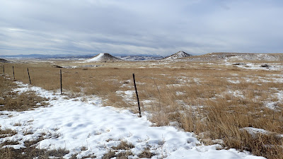
Throughout the hike, I would contend with patches of drifted snow covering the trail. The sometimes deeply drifted snow made the normally easy hike a bit more difficult. One of the highlights of the hike was the wildlife I encountered along the way. I saw a pretty large herd of pronghorn,


along with several prairie dog towns.


Besides the wildlife, there is an interesting structure covered with corrugated metal. Some type of cowboy or shepherds shack, I suppose.


Artifacts like square nails lay scattered on the ground nearby the structure. I took a quick look and replaced this nail where I had found it. 


Nearby to the shack was a very tall stone cairn. I thought the trail would pass by it, but it didn't. I was only able to observe it from a distance.

Once I had finished with my hike, I made the drive out of the natural area, passing the bison herd in a fenced pasture as I made my way out.


I would guess I was the last person to hike the Pronghorn Loop for 2023.

Saturday, November 18, 2023

Chadron State Park: Black Hills Overlook Trail

 Another pleasant day was forecast for today. Noelle, Sierra and I decided to get out and take advantage of the nice weather with a hike at Chadron State Park. I had done a little research online and found that the Black Hills Overlook Loop looked pretty interesting. We made the drive up north and arrived at the trailhead in the campground. Unfortunately, I didn't have any cell coverage and so I couldn't check AllTrails to ensure we were on the right path. We ended up taking the wrong trail and followed a section of the Campground Trail. While not our intended hike, the trail offered some nice views of the surrounding landscape. 


Our detour had been short, so when we returned to the car, we opted to try again for the hike we had originally planned. We went straight at a three-way intersection (we had made a right turn the first time) and followed the trail up a small canyon, passing through a few gates and stiles. 


Once we had emerged from the canyon, a sign ensured us we were on the right path.


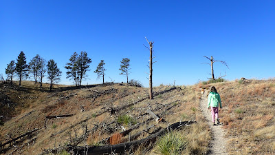
We climbed up to the top of a ridge,


leaving Chadron State Park and entering Nebraska National Forest. At the top of the ridge views opened up in all directions. 


We could indeed see the Black Hills far off to the north. 

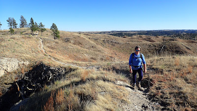
The trail here followed at or near the top of the ridge.


The views were pretty amazing. There were views over a series of canyons 


and far off to the north as well.


We stopped at three interpretive signs not far from a forest road.


Then, we turned around and headed back the way we had come. There was supposed to be another trail that branched off of ours, but we never found it. Instead, we headed back the same way we had come, admiring all the views from a different perspective. 


Saturday, November 11, 2023

The Colorado-Nebraska-Wyoming Tri-State Marker

Most people visit the CO-NE-WY Tri-State Point as part of a trip to the Highpoint of Nebraska: Panorama Point. However, the owner of the High Point Bison Ranch does not allow visitors to walk from the highpoint to the tri-state point. When we last visited Panorama Point, I tried to find the route to the tri-state point, but was unsuccessful. When Mom T and I visited Pawnee Buttes a few weeks ago, we headed home through Pine Bluffs and found the route to the tri-state point. No longer are you allowed to drive to the point. You must make a short hike. 

Heading out to the tri-state point meant that we would have to drive through Kimball, Nebraska. There's a ramen restaurant there called Ondori Ramen, and so before our visit to Wyoming, Colorado and Nebraska all at once, we stopped to fuel up in Kimball. The ramen did not disappoint!


Feeling full, we made the drive west into Pine Bluffs, Wyoming and then north on a county road. At the border with Colorado, the paved road turns to gravel. There is a pull-off on the east side of the road. We parked here, read the sign, 


and then crossed the fence for the flat walk to the tri-state monument.


There's not a whole lot to look at out here on the exceedingly flat plains. There are some windmills to generate electricity, and another windmill to pump water to the surface.


Just past the water tank windmill, we could see our destination: the tri-state monument. 


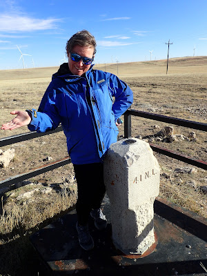
There's a concrete marker behind a fence with a benchmark embedded in the top.


These three states are special to Noelle and I. We were engaged in Colorado, married in Wyoming, and have lived in Nebraska for 4 years. We spent about a half hour investigating the site and taking photos.


Then, it was time to head back to the car for the drive home.


Thursday, November 9, 2023

Nebraska National Forest: Strong Canyon Loop

Today, Rosie and I made the drive up near Chadron to hike a section of the Pine Ridge Trail that starts just across US Highway 385 from the entrance to Chadron State Park. I took a different route than I would normally take to head in that direction, taking Nebraska Highway 71 north to Nebraska Highway 2 through Hemmingford. On the way, I stopped near the junction of Highways 71 and 2 to take a photo of the old, abandoned schoolhouse or church that sits just off the highway. 


Once back on the road, we drove east, then north up to the trailhead off of Mann Road. Right off the bat, the scenery was pretty impressive. 


Since we were unlikely to encounter any other hikers, I allowed Rosie to hike off leash.


We followed painted wooden posts that marked the route of the trail. 


It wasn't always obvious which way the trail went, so we stopped periodically to look around for the next post. The trail soon climbed through a burned area.


There were lots of great views from the high flat areas down into a series of small canyons.


The trail traversed meadows for a bit,

then headed down into, and back out of a small canyon.


Then, we repeated the process, descending into another canyon before climbing back out again.

We crossed Strong Canyon Road, close to where we had gotten our Christmas Tree last year.

When we reached a narrow canyon, 

I was feeling pretty tired and decided it was time to turn around and head back to the car. We climbing back up to the high meadow with lots more great views.

When we reached a windmill we had passed earlier in the hike, I decided it was time to follow a different route back. We made a left and followed another set of wooden posts until a faint road bed could be seen.

We continued to follow the road along a forest boundary fence and into a wooded area along another narrow canyon.

The road/trail eventually descended into the canyon and there was even some water flowing. 

Rosie decided to take a dip in the cold water. This seemed to invigorate her, as she got a case of the zoomies shortly thereafter. 

We continued on, soon leaving the canyon and passed another windmill.


We enjoyed the views of distant bluffs as we made our way along the last section of road back to the car.