Wednesday, December 22, 2021

Chatauqua Park: Flatirons Loop

For our last day in Boulder we had planned to meet some friends for lunch. We wanted to get in a short hike before that though. We headed to Chatauqua Park to hike the short Flatirons Loop. Originally, I had wanted to hike the trail to the First and Second Flatirons, but Sierra had a blister on her foot and seemed a bit worn out after the two previous days of hiking. We parked in the main lot near the Ranger Station and hit the trail. The views are spectacular!


The Chatauqua Trail is wide and flat, but it is pretty steep. We climbed up higher and higher to the base of the Flatirons.


Then, the trail seemed to relent for a bit as it roughly made its way parallel to the base of the mountains. We passed through a scree slope with views down to Boulder.


From there, the trail entered into thick woods. 


We paused at a small rock outcrop that jutted away from the trail.


Finally, we emerged from the woods at a picnic area and then headed back down to the parking lot on another wide, road-like trail. The views were again spectacular!


We made it back to the car with plenty of time before our lunch date at the Post, and so we headed over to the playground where Sierra got a chance to climb one of the Flatirons.

Tuesday, December 21, 2021

South Boulder Foothills Loop Hike

This morning we awoke in our rundown hotel room, dressed, and hit the road driving west to the foothills for today's hike, a short loop hike just east of Eldorado Canyon State Park. We parked in the large lot, paid the parking fee as non-Boulder County residents, and then hit the trail.


The hike is based on a loop featured in the guidebook "100 Classic Hikes in Colorado." However, a short portion of that hike does not allow dogs, and with Rosie we were forced to detour on the Homestead Trail instead of the Towhee Trail. Almost immediately we came to the Homestead Trail's namesake; the Doudy-Debacker-Dunn House.


Then, we continued a gentle climb on the Homestead Trail through short sumacs.


It was a warm day for late December. We spent a good portion of the hike in short sleeves. There were lots of great views west to the mountains.


Soon, the trail entered into some thicker woods. We stopped to take a break on a large boulder.


Then continued on our way walking north and parallel to the mountains.


Since we were now in thicker woods, the views became less frequent. Still, we caught occasional views of the Flatirons and Devil's Thumb.


On the way back to the car, 


we took a wrong turn and ended up following the Lower Big Bluestem Trail into the treeless prairie. While it added a bit of length to the hike, it offered some nice views of the mountains.


With our hike finished, we headed to Pearl Street to walk around a bit. We ended up eating a delicious lunch at Southern Sun.

Monday, December 20, 2021

Mount Sanitas and Sanitas Valley Loop Hike

This morning Noelle, Sierra and I packed our suitcases and headed south into Colorado for three days of hiking and adventure. After getting delayed by an accident on I-25 and lunch at Five Guys in Longmont, we headed over to Boulder and the first of our hikes, the 3.1 mile loop hike of Mount Sanitas. We parked at the trailhead on Sunshine Canyon Road and hit the trail, immediately starting our climb.

The trail quickly attained a ridge, and we followed this ridge for most of the beginning portion of our hike. There were lots of great views, both over the city of Boulder, and west to the higher mountains. We stopped frequently to enjoy the view and catch our breath. 


There were also views back towards the Flatirons and Green Mountain.


Slowly, but surely, we attained the summit of Mount Sanitas, gaining about 1,250 feet in the process. We relaxed at the summit for a bit.


Then, it was time to descend via the steep East Ridge and then down to the Sanitas Valley Trail. As we made our way down, the sun went behind the mountains and it got cool out. 


We arrived back at the car for the drive to our hotel in Westminster. 

Thursday, December 9, 2021

Gilbert-Baker Wildlife Management Area

 I've got some use or lose leave that I need to take and so I had the day off today. I decided to get out for a bit of hike today and to take Rosie along with me. I wanted to explore a new area, but I didn't want to drive too far. I opted to head north to Harrison, NE and see if I could find the Devil's Den, a surprisingly deep and narrow canyon in the Gilbert-Baker Wildlife Management Area. 

It was an uneventful drive past Agate Fossil Beds and through seemingly endless grasslands to Harrison. Just north of town we finally entered the ponderosa pines. I parked at a parking area with a pit toilet and after using the facilities, Rosie and I hit the trail. Almost immediately we crossed a ravine with a stream flowing through it and large trees growing along the banks.


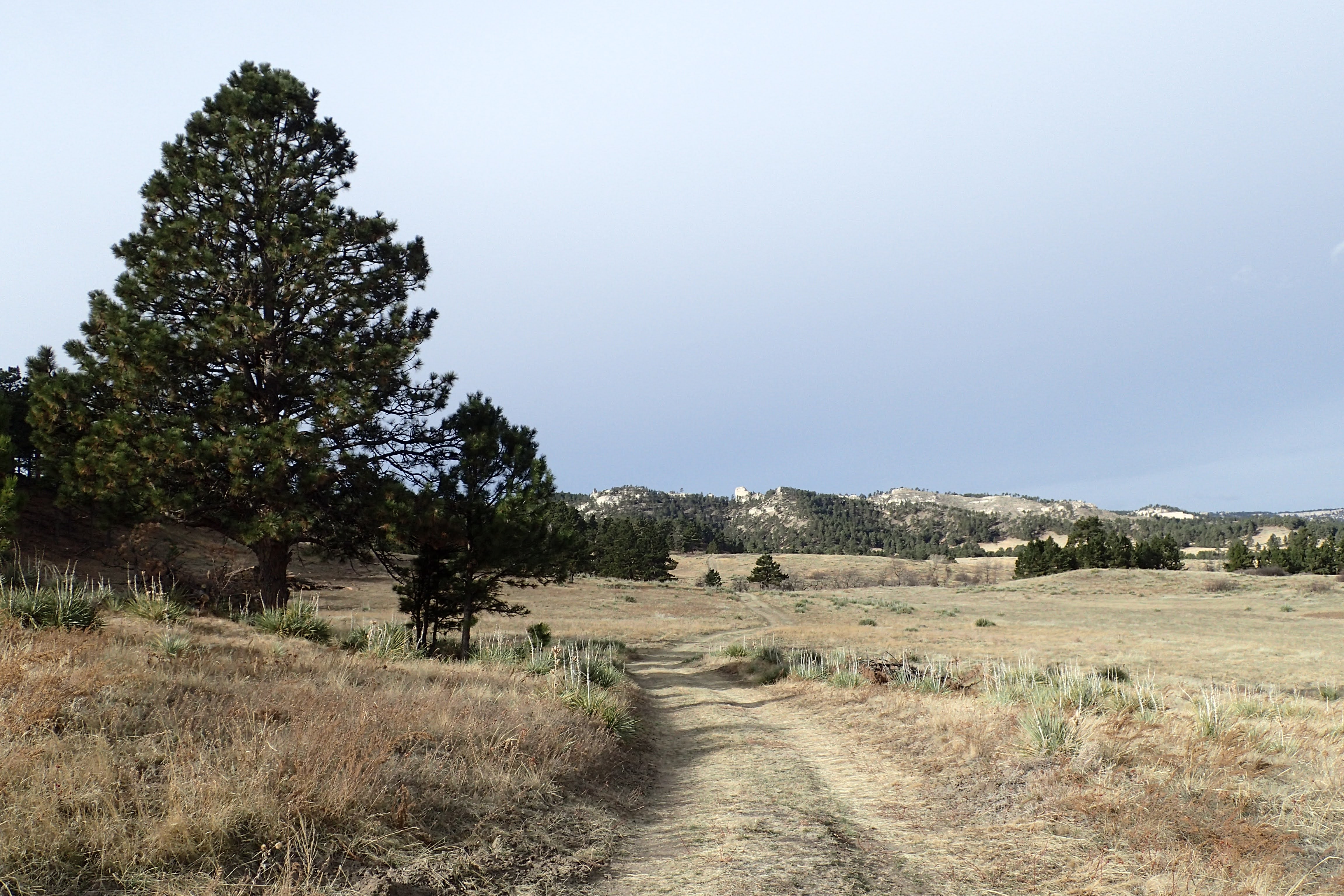
Then, we crossed a dry ravine and headed through a meadow,


before climbing a ridge to awesome views of the surrounding Pine Ridge 


and plains down below.


We descended off the ridge and then made our way down to a logging road below.


We followed the road for a while and then made a left turn into a pretty deep canyon. The canyon was choked with downed trees and vegetation and made for some pretty slow travel. Eventually, Rosie and I climbed out of the canyon and took a break just above.


The views from our break spot were pretty nice. 


Soon, we found another road, which we followed to a gate. We then followed the fence line, inside the public lands to a few ridges that offered wonderful views of the surrounding landscape.


We even followed one ridge out to a small natural arch.


Until this point, we hadn't had any luck finding Devil's Den. I pulled out my phone and was surprised to find that I had cell service and so I opened up All Trails and used it to navigate towards where I figured the canyon would be. This method worked, and soon we found ourselves just above the canyon. 


It was a steep climb to get into it though. After slowly making our way about halfway down, Rosie refused to go any further. I opted to head back to the car at this point. Because I had found the road on the way in, we followed that most of the way back through areas where forest thinning operations had taken place.


Soon, we were back to the car for the drive home. I fully expect to head back to this area soon, and climb down into the canyon.

Saturday, December 4, 2021

Roosevelt National Forest: Molly Lake Hike

After cutting down our Christmas tree, Noelle, Sierra and I decided to take advantage of the beautiful December weather and go for a short hike. We drove towards Red Feather Lakes and turned off at the trailhead for the Granite Ridge Trail for the short hike to Molly Lake. 

After using the restroom at the trailhead, we hit the trail, really just a wide, gravel road.


The trail didn't have much in the way of ascents or descents. It just wound through the woods and open areas of this beautiful section of Northern Colorado.


There were intermittent views of the surrounding mountains,


and scattered rock formations that reminded us of those found in Vedauwoo to the north in Wyoming.


In what seemed like no time at all, we reached the turn off for Molly Lake.


It was a short walk down to the lake itself where we explored, rested a bit and took some photos.

Then, we retraced our route back to the car, enjoying the warm weather, easy walking and beautiful scenery.