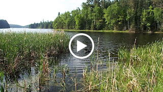
A little less than a year ago, a story I wrote about paddling Rainy Lake in Voyageurs National Park was published by the
Voyageurs National Park Association. Today we would paddle Rainy Lake again, but this time outside of the boundary of Voyageurs National Park. We put the canoe in the water at Tilson Bay and started to make our way north towards Grassy Island. As we approached the island we saw an adult bald eagle perched high up on a tree. Shortly after sighting the eagle, we saw a nest in a white pine. We continued to follow the shoreline of Grassy Island and eventually made our way to a small, rocky island that, from a distance, we noticed had something unusual on it. Noelle and I both guessed that the unusual object was a statue of the Virgin Mary and as we approached it, our suspicions were confirmed.
We decided to call the island Hail Mary Island and we would investigate it a little bit more later in our trip.
We continued past Hail Mary Island and saw a loon swimming around in the waters in the shelter of a cluster of islands.
We headed further east towards the Review Islands.
Soon enough we approached a screened in porch marking what we thought was the west side of Mallard Island.
Mallard Island is significant in that it was owned by conservationist Ernest Oberholtzer. It turns out that, though the porch is on land owned by Oberholtzer, it is actually on a separate island called Japanese Island. It is, however, connected to Mallard Island by a foot bridge.
The screened in structure is known as Japanese House.
We continued past Ober's Island to check out an interesting structure we could see when we lived on Rainy Lake. It is an imposing stone building, now a private residence, that in the past was known as the Musket Inn.
Before it was the Musket Inn, it was part of an estate known as Red Crest. Red Crest was owned by Chicago industrialist Bror Dahlberg. Dahlberg was head of the Southern Sugar Company which extracted sugar from corn stalks. He was also the inventor of Celotex, a building material, which is produced from corn stalks. Ernest Oberholtzer had supervised construction of the mansion here in 1924. The same year he started construction of his property on Mallard Island. We paddled past a dilapidated building on Red Crest Island
then turned around to start to make our way back to Mallard Island.
This time we paddled on the south side of Mallard Island, in between Mallard and Hawk Islands. We passed an interesting houseboat structure that Ober used as his kitchen.
Shortly thereafter we passed the Main House
and then headed away from the island. It would be interesting to get out and walk around on the island, but it is private property that is owned by the
Oberholtzer Foundation which "maintains Ober’s legacy and North Woods island home as a source of
inspiration, renewal and connection to Indigenous Peoples, kindred
spirits, and the natural world." Maybe someday we will afforded a chance to visit.
We continued our paddle by heading back to Hail Mary Island. This time we landed the canoe and got out to stretch our legs a bit.
We checked out the shrine
and the rest of the small island which included a few scattered wildflowers
and an old goose nest among the rocks.
Sierra played in the shallow water.
After a 20 minute break we headed back to the shoreline of Grassy Island home to Camp Koochiching. We paddled back towards the boat ramp at Tilson Bay, passing between Grassy Island and a nearby unnamed island. There was an old vehicle seen on the shore of Grassy Island.
It made me wonder how long it had been there and why it had been moved to the island.