Saturday, November 30, 2013

The Grunwald Family Christmas Tree 2013

The Grunwald's loaded up the old Family Truckster today and headed into the mountains of North Carolina to find the Griswold Grunwald Family Christmas tree 2013 edition. Since we now live back east, the $5 forest service permit is not an option. Instead, we would do our tree harvesting at a commercial establishment: Frosty Mountain Christmas Tree Farm which is in the Shelton Laurel area of North Carolina right on the Tennessee border. Yes it would be a good old fashioned family bonding experience right our of the movies!


We arrived with our saw and tie downs, but found out we would not need them. Due to insurance issues they do not allow customers to cut down their own tree. Instead they have a fancy chainsaw that they use to do it for you. They do give you a big tall PVC stick to measure your tree
and after acquiring our plastic stick we walked a short section of trail
to the forest of 6 foot tall Fraser Firs.
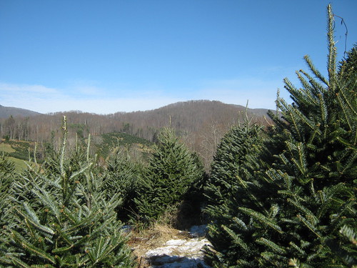
view from our tree
It didn't take long to find some really nice trees and we decided on a fine specimen after about 15 minutes.
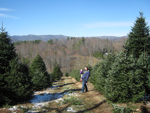
Noelle Sierra in tree farm
After waving our plastic stick in the air and waiting for a bit,
a sawyer cam by and lopped the tree off its foundation. We then walked back to the headquarters where they delivered the tree by pickup truck and then baled it and tied it to the roof of the truckster. It was $30 for our beautiful specimen. More expensive than our previous trees in 2011 and 2012, but a much fuller tree.   

Friday, November 22, 2013

Pisgah National Forest: Green Ridge Trail

There was a 50/50 chance of rain today, but I decided to take a chance and head out for a hike anyway. Actually, my drive into the Shelton Laurel area had a dual purpose. Not only would I be hiking the Green Ridge Trail, but I would also be scoping out the Frosty Mountain Christmas Tree Farm.

I headed into North Carolina after dropping off the recyclables at the dump/recycling center. The drive was pleasant and before I knew it I was in the Big Creek section of Shelton Laurel. I had a little bit of trouble finding the trailhead for the Green Ridge Trail, but after backtracking and crossing a shallow creek I turned past an old sawmill and found the start of the trail. There was an old strangely outfitted truck there.
Was it used to drill wells? At first the trail was really just a gated road.
The road gently ascended along Dry Creek.
At the point where the old road made a nearly 180 degree turn, I saw a faint path continuing straight ahead. This was the yellow-blazed Green Ridge Trail.

I have to admit that the Green Ridge Trail  is not the most interesting trail I've ever hiked. I did see a small waterfall that is currently almost completely dry.
I'll bet that after a good heavy rain it flows pretty nicely though. Once past the dry waterfall the trail starts switchbacking steeply up the mountain to the top of a ridge. The combination of a steep trail and lots of dead, downed leaves made for some slippery hiking conditions. The fact that all the leaves were down did have a benefit though, it allowed for lots of distant views through the bare trees.
I even caught a glimpse of the Christmas Tree Farm.

Once the trail reached the ridge it leveled out a bit. The trail did, however, become less distinct. I saw a pair of hunters out with their three dogs. I'm not sure what season it is in North Carolina right now. Once I reached the Appalachian Trail I headed north for a bit.
I was worried about the lack of daylight though, as I had gotten a late start. I had originally intended to hike to the Flint Mountain Shelter, but decided against it as I did not want to hike in the dark.

The return hike was easy, but a bit treacherous due to the slippery leaves.
It got a bit dark and threatened to rain, but the worst I encountered was a few minutes of light drizzle. On the way I passed a possible cave.
It was difficult to tell if went very far. I'm guessing it does not as I don't think there is a whole lot of limestone in the area. Once I got back to the road section I was able to really move and soon found myself back at my car.

Monday, November 18, 2013

Bristol Motor Speedway in Lights 2013

With Mom and Dad in town, we decided to celebrate Christmas a little bit early by heading up to Bristol for the annual Speedway in Lights display. While none of us are NASCAR fans, we all enjoyed the display and were amazed by the size of the track. It just seems too small for racing cars on!

Sunday, November 17, 2013

Fermenting

Brewed some pale ale with my dad this afternoon. The wort is fermenting in the closet. It should be ready to bottle in 3 weeks. Looking forward to trying this Sierra Nevada Pale Ale clone!

Monday, November 11, 2013

Mount Mitchell State Park: Mount Hallback, Mount Gibbes and Mount Craig

The forecast was good for today's weather and I had off for Veteran's Day, so I decided to take advantage of the situation with one last 6,000 footer bagging day for 2013. I made the drive into North Carolina and over to Weaverville. Then I headed up to the Blue Ridge Parkway which I followed to Mount Mitchell State Park. I drove the road up to the parking lot near the summit of Mount Mitchell and prepared for my 9 mile hike. I donned my winter hat and mittens under the beautiful blue sky and headed out.

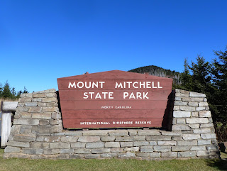
Interestingly, I wasn't quite sure where the trailhead for the hike actually was. I went to the end of the parking lot but only found an interesting CCC monument. Then I backtracked to the nature trail.

I followed the pleasant nature trail to the summit of Mount Mitchell,
but still did not find the Old Mitchell Trail. Finally on the way down the paved path from the summit of Mitchell, I found the trailhead for the Old Mitchell Trail.

The Old Mitchell Trail made a steady descent through firs and spruces. The air was cold and fresh and smelled like fresh Christmas trees. The air warmed to the point where I no longer needed my hat or mittens. Eventually the trail started to ascend. It climbed quite a bit and then started to descend down to the park entrance road. I realized that Mount Hallback must be a short way off the trail at this point. I found a lightly vegetated slope and climbed it up to a small wooden sign with the peak's name and elevation painted on it.

After a short break on the summit of Hallback I headed back to the trail
which I followed down to the park office and entrance road.
I crossed this road and found a gravel road on the other side. I would follow this gravel road for a short distance before heading off into the woods for a bushwack up to the summit of Mount Gibbes. As I walked the road I noticed some icicles in the shady, wet areas and looked for any sign that might indicate a route to the summit. Soon enough I found some plastic flagging tape tied around the branch of a shrub.
This would be the start of my bushwack.

The vegetation was pretty thick along my route to the summit of Gibbes. There was a lot of dead and downed timber littering the slope. I bashed through it all for a bit and soon found myself at the top of a ridge. I followed the ridgeline to a rock that appeared to be the highest point around. There were signs near this point showing that it was on the boundary of both the National Forest
and the State Park.
I did happen to notice a more defined user trail leading away from the rock and so I began to have my doubts about the rock being the summit of Mount Gibbes. I followed this trail along the ridge and eventually started to ascend. I ascended a rock outcrop and then found a rock with a benchmark embedded in it. The benchmark labeled the peak as Mount Gibbes.

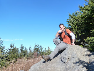
I relaxed and ate a snack on the summit. I then took a photo of myself there before retracing my steps along the ridge.
As I approached the rock I had initially believed to be the summit, I saw a cleared swath that led back in the direction of the gravel road. I'm guessing it was at one time a boundary line and my assumption that it led back to the road turned out to be correct. This proved to be much faster going than the way I had ascended. From the gravel road it was a quick return to the paved road and park office where I picked up the Commissary Trail and a hiking partner.

The Commissary Trail was actually a gravel road. The hiking partner that I picked up was a small, female hunting dog outfitted with a radio collar.
She stayed close to me as we hiked along the trail.
There were excellent views off to the side of the trail.
Eventually I came to an intersection. The gravel road continued straight ahead, but I would take a left and follow the Camp Alice Trail back towards the summit of Mount Mitchell. Near the intersection of the two trails was a small stream with a pleasant cascade that people had obviously camped at in the past.

The climb up the Camp Alice Trail was pretty steep, but there were a few nice views of Mount Mitchell to distract me.
As me and my canine hiking companion ascended higher we began to see more people and dogs hiking the trail. At some point my companion lost interest in hiking with me and likely joined up with some other hiking companions. When I arrived at the Mount Mitchell summit area, I descended back to the parking lot. For the last stretch of my hike I follow the trail that starts at the picnic area to the summit of Mount Craig and then retrace this trail back to my car. This last section of my hike was again pleasant. The trail was steep in places, but it was well-built with substantial rock steps.

As I approached the summit of Mount Craig I noticed a sign that directed hikers to stay on the trail to protect fragile plants.
The views from the summit area were wonderful
and I enjoyed another snack here. I took a photo of the memorial marker
and myself on the summit.
Then it was a quick one mile hike back to the car. A great last hike of the year in the highest peaks of the eastern US!

Saturday, November 2, 2013

Appalachian Trail: Indian Grave Gap to Beauty Spot

Mom offered to watch Sierra today, so Noelle and I had the afternoon to ourselves. We headed over to Erwin, past Rock Creek and over to Indian Grave Gap on the North Carolina border for a hike up to Beauty Gap.

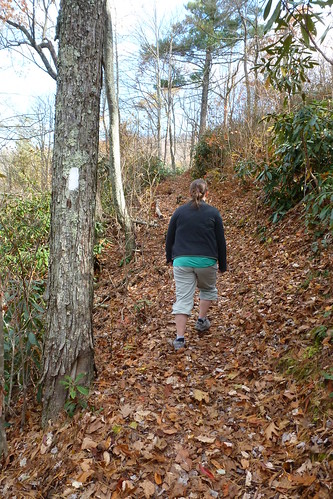
The hike started off with a pleasant ascent through a wooded area.
noelle hiking AT
Most of the leaves are already down in this section of forest,
Winter Trees and Distant Mountains
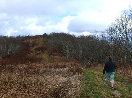
so today's hike felt more like a winter hike then a fall one. Soon we were hiking through an area that looked as if it burned some time in the recent past. The ascent was never really steep, but it was a fairly long climb. Eventually the trees thinned out a bit and the trail traversed a thin strip of meadow or old fields.
beauty Spot
This was the Beauty Spot.

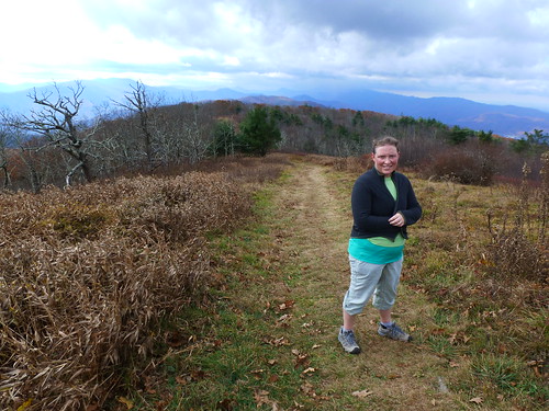
I don't remember Beauty Spot from my thru-hike, but it was a lot like a smaller version of Max Patch. We could see a storm approaching as we reached the high point of our hike and there was a parking area nearby.
approaching rain
Despite the threat of rain we followed the Appalachian Trail towards distant Unaka Mountain
and past the parking area and down to the Forest Service Road that closely paralleled the trail. When we reached the road we made a left onto it and followed it down to the trailhead at Indian Grave Gap.
A nice hike that probably would have been more pleasant just about a week or so ago when the fall colors were at their peak.

Friday, November 1, 2013

Craggy Dome from Balsam Gap

I took the day off from work and Noelle gave me permission to go off and do something on my own. I opted to head towards the Blue Ridge Parkway and Craggy Gardens. My objective was to ascend two of the Southern 6,000 foot peaks: Craggy Dome and Blackstock Knob.

The drive through the mountains was uneventful. I stopped in Weaverville for a breakfast to go and headed up to the Blue Ridge Parkway. There were still some low clouds and fog in some areas, but it would all burn off before too long. My objective was Balsam Gap where I would park and then walk to Craggy Dome. Then I would turn around, walk past my car and hike up to Blackstock Knob before turning around again to return to my car.

I hit the trail just as the last of the fog started to burn off. Sunlight coursed through the fog and gave each ray of sunlight the look of a beam of illuminated cloud.
Almost all the leaves were down. The leaf litter, composed of newly fallen leaves made for a visually interesting hiking surface.
The trail I followed, the Mountains to Sea Trail (MST) would ascend for a bit and then descend. It never strayed very far from the Blue Ridge Parkway. On a few occasions I even found myself at one of the many scenic overlooks at the side of the road.

The day had turned out to be much more pleasant than I had expected. I had packed my hat and gloves but I never needed them. In fact, I was able to hike the whole time in nothing but short sleeves.
Soon I found myself at a section of  trail with exposed views of the surrounding mountains. I could see parts of the Black Range where Mount Mitchell is located
and nearby Bullhead Mountain.
I had originally thought that Bullhead was Craggy Dome, but when the trail skirted to the side of the summit I realized that it was not my first objective.

Soon enough the trail headed towards the parkway for a road crossing. This is where I would depart the Mountains to Sea Trail for a bit. I would be bushwacking up Craggy Dome. I wasn't sure what to expect as far as bushwacking conditions. At first there wasn't any type of defined user trail. I started to mentally prepare myself for the possibility of thrashing through rhododendron and blackberry. However, I soon found a user trail, or "manway" as they call it in this region of the United States. The unofficial trail was almost as well defined as some of the official trails in the area. It did get a little overgrown near the summit,
but I was easily able to find the pipe that marks the summit. There was even a wooden sign on the ground at the bottom of the pipe.

I took a photo at the summit and then backtracked a short way to a rock that made a convenient place to eat a snack. When I stood on the rock it offered great views of the surrounding mountains.
I looked at my map while eating and realized that the summit of Bullhead was just a short way off the Mountains to Sea Trail. I began to think of bagging three peaks instead of just two today!
After my snack I began my descent back to the MST for the return hike to the car. The hiking went pretty fast at first as it was mostly downhill. As I approached Bullhead Mountain I decided to try for the summit. It was a really rough bushwack up to a small, relatively flat summit area. There were two summits up there and I walked around as close to the tops of both of them as I could before I decided to head down. This is where my day got interesting. I started heading down in the direction that I thought would lead me back to the MST. I descended down, down, down through some really thick underbrush. Finally, when I got a clear view, I realized I was heading back towards Craggy Dome and not towards the Black Range like I should be. I was headed in the wrong direction!

I bashed my way back to the summit area, but I still wasn't confident about my orientation. I sat down and looked at the map for a bit and was able to successfully use surrounding landmarks to orient myself. Then I headed down the thickly vegetated slope. I was relieved to see the MST just below me. I got back on trail and picked up the pace again. This little detour of mine had cost me more time and energy than I had expected. I began to reconsider my original goal of ascending Blackstock Knob.

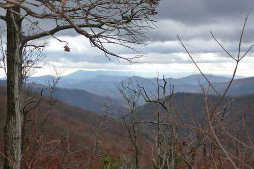
The hiking went relatively quickly and the views from the open areas were amazing.
Today had to have been one of the best weather days that we've had all year. I was quite tired by the time I approached the Asheville watershed protection area
and my car. I decided that I didn't have the energy for a 1,000 + foot ascent. I would be making the drive back home. While I didn't accomplish my original goal, I am still happy with my accomplishments for the day: One Southern 6,000 footer and one 5,000 foot peak!