Tuesday, October 28, 2014

Great Smoky Mountains National Park: Mount LeConte via Rainbow Falls Trail

Okay, I admit it. I am obsessed. Not to sound like a broken record, but it was yet another beautiful fall day and so I just had to get out for a hike. Today I would be headed to what I think might be my most favorite spot in all of the Volunteer State: Mount LeConte. I have hiked up LeConte twice before. The first time was back in 2006 when Noelle and I hiked up the Alum Cave Trail. Then, back in February, I hiked up via the AT and the Boulevard. Today I would make a grand loop by hiking up the Rainbow Falls Trail and down the Bullhead Trail.

I arrived to a somewhat empty parking lot at a little after 8:45. I used the restroom, gathered my gear and then hit the trail. There was a bear warning posted at the trailhead,
but I would not see a bruin, or even any evidence of them, on the trail. It is starting to get past peak for the fall foliage even in the lower elevations now. There were lots of leaves down on the trail.
The hike started off by closely paralleling LeConte Creek past lots of small cascades.
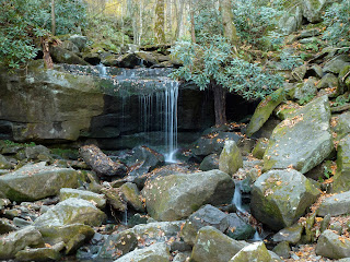
Soon I came to a small waterfall.
Could this be Rainbow Falls? Of course, it was not. A short time after my little "False Rainbow Falls" I found myself at the real thing.
Even though there was not much water flowing down, it was still impressive in a large amphitheater of rock. I ate a snack at the falls and then continued on up the trail.

Soon I came to the site where a large tree had lain across the trail. Sawyers had removed the portion of the trunk which blocked the trail and someone had done a little dendrochronology and counted the rings. They marked off increments of ten rings for a total of over 270 of them.
That is one old tree! It's too bad it did not survive any longer. Not only was there plenty of lingering fall color on the trail, I also spied the very last of the season's wildflowers. There was a little bit of aster, goldenrods, and this blue flower in bloom in a few places along the trail.

I continued to ascend up the trail,
gaining about 4,000 feet in elevation. That is an impressive amount of altitude gain for an eastern mountain! I eventually arrived at the signed Rocky Spur Overlook
which led out to a heath-covered section where the first spruces and firs showed themselves.
There were nice views out over the lowlands below and the monstrosities that are Gatlinburg and Pigeon Forge.
From certain vantage points I could even get a glimpse of yesterday's destination: Brushy Mountain. After another short break and snack, I continued on to the summit.

Soon the ecosystem started to change a bit. There were still deciduous trees, but the rocky path wound through a largely coniferous forest.
At one point a tree just off to the side of the tree had blown over and erosion had washed a deep (about 5 feet) rut into the trail.
There was a precarious ledge one could use to skirt around the deep pit, but I would hate to be the hiker who fell into that thing. Shortly after the "Bottomless Pit" I found myself at the junction with the Bullhead Trail for the last .6 mile to Mt LeConte.

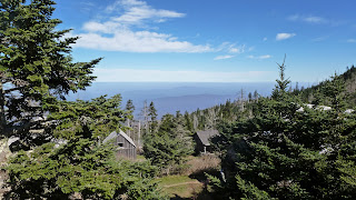
Before I knew it I was at LeConte Lodge,
arguably one of the most interesting places to spend the night in the Eastern US. I headed straight for the porch of the office where I relaxed on one of the rocking chairs
and struck up some conversation with a hiker from Kingsport, TN. The view from the porch was lovely and the temperature was perfect.
The thermometer on the wall read 64 degrees Fahrenheit.
After eating a snack I headed over to the dining hall to photo document this trip's date.
I then moved on to visit the actual summit of the mountain.

It was a quick jaunt over to the large summit cairn. I snapped another photo of myself standing next to it
and then headed back towards the lodge. The views from the trail here were pretty nice,
but I still opted to head over to Cliff Top to see the view from there. I would not be alone in admiring the view from the lofty perch.
After a few minutes I decided to move on. I headed back to the rocky trail
through the piney-scented forest of spruce and fir and began my descent. I was sad to say goodbye to this remarkable place. This is the one place in the southeast that I think feels the most like the way I think a mountain should feel. Even though there is a lodge on top, it doesn't seem (at least not to me) to detract from the setting. The mountain views are remarkable and the smell of the air is unforgettable. Still, I was not a guest at the lodge and I had to get back home to feed and walk Parker.

The hike down the Bullhead Trail went pretty quickly. There were not as many views as I had expected on this trail and so not much of a reason to stop. The trail bed itself is one of the more remarkable aspects of the trail. It is carved into the side of the mountain creating the feeling of hiking along a cliff in many areas.
One of the other interesting sites is a stone cairn that I have heard referred to as "The Pulpit". It was supposedly built by the CCC during the Great Depression. I photographed myself standing on it
and then continued on my descent. Eventually I arrived at an interesting rock shelter which looked like an interesting spot to wait out a rain storm.

At the end of the Bullhead Trail I was surprised by the sight of an NPS pickup truck parked at the junction with the Old Sugarlands Trail.
I was even more surprised by the two men lounging in the back of it when I passed. I continued on the Old Sugarlands Trail, which is a closed gravel road, through some of the last remaining foliage still on the trees,
and back to the car.

Sunday, October 26, 2014

Great Smoky Mountains National Park: Brushy Mountain Trail

Another beautiful day was forecast for today. I woke up early again and made the drive over to the Great Smoky Mountains National Park. Today I headed over to the Greenbrier section of the park for a hike up the Brushy Mountain Trail to, no surprise, Brushy Mountain.

I was on the trail at around 8:30. The trail was deserted. It was just me and the changing leaves. There was some fog in certain areas that the sun was trying to burn off. I started off hiking the closed gravel road that serves as the Porters Creek Trail. Porters Creek was lovely just like I remembered it from my last visit, clear and cascading over the abundant rocks in its bed.
I passed a large wasp nest just off to the side of the trail.
Luckily they were not active on this cool morning. There were lots of signs of the community that once existed in the area, lots of stone walls.

Soon enough I reached the turnaround loop on the gravel road. Here I found the Brushy Mountain Trail which I would follow for the next 4.7 miles up and then 4.7 miles back down.
The sun began to really burn through the fog at this point revealing the blue sky which contrasted dramatically with the reds, yellows, and oranges of the leaves.
At a little cascading creek that looked like a possible site for a natural water slide
(it was too cold to test it out) I stopped to check my map
and eat a snack. When I was finished eating I continued on with a steady ascent
eventually reaching the Trillium Gap Trail.

At the junction with the Trillium Gap Trail,
the Brushy Mountain Trail gets pretty interesting. The foot path becomes a deeply rutted track lined with mountain laurel and rhododendron.
As you ascend the vegetation gets a bit brushier (maybe this is why its called Brushy Mountain) and the views open up. There were impressive views over to Mount LeConte
and the mountains to the east. I had arrived just as the last of the fog was burning off.
I found a spot near the summit benchmark
to eat lunch and admire the views before turning around to head back to the car.

The hike down the mountain went faster than the climb up. I saw a few red squirrels in the trees on the way down and they both scolded me with their chattering.
I only ran into two other hikers on the trail. One was a volunteer out to remove some of the blowdowns blacking the trail. The other was an older gentleman who seemed to be enjoying the fine weather and fall colors.
Sierra must be influencing me a bit, because when I had descended to Porters Creek
I took off my shoes and dipped my piggies in the water.
It was very cold, but refreshing. After resting my feet for a bit I got out of the water
and headed back to the car for the drive home.

Saturday, October 25, 2014

Great Smoky Mountains National Park: Mt Sterling/Pretty Hollow Gap/ Little Cataloochee/ Long Bunk Loop

With beautiful weather forecast for today, I just had to get out for a hike. I decided to head over to Great Smoky Mountains National Park to enjoy the weather and fall foliage. Since I did not want to go anywhere near Gatlinburg, I decided to do a loop hike starting at Mt Sterling Gap. The drive was long, but uneventful and before I knew it I was at the trailhead to start my hike.

The hike started with an ascent on an old road. The fall colors in the morning light were quite spectacular.
After about an hour on the trail I had made my way up Mount Sterling. I climbed the old fire tower and admired the wonderful views.
The sky was absolutely cloudless and there was no humidity making for the beautiful bluebird skies that one sees in the western US.
The views in all directions were just spectacular.
I spend about 10 minutes admiring the view and then headed down the tower and back down the Mt Sterling Ridge Trail to continue on the loop of my hike. At the junction with the Pretty hollow Gap Trail
I turned left and descended,
eventually walking along Pretty Hollow Creek.

Eventually my descent ended and I turned onto the Little Cataloochee Trail.
I was really looking forward to this portion of the hike as I had read about some of the old buildings that have been preserved in the Little Cataloochee Valley. I soon found an obviously maintained side trail that led up and up. It eventually ended at a cemetery. There was only one marked grave in the cemetery. It was that of a 2 year old boy named Charlie Burress.
After pausing for a minute I returned to the main trail to continue my hike into Little Cataloochee.

The first evidence of past habitation that I found was a large flat area that was obviously an old home site. There was one of the old hog traps
set up on the flat area and nearby were a few moldering logs left from a log structure.
I continued on through beautiful colors
to the Cook Cabin
where I met and talked to a man from Charleston, SC. There was a brilliant orange butterfly fluttering about in the grass outside the cabin. I was able to get close enough to it to get a nice photo.
The butterfly then took off flying and landed right on my arm.
I admired the close view of the butterfly for a few minutes before it flew away again, this time for good. Nearby to the Cook Cabin is the old Cook apple house.
The Cooks acquired quite a bit of wealth growing and selling apples.

From the Cook place I followed the trail (really a road at this point) up to the Little Cataloochee Baptist Church.
It is a pretty little church. I went inside to have a look around
bible
and even rang the church bell a few times. I then went back outside to inspect the cemetery a little bit. From the cemetery I got back on the trail and headed across Little Cataloochee Creek
over to the Hannah Cabin
which looked to be smaller than the Cook Cabin and was certainly less interesting. Shortly after leaving the Hannah Cabin I found my self at the junction with the Long Bunk Trail which I had hiked to from Old NC Highway 284 two weeks ago.

I h turned onto the Long Bunk Trail and began an ascent to the Hannah Cemetery.
I did not stop long at the cemetery as I was starting to get tired. Instead I kept moving, albeit slowly, up the trail. The Long Bunk Trail portion of today's hike turned out to be the least interesting part of the hike. I did find a tree marked with a faint white blaze with a trail nearby that led to what I am guessing is an old cemetery with unmarked graves as it was a flat area cleared of woody vegetation. There was one stone set in the ground that appeared to be a grave marker,
but nothing else. When I finally arrived back at the junction with the Mt Sterling Trail, it was a quick walk back to the car fro the drive back to Greeneville.