I arrived to a somewhat empty parking lot at a little after 8:45. I used the restroom, gathered my gear and then hit the trail. There was a bear warning posted at the trailhead,
but I would not see a bruin, or even any evidence of them, on the trail. It is starting to get past peak for the fall foliage even in the lower elevations now. There were lots of leaves down on the trail.
The hike started off by closely paralleling LeConte Creek past lots of small cascades.
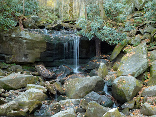
Soon I came to a small waterfall.
Could this be Rainbow Falls? Of course, it was not. A short time after my little "False Rainbow Falls" I found myself at the real thing.
Even though there was not much water flowing down, it was still impressive in a large amphitheater of rock. I ate a snack at the falls and then continued on up the trail.
That is one old tree! It's too bad it did not survive any longer. Not only was there plenty of lingering fall color on the trail, I also spied the very last of the season's wildflowers. There was a little bit of aster, goldenrods, and this blue flower in bloom in a few places along the trail.
I continued to ascend up the trail,
gaining about 4,000 feet in elevation. That is an impressive amount of altitude gain for an eastern mountain! I eventually arrived at the signed Rocky Spur Overlook
which led out to a heath-covered section where the first spruces and firs showed themselves.
There were nice views out over the lowlands below and the monstrosities that are Gatlinburg and Pigeon Forge.
From certain vantage points I could even get a glimpse of yesterday's destination: Brushy Mountain. After another short break and snack, I continued on to the summit.
Soon the ecosystem started to change a bit. There were still deciduous trees, but the rocky path wound through a largely coniferous forest.
At one point a tree just off to the side of the tree had blown over and erosion had washed a deep (about 5 feet) rut into the trail.
There was a precarious ledge one could use to skirt around the deep pit, but I would hate to be the hiker who fell into that thing. Shortly after the "Bottomless Pit" I found myself at the junction with the Bullhead Trail for the last .6 mile to Mt LeConte.
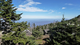
Before I knew it I was at LeConte Lodge,
arguably one of the most interesting places to spend the night in the Eastern US. I headed straight for the porch of the office where I relaxed on one of the rocking chairs
and struck up some conversation with a hiker from Kingsport, TN. The view from the porch was lovely and the temperature was perfect.
The thermometer on the wall read 64 degrees Fahrenheit.
After eating a snack I headed over to the dining hall to photo document this trip's date.
I then moved on to visit the actual summit of the mountain.
It was a quick jaunt over to the large summit cairn. I snapped another photo of myself standing next to it
and then headed back towards the lodge. The views from the trail here were pretty nice,
but I still opted to head over to Cliff Top to see the view from there. I would not be alone in admiring the view from the lofty perch.
After a few minutes I decided to move on. I headed back to the rocky trail
through the piney-scented forest of spruce and fir and began my descent. I was sad to say goodbye to this remarkable place. This is the one place in the southeast that I think feels the most like the way I think a mountain should feel. Even though there is a lodge on top, it doesn't seem (at least not to me) to detract from the setting. The mountain views are remarkable and the smell of the air is unforgettable. Still, I was not a guest at the lodge and I had to get back home to feed and walk Parker.
The hike down the Bullhead Trail went pretty quickly. There were not as many views as I had expected on this trail and so not much of a reason to stop. The trail bed itself is one of the more remarkable aspects of the trail. It is carved into the side of the mountain creating the feeling of hiking along a cliff in many areas.
One of the other interesting sites is a stone cairn that I have heard referred to as "The Pulpit". It was supposedly built by the CCC during the Great Depression. I photographed myself standing on it
and then continued on my descent. Eventually I arrived at an interesting rock shelter which looked like an interesting spot to wait out a rain storm.
At the end of the Bullhead Trail I was surprised by the sight of an NPS pickup truck parked at the junction with the Old Sugarlands Trail.
I was even more surprised by the two men lounging in the back of it when I passed. I continued on the Old Sugarlands Trail, which is a closed gravel road, through some of the last remaining foliage still on the trees,
and back to the car.


No comments:
Post a Comment