It was a solo hiking day today. I got an early start and hit the road a little bit after 5 am. I made the drive through Newport, east into North Carolina, through Maggie Valley, along the Blue Ridge Parkway and into the Great Smoky Mountains National Park. After a stop to observe an elk and the sunrise,
I was at the trailhead in 2 hours.
I put on my hiking boots and hit the trail in fog and generally dark skies.
The first part of the Hemphill Bald Trail followed an old logging railroad grade and offered extremely easy hiking.
As I moved on the lighting changed drastically. Sunlight peeked through the fog and left everything bathed in a strange yellowish orange light.
Parts of the trail closely followed the park boundary where an old CCC-built split-rail fence once kept cows from grazing in the park.
The trail began to climb a bit. First I ascended Whim Knob, then Little Bald Knob. The split rail fence then vanished and was replaced with barbed wire.
The park shared its boundary with Cataloochee Ranch at this point.
The trail along the boundary with Cataloochee Ranch was a bit overgrown. There were lots of wildflowers like white snakeroot, goldenrod,
and a yellow flower that I con not identify.
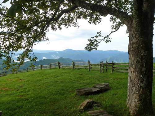
The land on the ranch property was grassy and open. There were lots of great views off to the south.
At one point I saw some folks driving a pickup on the ranch, later on I saw a few cows. Soon enough I found the summit of Hemphill Bald. The Southern Appalachian Highlands Conservancy has acquired a conservation easement for the summit, which sits on Cataloochee Ranch Property.
You pass through a stile and have a a nice grassy area in the shade of a buckeye tree to relax in,
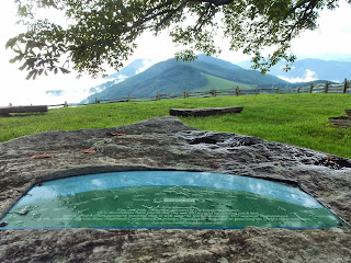
complete with a stone table (with a built in peak finder) and benches.
The views are great from this lovely spot!
After a snack, I reluctantly moved on. It was a short hike to the junction of the Cataloochee Divide Trail. I, however, would be staying on the Hemphill Bald Trail for a bit longer. The trail started a long descent through the woods. There was not a whole lot to look at for a while.Then, all of a sudden, a huge Northern red oak tree appeared in front of me.
I had my photo taken with the giant and then continued on to the Caldwell Fork Trail. The 1.7 mile segment of Caldwell Fork I had hiked before. I passed by the closed campsite #41
and then started a relatively steep ascent. I stopped at the "Big Poplars" like on my last hike through the area. As far as I can tell, only one of the trees remains, but it is just too impressive to pass by.
Soon after visiting the large tree I found myself at the junction with Rough Fork Trail.
Rough Fork started with a steep ascent, but soon joined the bed of an old logging railroad.
The hiking from that point on went very fast. I was back at the car just before 1 pm. Since 12:30 the sky had darkened and I felt a few drops of rain. Heavy rain never materialized though.


No comments:
Post a Comment