I awoke early this morning, sneaked out of the house as quietly as possible, and hit the road bound for the Great Smoky Mountains. After a stop in Newport for gas and a
yummy gas station breakfast I made my way through the curves on Interstate 40 and into North Carolina. I passed through Maggie Valley, Cherokee and into the National Park to find that the Newfound Gap Road was closed. Luckily it was open to the Smokemont Campground and the trailhead for the start of my hike.
While the Bradley Fork Trail starts in the the D Loop of the Smokemont Campground, only the first loop is currently open and so I drove over to the parking lot at the Luftee Baptist Church, parked, and hit the trail from there. Actually, I checked out the old church
and its outhouse
first and then hit the trail. The first section of trail I hiked is signed as the Smokemont Stables Trail. It was one mile to its junction with the Bradley Fork Trail.
Along the way I passed an old abandoned amphitheater.
I'm sure many an evening campfire program occurred here back in the day, but today it looks like the apocalypse has wiped out human civilization allowing nature to reclaim the earth.
After a short time, I reached the Bradley Fork Trail. The lower sections of the trail are really an infrequently used road.
The smooth surface and gentle ascent made for some fast hiking. Every now and then I stopped to admire the view of the trail's namesake Bradley Fork. The lower sections of the stream were relatively tame,
but the higher sections churned and cascaded over boulders and tree branches.
I quickly reached the intersection with the Chasteen Creek Trail
and continued on the Bradley Fork Trail. Soon the trail hugged the edge of the stream.
Eventually the trail reaches a spot where a small creek cascades into Bradley Fork.
Soon after the trail reaches its junction with the Cabin Flats Trail. This is where I would leave the Bradley Fork Trail.
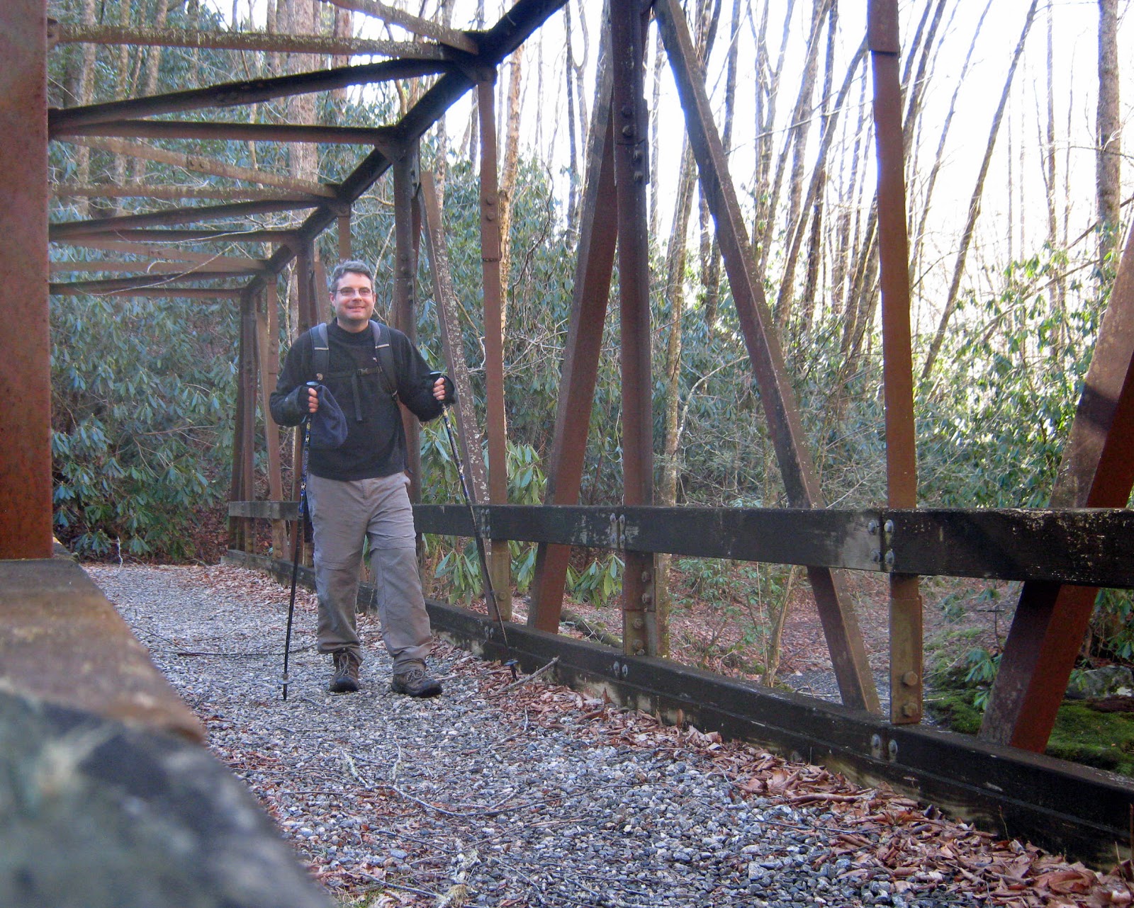
Almost immediately after it starts, the Cabin Flats Trail crosses a stream on a sturdy steel bridge.
There were several big old-growth trees along the Cabin Flats Trail and I stopped to admire a few of them.
I made my way to Campsite 49
and then turned around to head back to the junction with the Dry Sluice Gap Trail. It would be quite an ascent on the Dry Sluice Gap Trail. Luckily, there were a few more large trees to break up the climb.
While I didn't see much wildlife on the hike, I did at least see evidence of wildlife, including these holes drilled into a tree by a pileated woodpecker.
Besides the steepness of the trail, the climb on the Dry Sluice Gap was made difficult by snow. I had come unprepared. I didn't think to bring my microspikes.
The lower parts of the trail featured just a thin, but slippery, coating of snow.
However, as I approached my turnaround point at the Grassy Branch Trail, the snow was about 3 inches deep.
After tagging the sign at the junction,
I slipped and slid back down the trail and made good time all the way back to Bradley Fork. On my way back to my car I noticed a side trail, complete with a "no horses" sign,
that I had missed on the ascent portion of my hike. As I had expected, this trail led to a cemetery. There was only one marked grave, that of the daughter of Tom and Clarinda Huskey.
After paying my respects I continued on. This time, rather than taking the Smokemont Stables Trail, I opted to continue on the Bradley Fork Trail and make my way through the campground.


No comments:
Post a Comment