Sunday, January 26, 2025

Scotts Bluff National Monument: Owl Road

This morning it was cold, but Noelle and I got out to walk Owl Road. Not a lot of active birds, but we did see a nice bald eagle perched at the top of a tree along the North Platte River.


Distance hiked: 2.7 miles

Cumulative distance hiked in 2025: 28.0 miles


Saturday, January 25, 2025

Scotts Bluff National Monument: Hiking the Western Boundary North from Old Oregon Trail to Irrigation Canal

Another cold day. I headed out to the west entrance of the monument and parked the car alongside the road to hike more of the boundary. I knew it would be chilly today, but I wasn't expecting the wind that greeted me as I set out on my hike.


I followed the boundary as it made its way north past some homes on private property. Eventually I reached the point where the Emigrant Trail had once carried hundreds of thousands of pioneers west to new homes.


For a good portion of the beginning of the hike there was a fence along the boundary that made for an obvious route. However, after about a half mile the fence ends and according to the online map I was using, the boundary was in the bottom of a shallow ravine. I followed the ravine to a couple of large trees that grew along the irrigation canal.


Here I followed the canal east, past occasional posts which once were posted with NPS boundary signs, 


to the point where I had turned around on last Sunday's hike. At the turnaround point I opted to hike back to the start using a slightly different route so that I could check out an interesting looking prairie dog town.


Distance hiked: 3.1 miles

Cumulative distance hiked in 2025: 25.3 miles

Sunday, January 19, 2025

Scotts Bluff National Monument: Hiking the Boundary from Country Club Road northwest to the Irrigation Canal

This morning the air was even colder than yesterday, but because there was little wind it actually felt warmer. I parked at Country Club Road and started walking along the fence line north towards the North Platte River. Again, there were nice views west to Scotts Bluff.


Soon enough I found myself at the irrigation canal. Luckily the canal is pretty much dry, though there was a frozen waterfall leading into it. 


I crossed the canal, then headed east on the canal road to the edge of the monument badlands. The view out over the badlands with the steam rising from the sugar factory smokestacks was interesting. 


Towards the bottom of the badlands, I met the railroad tracks, walked a short distance west along the tracks and then bushwhacked north towards Owl Road and the North Platte River. On this cold day the river was like flowing slush. 


The diversion canal made a small frozen waterfall as it emptied back into the river.


As I walked Owl Road between the river and the canal, I would occasionally hear the ice that formed on the canal making snapping and cracking sounds.


At the west end of Owl Road I set off traveling further west in the river floodplain. This would not be a fun walk in the summer. I'm sure it's choked with poison ivy and ticks. There were a few areas that appeared to be places where deer bedded down. However, on this cold day I saw very little wildlife. 

At the western end of the monument's river boundary, I climbed a steep hill out of the floodplain, across the railroad tracks and along the western boundary which abutted corn fields. Sparrows were everywhere in this area. They perched all along the boundary fence.


I followed the boundary south to the irrigation canal. From here I followed the canal road east and back to the start of my hike at Country Club Road. 

Distance hiked: 5.2 miles

Cumulative distance hiked in 2025: 22.2 miles

Saturday, January 18, 2025

Scotts Bluff National Monument: Hiking the Boundary from Old Oregon Trail North to Country Club Road

It's cold out there today! I've been wanting to really track the number of miles I hike this year and am hoping to top the 1,000 mile mark. I think I probably do this pretty consistently, but I've never actually tracked it to be sure. As much as I've been itching to get out of town and hike somewhere new, the forecast of cold temperatures and snow hasn't been conducive to driving. Instead, I opted to start a project of hiking the entire boundary of Scotts Bluff National Monument.

I started by making the drive to the east boundary sign where I parked and hit the trail, or rather the fence line. Immediately, I was treated to some nice views of Mitchell Pass off to the west. 


 As I made my way along the border, I saw what appeared to be an old trailer moldering away on the prairie.


Nearby ravines were filled with old refuse. I'm guessing it was a really old dump site. As I continued on views to the east, outside the monument boundary showed old farm machinery and an interesting old truck.


Soon, I made my way to the Monument Valley Pathway. The paved trail made for much faster walking than the bushwacking I had done thus far. Views off to the west were great.


I made it as far north as Country Club Road. I had hoped to make it further, but the cold and especially the wind made for challenging hiking conditions. On the way back to the start of my hike I opted to follow the canal road through the monument instead of the boundary. This decision made for a much faster return hike.

Distance hiked: 3.6 miles

Cumulative distance hiked in 2025: 17 miles

Saturday, January 11, 2025

Scotts Bluff National Monument: Owl Road (again)

I've been wanting to get out of town to hike a longer trail that I've never hiked before. However, the weather forecast of snow and wind didn't cooperate and so I opted to head down to Owl Road again to stretch my legs. I brought the camera and here's what I saw:

Bald eagle

Downy woodpecker (male)

gadwalls

Lots of Canada geese

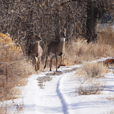
White-tailed deer

Distance hiked: 2.73 miles

Cumulative distance hiked in 2025: 13.43 miles

Sunday, January 5, 2025

Scotts Bluff National Monument: Saddle Rock and Overlook Trails in the snow

I had a few quick things to do at work this morning. Once I finished, I figured I might as well go for a hike. We got about 3 to 4 inches of snow and so today's hike would be in a winter wonderland. 


I started my way up and just past Scotts Spring I saw a large herd of about 25 deer.


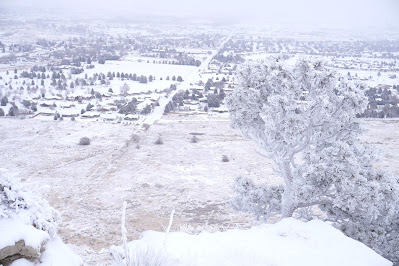
I made the steady climb higher and higher up the bluff. Starting about 1/3 of the way up the trees and other vegetation was coated with rime and snow.


The summit itself was very beautifully decorated, like a Christmas card.


I explored both the north and south overlooks and then headed back down, past the deer herd, to the visitor center.


Distance hiked: 4.4 miles

Cumulative distance hiked in 2025: 10.7 miles

Saturday, January 4, 2025

Scotts Bluff National Monument: Owl Road

 It's supposed to snow today and I wanted to get outside for some fresh air and exercise before it starts. I headed down to Owl Road with my camera to walk and look for animals. It was cold, windy and there was a hint of moisture in the air. I didn't end up seeing many birds (other than Canada geese), but I did see about 6 bald eagles, a few flickers, and some mourning doves. 


Besides the few birds I saw, I caught a quick glimpse of what I thought was a feral dog we had seen on a previous outing to Owl Road. It quickly saw me and ran off. When I made it to the area the dog had been, I found a dead opossum. It was definitely NOT playing 'possum. 


It appeared that the animal I had seen earlier had been feeding on the opossum. I was skeptical it was the dog. Sure enough, a little later into the hike I saw a coyote.


When I reached the end of the canal road, I crossed to the other side and walked game trails between the canal and railroad tracks. I didn't see much more wildlife on this cold day. However, on past hikes in the area, here's what Noelle and I have seen:

Broken arrowhead found in gravel along the river.


Old, weathered bone (not fossilized) eroding out of badlands formations. Probably bison bones.


Distance hiked: 3.1 miles

Cumulative distance hiked in 2025: 6.3 miles