Noelle and I went out to Owl Road to look for birds again. Amongst the species we saw were:

common mergansers,

and bald eagles.
After our outing, we went and got some beers at Scott Free Brewing.

Noelle and I went out to Owl Road to look for birds again. Amongst the species we saw were:
common mergansers,
and bald eagles.
After our outing, we went and got some beers at Scott Free Brewing.
We've got some good snow on the ground for the first time this winter and Noelle and I decided we would take advantage of it by getting the old skinny skis out and skiing at the monument. We were out just as the sun emerged from the clouds and began to set, making for some spectacular scenery.


Today I convinced Sierra to get out and go for a hike with me, so we made the short drive to Wildcat Hills State Recreation Area to hike the Turkey Run Trail and Northlook Nature Trail. There was some snow on the ground, which made for some nice scenery. It was warm though, and the wet snow would stick to our shoes.


Distance hiked: 4.7 miles
Cumulative distance hiked in 2025: 42.6 miles
Noelle and I got out to Owl Road to do some birding.


Distance hiked: 2.7 miles
Cumulative distance hiked in 2025: 37.9 miles
I got out for a hike in the monument as the sun rose this morning. I opted to hike up Saddle Rock Trail


Distance hiked: 3.2 miles
Cumulative distance hiked in 2025: 35.2 miles
We drove back home from Laramie today, after a great ski trip and an enjoyable time in town. I opted to get out for a hike and so headed out from home to hike a portion of the monument boundary from Old Oregon Trail Road as far as I could get until I got cliffed out.
It was a quick walk from home, past Five Rocks Amphitheater and into the monument. Once inside the monument I headed north first, past the big water tanks just outside the boundary.


I found the spot where the old monument boundary cut through Dome Rock. A USGS marker marked the spot of a significant old metal fencepost.


Distance hiked: 4.0 miles
Cumulative distance hiked in 2025: 32.0 miles
The past two days we've been in Laramie for our annual ski trip at Snowy Range Ski Area. Noelle and I had two fun days of skiing, while Sierra unfortunately, got sick on day 2.


Today, despite the cold wind, I continued my quest to hike the entire boundary of Scotts Bluff National Monument. Today's hike started at the West Entrance.

From the entrance sign I walked west along Old Oregon Trail to the unfenced monument boundary at a fairly deep ravine. I would follow this ravine for much of the 1st half of the day's hike.

There were some pretty sheer cliff lines in the ravine.

A project to repair some damaged fence last summer meant the way through the ravine was fairly well opened up so that employees could get supplies and themselves to the damaged section of fence more easily.

There were two big sections of corrugated metal down in the ravine at one point. Maybe an old water tank that had been blown in by the wind?

I eventually exited the ravine and then followed a fence line due west. An interesting old truck was out in a neighbor's field.

Soon the boundary headed south towards South Bluff.

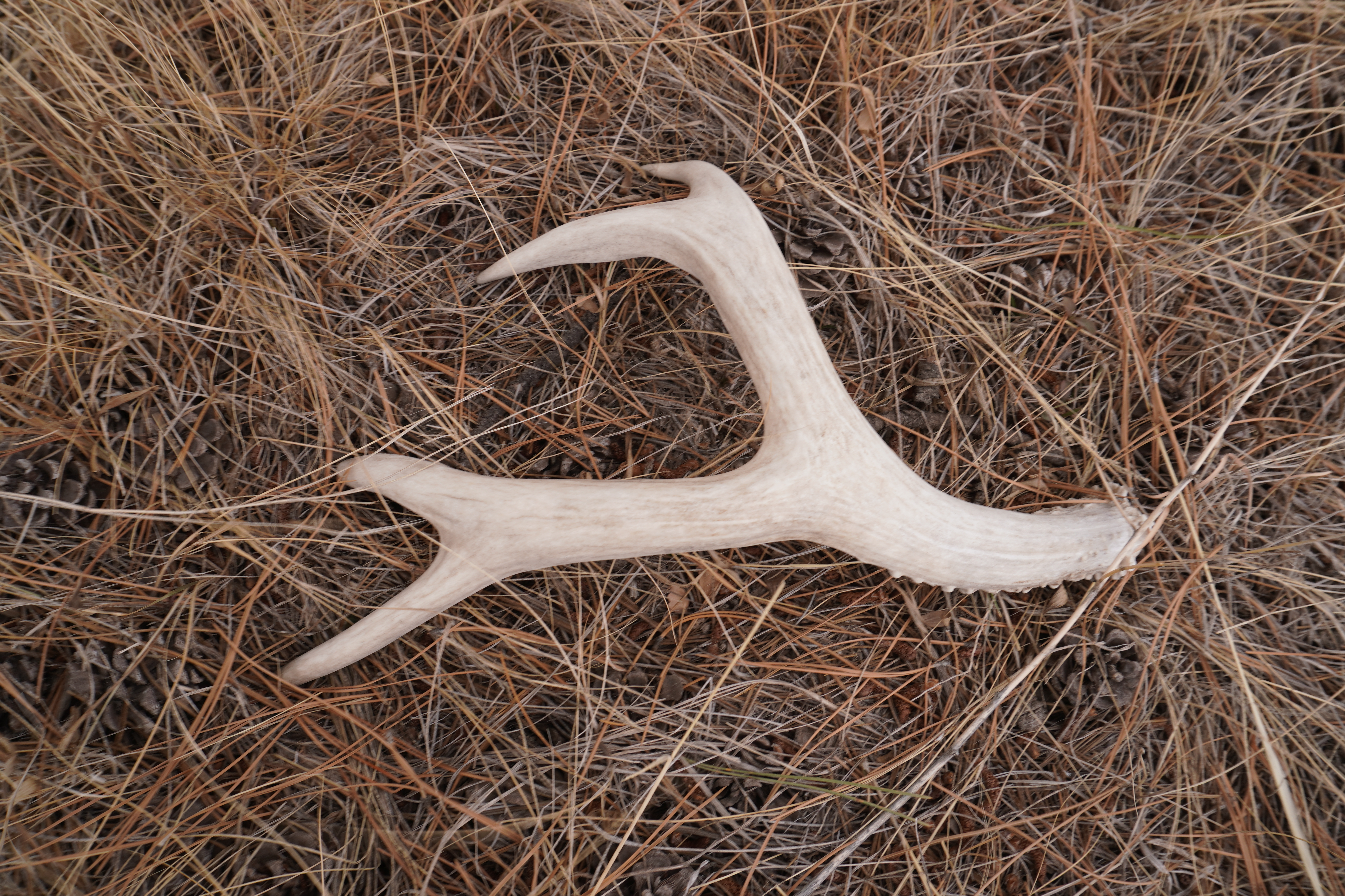
I opted not to climb the steep sketchy-looking slope up the bluff. Instead, I headed over to the old picnic area and then followed the old picnic back to the car. Along the way I found a nice deer antler.