Noelle had to take her car to the Subaru dealer because of a
recall and so we used the recall as an excuse to head over the mountains to
Asheville. Noelle dropped her car off at the dealer and I picked her up and we
headed out. First we headed over to REI. I bought a map and we got a pair of
baby sunglasses for Sierra. We also checked out a really cool toy store near
REI and got lunch at the delicious Neo Burrito.
After lunch it was a bit drizzly and overcast, but the sun
seemed to be peeking out of the clouds and so we decided to head east to
Chimney Rock State Park near the town of Bat Cave, North Carolina.
After
passing through Bat Cave we drove along the pretty Rocky Broad River. We
crossed the river and headed into the park. The entrance fee was a whopping $12
each for Noelle and I. It would have been $15 dollars each but the trail to
Hickory Nut Falls is closed due to a rockslide. It is unfortunate that the
trail to the falls was closed though, as you get a distant view of the falls
from the highway and it is quite impressive. It looks like something out of
Yosemite.
After paying our entry fee and driving up the mountain we
found ourselves at a large parking lot with a decent view of Chimney Rock
itself.
Before hitting the trail though, we fed Sierra her lunch. As we did a
little bit more blue showed itself in the sky. After lunch we hit the trail. We
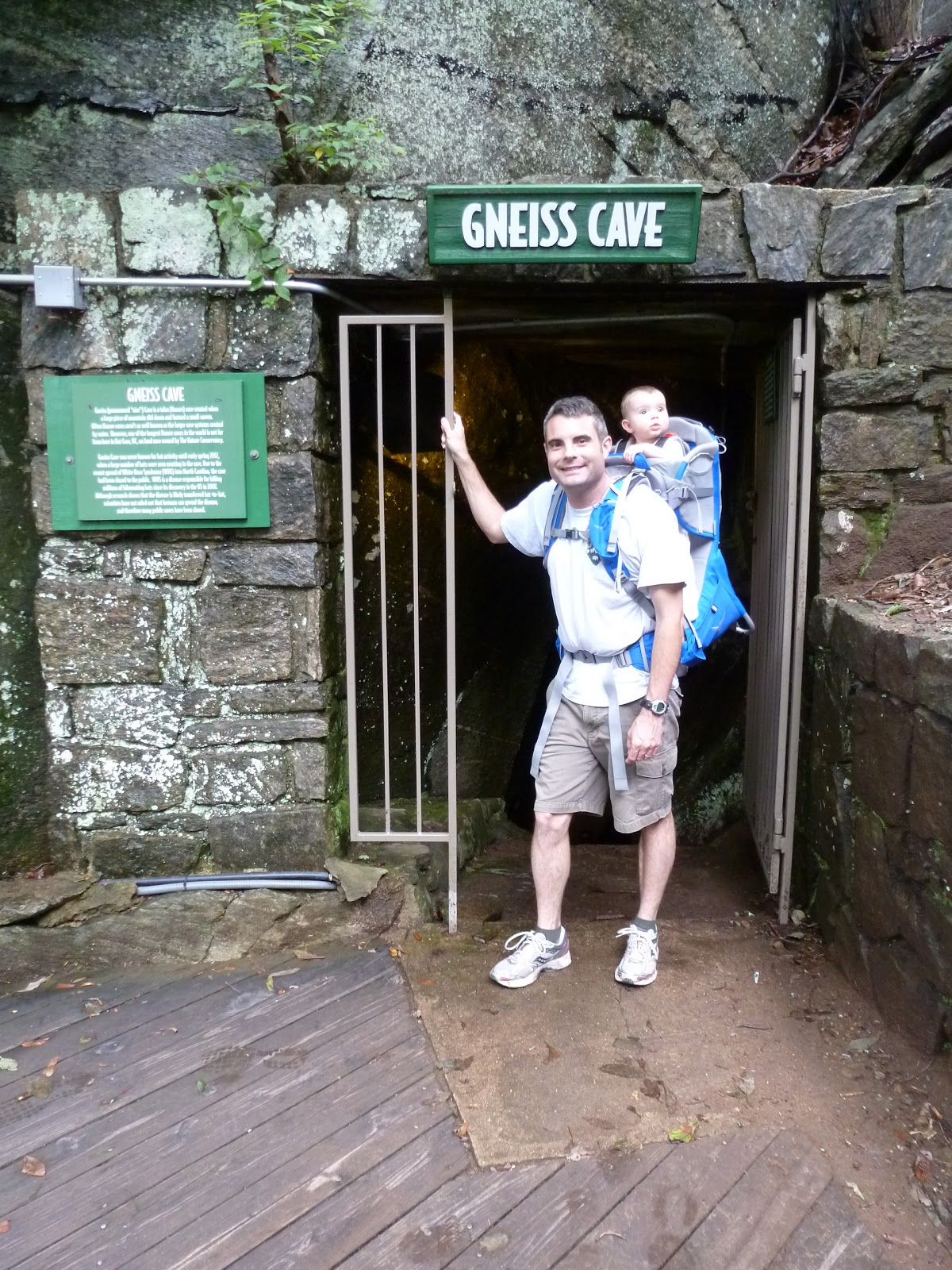
soon passed the Gneiss Cave
and then started our ascent up many stairs.
We
stopped for a short time at the Birdhouse that had some information about some
of the native birds in the area. On top of one of the wooden bird silhouettes a
bird had built a nest.
It really is a “birdhouse”. Near the birdhouse was a
nice overlook called Vista Rock.
The Hickory Nut Gorge is really impressive:
deep with sheer granite walls in places.
We got a great view of the gorge and
Lure Lake, an unimpressive, man-made reservoir.
From Vista Rock it was more steep, stair climbing up to
Chimney Rock. There was another impressive view from Chimney Rock and two
ladies who were smitten with Sierra took a family photo of us on top.
After our
photo we looked around the rock for a bit
and then headed higher yet up the
Skyline Trail. We stopped at the Opera Box and Devil’s Head
before climbing up
to Exclamation Point and yet another great view of the Hickory Nut Gorge.
After a few minutes on Exclamation Point we started to make
our descent. I must say that I really was impressed by Chimney Rock.
It is
clean and well-maintained. However, I do believe that the entrance fee is a bit
too steep, especially considering it is now a state park. That being said I
would like to return some day when the trail to Hickory Nut Falls is
reopened.
Friday, June 7, 2013
Thursday, June 6, 2013
Pisgah National Forest: Lover’s Leap Loop
I’ve been a bit stressed out about our home purchase and
mortgage lately. I just had to get out of the house. Noelle gave me permission
to head out for a hike and, not wanting to go too far I decided I would hike
somewhere in the Hot Springs, NC area. A look at the map showed a trail called
Betty’s Place that looked to be relatively close and not too long and so I
headed east into North Carolina.
The drive to Hot Springs was uneventful, but the Laurel
River did appear to be muddy and swollen. We had gotten some heavy rain last
night, but this area must have really gotten nailed. I made my way to Hot
Springs, drove through town and then headed back towards Tennessee on US
Highway 25/70.
I soon found the turnoff for Upper Shut-in Road and quickly realized that something was not right. There was a “construction ahead” sign and lots of trucks hauling rock. I slowly followed one of the trucks up the hollow and noticed an increasing amount of water along the side of the road. Soon the road was covered in mud and the houses on the other side of the creek were not accessible. The storm last night must have washed out several bridges. At this point I was between two large, slow-moving dump trucks and there was no place to turn around. Sections of the road closest the creek were washed away. Things were not looking good. Eventually all traffic came to a stop. I used this opportunity to turn around. The hike to Betty’s Place would have to wait for another day.
I headed back to Hot Springs and formulated a plan in my mind as I drove. I decided I would head to the Silvermine Trailhead where I parked the other day for my hike on the Pump Gap Trail. I would hike the short Lover’s Leap Trail. The road back to the trailhead was covered with mud and debris, but was still easily passable. I parked the car and hit the trail under an overcast sky. I retraced my route of my previous hike in the area until I came to a junction. The Pump Gap Trail continued straight ahead while I followed a switch-back to the right. It was obvious from the faint white blazes on the trees that this trail I was following was originally the Appalachian Trail before the AT was rerouted.
I slowly ascended to Lover’s Leap and the current Appalachian Trail. I followed the AT to an overlook of the French Broad River
and the town of Hot Springs.
There was a friendly fence lizard there basking on the rocks.
I rested a bit and then hit the trail again. I would follow the AT back to the road that leads to the Silvermine Trailhead. This section of Appalachian Trail was impressive. It was a narrow footpath blasted out into a sheer rock face.
It must have taken a lot of work to build this section of trail. There were lots of clusters of small white flowers scattered along the side of the trail.
The flowers appeared to be of some type of lobelia. I descended down, eventually walking along the French Broad River. I saw a few kayakers out playing in the rapids. I also saw a few tents set up right along the trail.
These tents appeared to belong to people who were not backpackers, but were living along the river semi-permanently. Could they belong to river guides? One of the tents had a 40 of malt liquor sitting outside its door. I followed the swollen river
back to the road and followed the road back to my car. While it was not my original plan to hike the Lover’s Leap trail, it turned out to be a good hike and I drove home in a pouring rain. Noelle told me it had started to rain in Greeneville shortly after I left. Somehow I missed hiking in it though.
I soon found the turnoff for Upper Shut-in Road and quickly realized that something was not right. There was a “construction ahead” sign and lots of trucks hauling rock. I slowly followed one of the trucks up the hollow and noticed an increasing amount of water along the side of the road. Soon the road was covered in mud and the houses on the other side of the creek were not accessible. The storm last night must have washed out several bridges. At this point I was between two large, slow-moving dump trucks and there was no place to turn around. Sections of the road closest the creek were washed away. Things were not looking good. Eventually all traffic came to a stop. I used this opportunity to turn around. The hike to Betty’s Place would have to wait for another day.
I headed back to Hot Springs and formulated a plan in my mind as I drove. I decided I would head to the Silvermine Trailhead where I parked the other day for my hike on the Pump Gap Trail. I would hike the short Lover’s Leap Trail. The road back to the trailhead was covered with mud and debris, but was still easily passable. I parked the car and hit the trail under an overcast sky. I retraced my route of my previous hike in the area until I came to a junction. The Pump Gap Trail continued straight ahead while I followed a switch-back to the right. It was obvious from the faint white blazes on the trees that this trail I was following was originally the Appalachian Trail before the AT was rerouted.
I slowly ascended to Lover’s Leap and the current Appalachian Trail. I followed the AT to an overlook of the French Broad River
and the town of Hot Springs.
There was a friendly fence lizard there basking on the rocks.
I rested a bit and then hit the trail again. I would follow the AT back to the road that leads to the Silvermine Trailhead. This section of Appalachian Trail was impressive. It was a narrow footpath blasted out into a sheer rock face.
It must have taken a lot of work to build this section of trail. There were lots of clusters of small white flowers scattered along the side of the trail.
The flowers appeared to be of some type of lobelia. I descended down, eventually walking along the French Broad River. I saw a few kayakers out playing in the rapids. I also saw a few tents set up right along the trail.
These tents appeared to belong to people who were not backpackers, but were living along the river semi-permanently. Could they belong to river guides? One of the tents had a 40 of malt liquor sitting outside its door. I followed the swollen river
back to the road and followed the road back to my car. While it was not my original plan to hike the Lover’s Leap trail, it turned out to be a good hike and I drove home in a pouring rain. Noelle told me it had started to rain in Greeneville shortly after I left. Somehow I missed hiking in it though.
Wednesday, June 5, 2013
Appalachian Trail: Firescald Ridge Relocation Loop
Not the greatest weather this morning, but I still decided I needed to get out of the house for a little hike. I packed up my pack and hit the road. I traveled the Asheville Highway to just before the North Carolina border and then headed up Viking Mountain Road. I ascended and ascended and ascended eventually ending up high on Camp Creek Bald. I parked the car at the intersection of two roughly paved roads and stepped out into the enveloping fog. The fog lent an air of mystery and melancholy to the scene at Jones Meadow
and I explored the meadow a bit before turning off onto a blue-blazed road for my hike, a 4.5 mile loop on the relocated Appalachian Trail over Firescald Knob and old Appalachian Trail.
The road walk was easy but a bit confusing as there were roads heading in many different directions. Plus, the recent rains turned the middle of several sections of road into big mud bogs. I did see an interesting section of wall.
Could this be the remains of the resort that is rumored to have existed up here? I was relieved when I reached the Appalachian Trail itself. This section of the AT was relatively easy hiking; level and not too rocky. I made good time to the intersection of the old and new sections of trail.
At the intersection I opted to hike the old, blue-blazed section first. My reasoning was that it was still a bit foggy up here and I thought that maybe as the day progressed the sun would burn off some of the fog and I would get better views on the new and more exposed AT.
The hike along the blue blazed "foul weather" section of trail was not too interesting, but the hiking went pretty fast.
I did see a few juncos flitting here and there.
Before I knew it I was at the other intersection of the trails, the point where I would take the new AT and start to head back towards the car. The hiking almost immediately got more interesting as I climbed up to a narrow rocky ridge with lots of views through openings in the fog to the east into North Carolina
and west into Tennessee. The trail was quite rugged up on the ridge.
There was uneven footing and the the damp fog made the rock slick.
There were lots of flowers in bloom. Mostly they were white clusters of flowers on a stalk with grassy-looking leaves.
There was also some rhododendron in bloom.
Eventually the trail headed off the ridge and back into the woods. I came to the end of the loop section of trail and started to retrace my steps on the section of AT that I had hiked earlier. This time I decided to take the side trail that led to Blackstack Cliff.
The trail was quite rugged, but it led to a very nice view off into Greene County and Greeneville.
I can imagine this view is even more spectacular on a nice clear day.
I rested for a few minutes at the viewpoint before retracing my steps to the AT.
It was a short walk on the AT back to the blue blazed road/trail that led to the car. Once I was back at the car I could look back at the Blackstack Cliffs which I had stood on just a few minutes earlier.
Jones Meadow was no longer as fogged in as it was earlier and I didn't really want to leave. I did want to see Noelle and Sierra though, and so I reluctantly got in the car and made the drive down the mountain and back home.
and I explored the meadow a bit before turning off onto a blue-blazed road for my hike, a 4.5 mile loop on the relocated Appalachian Trail over Firescald Knob and old Appalachian Trail.
The road walk was easy but a bit confusing as there were roads heading in many different directions. Plus, the recent rains turned the middle of several sections of road into big mud bogs. I did see an interesting section of wall.
Could this be the remains of the resort that is rumored to have existed up here? I was relieved when I reached the Appalachian Trail itself. This section of the AT was relatively easy hiking; level and not too rocky. I made good time to the intersection of the old and new sections of trail.
At the intersection I opted to hike the old, blue-blazed section first. My reasoning was that it was still a bit foggy up here and I thought that maybe as the day progressed the sun would burn off some of the fog and I would get better views on the new and more exposed AT.
The hike along the blue blazed "foul weather" section of trail was not too interesting, but the hiking went pretty fast.
I did see a few juncos flitting here and there.
Before I knew it I was at the other intersection of the trails, the point where I would take the new AT and start to head back towards the car. The hiking almost immediately got more interesting as I climbed up to a narrow rocky ridge with lots of views through openings in the fog to the east into North Carolina
and west into Tennessee. The trail was quite rugged up on the ridge.
There was uneven footing and the the damp fog made the rock slick.
There were lots of flowers in bloom. Mostly they were white clusters of flowers on a stalk with grassy-looking leaves.
There was also some rhododendron in bloom.
Eventually the trail headed off the ridge and back into the woods. I came to the end of the loop section of trail and started to retrace my steps on the section of AT that I had hiked earlier. This time I decided to take the side trail that led to Blackstack Cliff.
The trail was quite rugged, but it led to a very nice view off into Greene County and Greeneville.
I can imagine this view is even more spectacular on a nice clear day.
I rested for a few minutes at the viewpoint before retracing my steps to the AT.
It was a short walk on the AT back to the blue blazed road/trail that led to the car. Once I was back at the car I could look back at the Blackstack Cliffs which I had stood on just a few minutes earlier.
Jones Meadow was no longer as fogged in as it was earlier and I didn't really want to leave. I did want to see Noelle and Sierra though, and so I reluctantly got in the car and made the drive down the mountain and back home.
Monday, June 3, 2013
Pisgah National Forest: Pump Gap Loop
I headed over to Hot Springs today to hike a loop I had seen on my map called the Pump Gap Loop. I had a slightly difficult time finding the trailhead as it appeared to be on the left side of US Highway 25-70 as you head into Hot Springs from Greeneville. The only problem was there was no road on the left side. I quickly realized that I had to make the right at that intersection and then head underneath the French Broad River bridge at the side of the river. This led me right to the parking lot.
After a time following the cascading creek I began to ascend. There was lots of mountain laurel in bloom.
There was also some tulip poplar in bloom.
Eventually the trail leveled out a bit and followed an old road for a bit to an old cemetery.
It was an interesting, semi-forgotten looking place with a few readable headstones.
I spent a few minutes snooping around and then got back on the trail which remained an old road for a bit.
There is, in fact, a whole maze of old roads back there. I left the old road and began to descend. Soon I came to a wet section of trail near a creek. I saw a garter snake out basking in the sun.
Along my hike I also saw some day flower in bloom,
a caterpillar,
and some bright orange fungi growing on a tree.
I slowly made my way back to the group campground and followed the gated road from there back to my car.
From the parking lot I followed a slightly overgrown trail uphill.
There were faint white blazes on some of the trees so I guess this was once the Appalachian Trail before it was rerouted. I soon came to a junction in the trail with a downed sign. The trail that switchbacked to the right led to Lover's Leap while my trail led straight ahead. I descended to a group campground and then followed a creek along an interesting section of old road. There were some creepy looking explosives sheds
and old Pisgah National Forest signs moldering away.After a time following the cascading creek I began to ascend. There was lots of mountain laurel in bloom.
There was also some tulip poplar in bloom.
Eventually the trail leveled out a bit and followed an old road for a bit to an old cemetery.
It was an interesting, semi-forgotten looking place with a few readable headstones.
I spent a few minutes snooping around and then got back on the trail which remained an old road for a bit.
There is, in fact, a whole maze of old roads back there. I left the old road and began to descend. Soon I came to a wet section of trail near a creek. I saw a garter snake out basking in the sun.
Along my hike I also saw some day flower in bloom,
a caterpillar,
and some bright orange fungi growing on a tree.
I slowly made my way back to the group campground and followed the gated road from there back to my car.
Saturday, June 1, 2013
Cherokee National Forest: Rock Creek Falls
Today Noelle, Sierra and I headed up to Erwin to check out the Rock Creek area and hike to the Rock Creek Falls. The hike started on a nice smooth gravel path near a swimming pond.
It was a very pleasant hike as we passed a few campsites and then headed into the wilderness
on a much more rugged trail. There were several stream crossings, none of which were too difficult.
Lots of people on the trail too. It was good to see so many people outdoors taking advantage of the beautiful weather.
Soon we could hear the sound of rushing water and the Lower Rock Creek Falls came into view.
Not long after passing the lower falls we found ourselves at the impressive two-tiered Upper Rock Creek Falls.
We spent a few minutes at the falls admiring the view
and then headed back down the trail to the car. The return hike, being downhill, was easy and we made quick time back to the car.
It was a very pleasant hike as we passed a few campsites and then headed into the wilderness
on a much more rugged trail. There were several stream crossings, none of which were too difficult.
Lots of people on the trail too. It was good to see so many people outdoors taking advantage of the beautiful weather.
Soon we could hear the sound of rushing water and the Lower Rock Creek Falls came into view.
Not long after passing the lower falls we found ourselves at the impressive two-tiered Upper Rock Creek Falls.
We spent a few minutes at the falls admiring the view
and then headed back down the trail to the car. The return hike, being downhill, was easy and we made quick time back to the car.
Subscribe to:
Posts (Atom)