Monday, May 12, 2014

Pisgah National Forest: Black Mountain Crest Trail Mt Mitchell Parking Lot to Celo Knob

It had been a long time since I had gone on a solo adventure! Today I took my opportunity to do some peak bagging in North Carolina's Black Mountains. I awoke at 6 am, walked the dog and threw my gear into the car for the drive through Weaverville, up to the Blue Ridge Parkway, and over to Mount Mitchell State Park. I parked the car at the trailhead for the Deep Gap Trail which is also known as the Black Mountain Crest Trail. This trail is where I would spend the vast majority of the next 9+ hours of my life.

The trail started with an easy, well-graded, downhill walk to a gap
and then a not-too-tough ascent of Mount Craig which I had ascended back in November. Today however, I cruised right past the summit to continue on in my quest to ascend all the 6,000 foot peaks in the southeast. Just past the summit of Mount Craig was a wonderful overlook of the rest of the Black Mountain Range.
I would be ascending all the peaks on the ridge, and from that vantage point my task did not seem all that difficult. Things were about to get a whole lot tougher though.

From the overlook on Craig I descended to a small col between Craig and Big Tom, and then asended to the summit of Big Tom. Big Tom is named for Big Tom Wilson a mountain man who discovered the body of geologist Elisha Mitchell. I snapped a quick photo of Big Tom
and then continued on heading down into another gap. Along my hike I was treated not only to wonderful mountain views,
but also glimpses of some wildflowers that had ceased blooming in the lowlands weeks ago
including several varieties of trillium.
I ascended out of the gap and up onto the summit of Balsam Cone.

From Balsam Cone it was another descent into a gap and then an ascent up to the false summit of Cattail Peak. There is a sign indicating Cattail Peak just off to the side of the Black Mountain Crest Trail.
However, this sign is inaccurate. The true summit requires a quarter mile bushwhack up the ridge to the summit. There is supposedly a benchmark on the summit of Cattail Peak, but I could not find it. If I did not find the true summit of Cattail Peak, I must have been very close to it as I scoured the ridge twice. ( The second time being on my return hike.)  After Cattail Peak it was a quick descent and then ascent up to Potato Knob.      

From Potato Knob it was a long steep descent
into Deep Gap and the first legal campsites on the southern end of the trail. As I made my way down, I could see my next objective for this hike through the trees: Winter Star Mountain and its sister summit Deer Mountain.
I made my way up Winter Star and found a benchmark at the summit.
Then it was yet another descent down into a gap with a climb back out. Views opened up to my final two major objectives: Gibbs Mountain and Celo Knob.
Unfortunately, they were still a pretty long ways off. By this time I was starting to understand the difficulties of the trail. While I had read how difficult the Black mountain Crest Trail is, I really thought what I had read were exaggerations and truly underestimated the difficulty of the trek. Still, I decided to continue on.

After climbing out of the gap between Winter Star and Gibbs Mountain the views really opened up.
There were frequent high meadows off to the side of the trail. The directions to Gibbs that I had copied off the Carolina Mountain Club website were confusing and so I decided to skip the ascent of that mountain until another day. Instead I headed to Celo Knob
under a darkening sky. There is a user trail that branches off the official Black Mountain Crest Trail just past Horse Rock. This trail, though quite faint, leads to the summit of Celo Knob. I followed it to the summit where I took a break and studied the topo map to see if I could gain any new insights into finding the summit of Gibbs Mountain.
The problem with the map is that it states the elevation of Gibbs to be 5,545 feet; clearly not a 6,000 footer. I should have done more research before I left. However, on the bright side, my inability to ascend Gibbs
gives me another excuse to make a trip up into the Blacks sometime in the future.

From the summit of Celo Knob I found my way down to the Black Mountain Crest Trail and started heading back to the parking area near Mount Mitchell. I was definitely starting to feel like I had bitten off more than I could chew. I still had a long hike back to the car under increasingly dark sky
with rumbles of thunder every now and then. To make matters worse, my thighs were starting to cramp quite severely.  I soldiered on though. What else could I do? Because I was so tired, I had little energy for taking photographs. I simply put one foot in front of the other and continued on as best I could. I ate my last granola bar and drank my last bit of water before I even made it back to Potato Knob, but luckily I arrived back at the car dry just after 6 pm for my long drive back to Greeneville.

Sunday, May 11, 2014

Pisgah National Forest: Catawba Falls

Noelle, Sierra and I celebrated Mother's Day as a family with a trip into North Carolina for some hiking and delicious food. We made the drive through Asheville and into Black Mountain where we stopped for a delicious lunch at the Trailhead Restaurant.   After lunch we drove a little bit further east to the town of Old Fort and the traihead for our hike to Catawba Falls.

While the Forest Service has recently built a parking area for the popular trail, it lies on the other side of a closed bridge, and so it is inaccessible to vehicles. Pedestrians are still allowed to hike across it though, and so we started our hike by walking across a closed bridge and through an abandoned parking lot. Once on the actual trail the hiking experience greatly improved. We soon came to a few relics of past human use. There were a few stone walls lining the trail and even the ruins of some sort of building.
After inspecting the ruins we were back on the trail heading upstream to the falls.

We crossed a small, cascading side stream
and then found an old concrete dam
and another set of concrete ruins.
As we headed further up the trail we saw one of the largest garter snakes I've ever seen.
Then, before we knew it, we were at Catawba Falls.
We stayed at the bottom of the lower falls, but there was a trail that led to a platform in the middle of the large set of cascades. Supposedly, there is a rope fixed that allows hikers to access the impressive upper falls. However, with Sierra in the backpack, there was no way we were going to do any rock climbing today.

Instead of rock climbing we relaxed on the rocks at the base of the falls and enjoyed the sound of the cascading water. It was also fun watching Sierra play in the water and throw rocks into it.
We even found a few salamanders.
Sierra was a bit curious about them.
After about 45 minutes at the falls, we decided it was time to head back to the car. We crossed the Catawba River on stepping stones
and took a short side trail to another set of ruins that I believe may be an old electricity generating station.
From there it was a quick walk back to the car. We headed back to Black Mountain for some ice cream before making our way back to Greeneville.

Sunday, May 4, 2014

DuPont State Forest: Waterfall Trio Hike

What a beautiful day for a hike! Temperature in the high 70s, blue sky, light breeze. We took advantage of the wonderful day by going for a hike southwest of Asheville at the DuPont State Forest. Today was our last day to pick up the new family tent we had ordered from REI. We had it delivered to the store in Asheville to save money. We picked up said tent, ate lunch at the nearby, delicious Neo Burrito, and then headed past a raging house fire (I sincerely hope everyone made it out safely) to DuPont.

The parking lot was packed upon our arrival. We were obviously not the only ones out looking to take advantage of the wonderful weather. We got Sierra in her backpack and then hit the trail.
Our first stop was just a short walk down the trail at Hooker Falls. We got a good view from the side of the falls
and then descended to the base.
Hooker Falls
We spent just a few minutes admiring the falls (it looks kinda like a really small Cumberland Falls) before retracing our steps to start the next leg of our journey.

We then crossed a relatively new footbridge across the Little River and followed the trail
(really a gravel road) to our next destination: Triple Falls.
Triple Falls
Wow! I was really impressed with Triple Falls. I had seen photos on the internet, but they just don't really give you a sense of the scale of these falls. We checked them out from an overlook and then headed further up the trail to check out High Falls.

High Falls, like Triple, was very impressive. We first walked to the base of the falls and then hiked up to a higher viewpoint. We hiked past the viewpoint to a covered bridge, which was our turnaround point for the hike.

On our way back to the car we took a side trip down to Triple Falls. A set of wooden stairs led down to the base of the middle of the three falls. We rested there while Sierra ate an apple and splashed in the water for a bit.
Then we headed back to the car for a quick stop at the Dairy Bar and the drive back to Greeneville. The drive home was a bit more interesting than usual, as we got stuck behind a driver in a Mini who had very unsafely lashed some building materials to her car.
They looked like they could have fallen off at any moment and the wind was doing its best to pry the materials off. We survived though!

Sunday, April 27, 2014

Banff Mountain Film Festival World Tour 2013-14

After my sister's wedding last evening, we were all pretty tired. Still, Noelle and I headed up to Bethlehem on some old familiar roads to attend the 2013-14 version of the Banff Mountain Film Festival World Tour. Seeing as we usually attend the one of the first stops on the tour (Duluth or Eau Claire) this would be a late viewing of the films for us.

The venue was decent, though our seats were not the best as they were too close to the screen. The films were very good, though I was not as excited about them as some of the films we have seen in the past.
These are the films we saw in the order in which we viewed them: 

Thursday, April 24, 2014

Rehoboth Beach, Delaware

So today Noelle, Sierra and I spent a good part of our day in Delaware. The experience was a bit like this:

Actually, we had fun on the beach even though it was a bit cold and windy.
We also enjoyed some ales at Dogfish Head's brewpub.

Wednesday, April 23, 2014

Thomas Stone National Historic Site

Last night we stayed with family in beautiful Woodford, Virginia. This morning we hung out for a bit before hitting the road on our way north to Pennsylvania. Our first stop would be across the Potomac River at Thomas Stone National Historic Site. (Stone was one of the signers of the Declaration of Independence.) Sierra was not in the most cheerful of moods and so we did not go on a ranger guided tour of the home Haberdeventure. Instead we walked a short trail that led from the visitor center,
past the Stone Family Cemetery
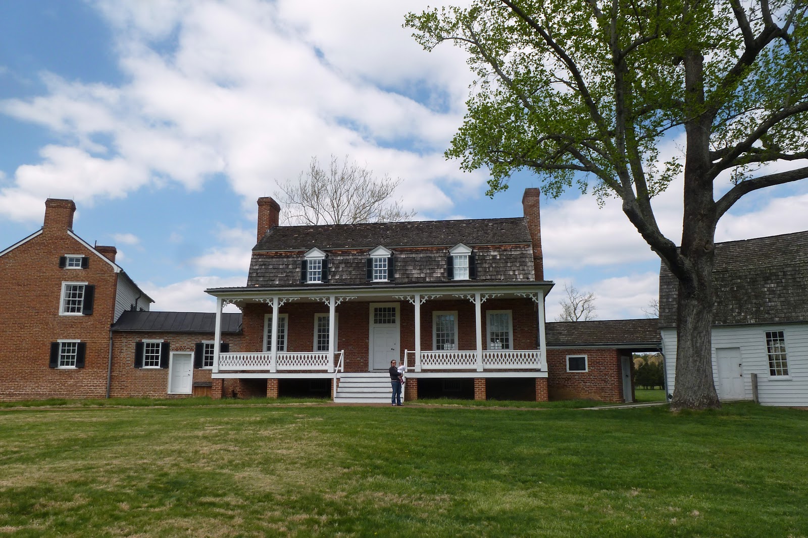
and over to the home.
We walked around the old home
and over to some of the outbuildings, including a tobacco barn.
Then we returned to the visitor center to get ready for the rest of the day's drive into Delaware.