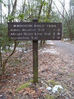
I finished the coffee I had bought in Newport and then hit the Maddron Bald Trail which at this point is a wide, closed gravel road. The hiking on the road went fast and before I knew it I was at the Baxter Cabin.
The cabin dates back to the late 1800s. I had a look around and found the improved spring that the Baxters must have used for drinking, cooking and cleaning.
From the cabin it was a short walk to the intersection of the Maddron Bald, Gabes Mountain and Old Settlers Trails. I made a right onto the Old Settlers Trail and started downhill.
There were lots of graves marked only with uncarved, rough stones. I did find two headstones that were carved. One was difficult to read,
but the other plainly said Madron.
I'm guessing it was the grave of an infant as there was only one date on inscribed on it.
From the cemetery I made my way farther along the Old Settlers Trail. Evidence of the former community that once existed here was abundant. I crossed a substantial creek (possibly Dunn Creek) on a footbridge.
I then followed the vestiges of an old road lined with mossy rock walls.
These rock wall lined roads would become a familiar presence on this hike. Soon I found an old home site that I wanted to explore a bit. There was a crumbling old chimney, and old blue pot,
and some broken pieces of pottery. I returned to the trail and made my way west. There really were piles of rock everywhere. Not all the piles appeared to be chimneys or walls though. Some seemed to be places where the settlers had piled the rocks that they cleared from their farm fields.
With all the trees here now, it's hard to imagine that 100 years ago this area would have been mainly agricultural fields.
The trail descended along a creek
and near the bottom of the descent was a marked side trail that led to the McCarter Barn. I followed the trail to the quiet setting. The barn was large and the sign outside it stated that it was built around our nation's centennial in 1876.
I could see another structure near the cabin and walked over to it to investigate. It was the springhouse
and outside its now unchinked walls the first signs of spring were showing: the green stalks of flowers, likely daffodils.
I found a nice rock to sit on and ate a snack near the cabin. Then it was back to the Old Settlers Trail to continue my march west.
As I continued the signs of human habitation were everywhere. There were lots of tall rock walls lining the trail.
I also found several more home sites. In fact, I started to find so many old chimneys, I stopped photographing them all. I did, however, photograph some of the more interesting ones.
At one old site I found lots of broken glass.
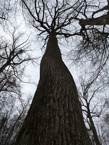
Besides the old home sites I did get up into some of the higher elevations away from where people built their homes. In these areas I found a few really big trees.
It was interesting to see how extensive the settlement was though. I would get to some really rough, seemingly hard to access areas and still find rock walls and chimneys (and sometimes a beer can).
Those settlers were pretty hard core.
It was sometimes very easy to find the location of an old home. Even if there was not much of the chimney left there might be some yuccas growing near a small rock pile;
a sure giveaway that a home had once existed there. I began to descend near a creek again. towards the bottom of the descent the Old Settlers Trail made a sharp left. I saw a pretty well-worn trail on an old road heading right though and decided to follow it. It led down to a small flat area where the creek cascaded. I was about to head back to the OST Trail when I caught a glimpse of a chimney in really good shape and so I went over to investigate.
I crossed the creek and had a look. It was an impressive place for a home with the creek cascading over rocks and even a small waterfall.
I stopped here, near the creek for lunch. Then retraced my steps back to the Old Settlers Trail.
Shortly after returning to the Old Settlers Trail I found another tall chimney in good shape.
Then there were more scattered remnants of civilization.
Soon I found myself at Campsite 33.
I was pretty tired at this point and I didn't think I would make it back to my car before dark if I retraced the OST back to my car. Instead, I decided I would follow Redwine Creek down to Highway 321 and follow the road back to my car. I decided to see if I could find an old road to follow, rather than bushwhack down to the road. Sure enough, just past the campsite, I found an old unmarked road that seemed well-traveled.
I followed it down to Highway 321
at a point where there was a golf course and a group of condos high up on the mountain on the other side of the highway.
I followed the highway east past homes, campgrounds, and struggling businesses on my way back to the car. I also passed a cascading waterfall
and the site of some research being done in the park.
I'm guessing it's research on the Hemlock Wooly Adelgid as the area contained lots of hemlock trees
and two of them were covered in what appeared to be tents.
After checking out the research site I dodged traffic on the highway back to the car.


1 comment:
Consider the possibility that those piles of rock are Native American.
Post a Comment