Noelle and I had originally planned a trip to Asheville, but Noelle ended up not feeling too well and decided to let me go off on my own for a "Man Day". It was about nine when I realized I had a free day, and so I had a late start in hitting the road. I quickly packed my pack, and hit the road for the Great Smoky Mountains National Park. I pulled into the gravel area off the side of the Greenbrier Road and the Grapeyard Ridge Trailhead a little bit after 10:30 and hit the trail.
I had originally planned to hike the Grapeyard Ridge Trail in its entirety, all at once. However, With my late start I knew that there was no way I could hike the 15+ miles roundtrip and get back home at a reasonable time. Instead, I decided to hike Grapeyard Ridge to Campsite 32. I had read that there was an unofficial trail, called the Injun Creek Trail, that started just past the campsite. I would hike this trail to the Greenbrier Road and follow the road back to my car.
As I started my hike, it was immediately evident that spring is, indeed here. I saw some vinca in bloom
right at the trailhead.
As I made my way up the trail (really an old road) I saw some yellow violets in bloom as well.
Almost immediately I found a side trail, an old road that led to a cemetery.
It is apparently called the Friendship Baptist Church Cemetery, but many of the graves were marked with the name Whaley.
After exploring the cemetery for a bit I retraced my steps to the main trail which led through a tunnel of rhododendron. Soon I found myself closely following Rhododendron Creek.
I crossed the creek several times on stepping stones. I found more flowers along Rhododendron Creek including spring beauty
and even some trillium, not quite yet in bloom.
Soon I crested a gap and started a descent. The descent followed Injun Creek and I quickly found myself at the remains of a steam powered tractor that had been used in logging trees in what is now the national park.
I explored the remains a bit and then continued on. It wasn't long before I stood at the junction of the Grapeyard Ridge Trail and the unofficial Injun Creek Trail near Campsite 32.
I passed the campsite and continued on the trail which was, not surprisingly, an old road.
I passed a few cascades on Injun Creek
and then found a signed side trail that led to the EE McCarter Cemetery.
The trail that led to the cemetery was well maintained and even had a bridge that crossed over a small stream.
The cemetery itself was interesting.
There were headstones with barely legible names and dates carved into them.
The McCarters must not have had a whole lot of formal schooling. After a few minutes at the cemetery I returned to the main trail and continued to descend on an old road along Injun Creek.
The park service must maintain the unofficial trail to allow descendents to get to the cemetery for Decoration Day. As I made my way further down I saw a few signs of past habitation, including a tall stack of rock,
and a developed spring.
I also found a faint trail that led to a very large tree.
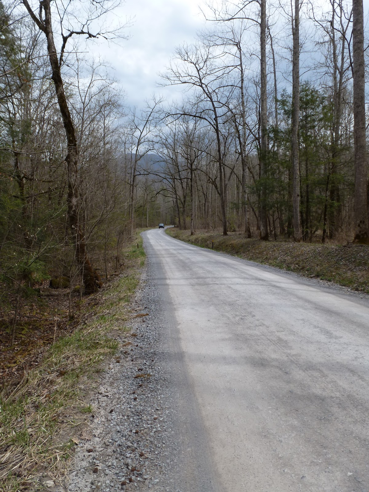
Within minutes of leaving the large tree I exited the woods at the Greenbrier Ranger Station
and turned right onto the road.
The road walk turned out to be more interesting than I had imagined it would be. Moving at a walking pace allowed my to discover trails leading off into the woods that I never would have seen had I been zipping past in a car. At a gravel parking spot, I found a path down to the Little Pigeon River.
When I returned to the road I noticed a trail on the other side. I was intrigued. I had to find out where it led. It turned out to lead to an old home site complete with standing chimney
and old rusting metal wash tubs.
Just past the home site was another cemetery, the FE Huskey Cemetery.
Again I spent a few minutes exploring the cemetery and then returned to the road.
The road passed some rapids on the river
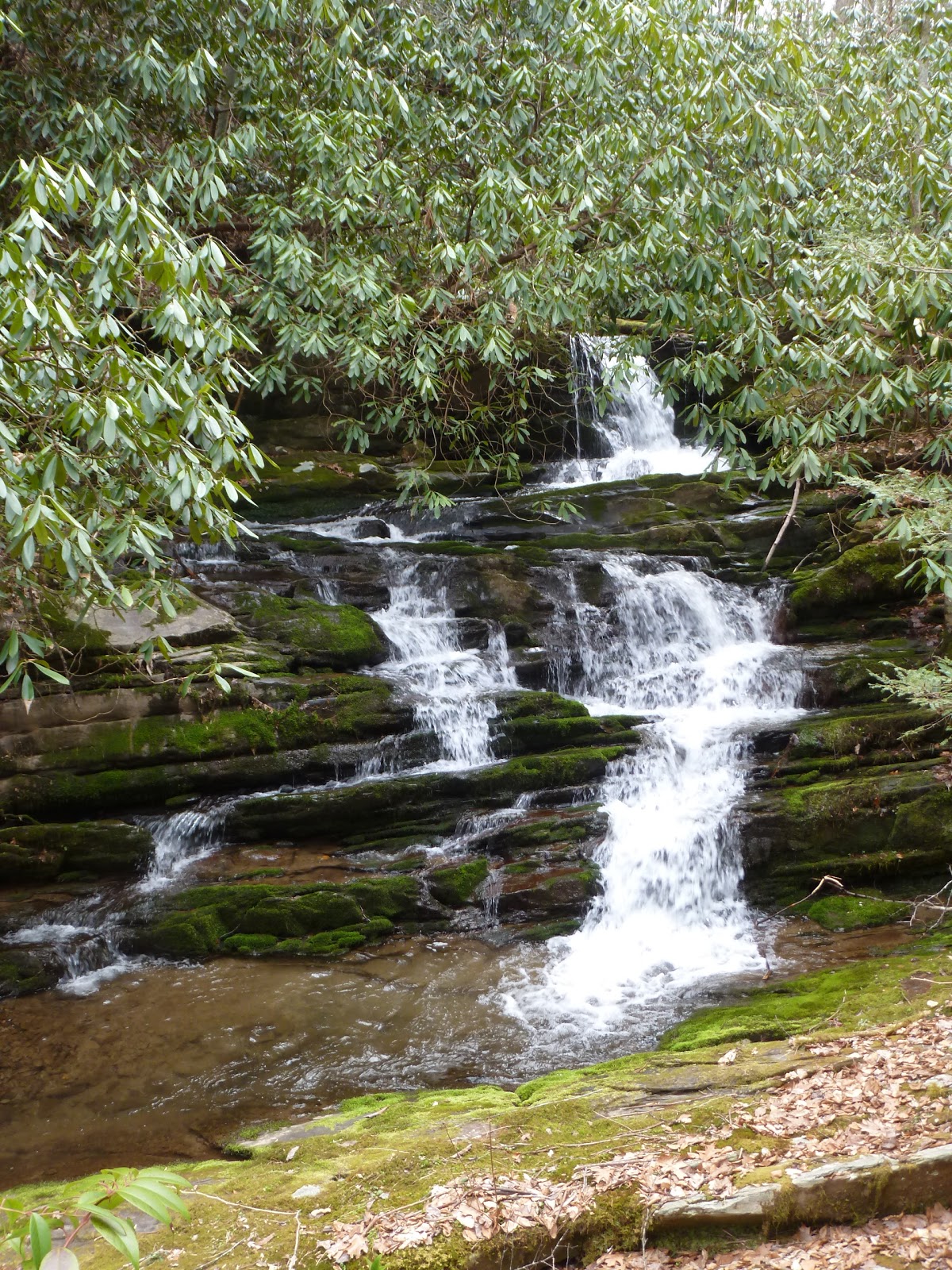
and then I found yet another side trail on the opposite side of the road. This trail followed a section Rhododendron Creek lower down than the section that the Grapeyard Ridge Trail had followed. It wound its way through thick patches of trillium that were not yet in bloom. I also saw my first blooming bloodroot of the year!
Should be really good wildflower viewing in a week or two. Then it led to some small waterfalls and interesting cascades.
I followed the trail higher up the watershed until I found myself back on the Grapeyard Ridge Trail. Now I had a choice; should I follow the Grapeyard Ridge Trail back to the car, or should I backtrack on the unofficial trail along Rhododendron Creek and follow the road. I decided to retrace the Rhododendron Creek Trail since I wanted to get a better view of some of the waterfalls.
It was a quick return hike to the road.
Once on the road I hiked past the picnic area and saw some more wildflowers in bloom off to the side of the road.
Before I knew it I was back at the car. It was an interesting day of hiking and I was glad I had the chance to make some discoveries on a pair of interesting unofficial trails.