Wednesday, August 29, 2012

Lincoln National Forest: Lonesome Ridge

Noelle gave me permission to go on another solo adventure today and so I headed up into the Guadalupes. I wanted to go back to Lonesome Ridge. I had hiked Lonesome Ridge years back. One day after work I packed up Noelle's Subaru with my camping and hiking gear and headed up Dark Canyon Road and the Queen Highway to the end of Forest Road 540. Unfortunately, as I made the drive up there I started to feel sick. It was my pericarditis returning to bother me once again. Still, after sleeping in the car for the night I decided I didn't want to turn around and head back home without hiking and so I set out to hike Lonesome Ridge despite my illness. I remember the hike being torturous. I felt horrible and didn't take the time to take any photos or even look around at my surroundings. I would return today to experience all that I had missed out on during my last visit.

After the long drive up to the end of Forest Road 540 I set out on the Guadalupe Ridge Trail.
The 3 miles along the ridge were not really all that interesting. I found a cairned trail leading down into a canyon and followed it for a bit.
I thought that it might lead to a cave or some other interesting feature but it just went on and on and I didn't feel like straying from my original itinerary and so I backtracked to the the Guad Ridge. Eventually I made my way to the Lonesome Ridge Trail which is at first an old road. The road followed a fence for a bit,
then passed through the fence at a gate. After passing through the gate the views started to open up down into Big Canyon.
Then the road ended and I followed an overgrown trail.

I should have brought the bottoms to my zip-offs because my shins were getting shredded on the oaks and other shrubs. The trail passed a few overlooks
and alternately ascended and descended along Lonesome Ridge. Soon the trail came to a steep drop-off. I decided the drop-off must be the start of the Golden Staircase Trail and so I decided to turn around at this point and retrace my steps. Along the way I saw some flowers
as well as some wildlife including a really interesting green beetle
and tiny horned lizard.

Tuesday, August 28, 2012

Tour de Carlsbad

I've been spending a lot of time hanging around the house because you just never know when Noelle is going to go into labor and I want to be around when she does. I just had to get out out though, and so after replacing the inner tubes on my bicycle with some Slime ones I decided to take the new tubes out for a test ride. I decided to ride along the canal, like usual, but to link up with the trail that parallels the Pecos River
and then ride San Jose back to the bike trail and then back home.

The ride was hot with little shade along the canal, but the ride along the river was shadier. I took the opportunity to stop at the Veteran's Memorial Park.
There were some new monuments and sculptures installed since my last visit.
Still, the park looks like it could use some work. From the Veteran's Memorial I rode over to San Jose Boulevard and the strange San Jose Plaza.
I guess at one time the Carlsbad City leaders wanted to create a plaza like in Santa Fe, Taos, or Mesilla. The plaza here in Carlsbad though is poorly designed and not anywhere near the center of town where it might attract people other than vagrants and drunks. From the plaza I rode San Jose back to the bike path along the canal and up Radio to Standpipe to home.
  
Find more Bike Rides in Carlsbad, NM

Tuesday, August 21, 2012

Florida Mountains

No, there aren't any mountains in Florida. The Florida Mountains I'm writing of are in southern New Mexico just outside of Deming. Yesterday afternoon, after my ascent of Cooke's Peak and exploration of the Fort Cummings ruins, I headed over to Rockhound State Park to find a campsite for the night. It was hot when I got there, so I spent most of the late afternoon and early evening relaxing and reading in the shade. Just before the sun set, I headed out for a quick hike on the Thunderegg Trail
to see if I could get a good view of the surrounding Floridas. Not only did I get a good view of the mountains,
but I also encountered some wildlife, two lizards. One was a species I am not familiar with.
The other was a Texas horned lizard.
After my hike, I set up the tent (without the rain fly) and settled in for a good night's rest.

This morning I awoke at sunrise, ate breakfast, and packed up camp. I got a later start than I had wanted due to some stomach issues. When I finally got started hiking it was already hot. I left the trailhead near Florida Gap and headed up a rough, old road and into a canyon.
Eventually, the road ended and I followed a faint use trail further up the canyon.
I got rattled at by two rattlesnakes as I ascended. As I made my way further up-canyon the canyon split into two drainages. I decided to take the drainage to the right and this turned out to be a big mistake.

The going in the drainage was very easy at first. I traveled on slabs of smooth rock. Soon, however, the rock slabs gave way to steep, slippery scree. I would take one step forward and slide 3/4 of the way back down. To make matters worse, the vegetation was thick. I spent a lot of time bashing through the bushes. As I approached what I thought was the summit ridge, I looked at a large rock spire in front of me and assumed that this must be the summit block. I knew there would be some exposed climbing involved but this climb would be beyond my comfort level. After attempting a climb up a steep, narrow crack I was ready to give up. I pulled out the directions I had printed off and read them again for about the 20th time.

Finally, I had figured out that I was not on the top of the ridge. I had a new plan. I bushwhacked up to the ridge and then found the two spires described on my paper. in addition, there was a large natural arch in the rock that I remembered seeing a photo of.
I passed the arch and soon found the class 4 climb described on my paper. It was exposed, but not nearly as bad as the climb I had attempted earlier. Soon I was on the summit.
I signed the log and took my photo.
Then I was ready to descend back to my car. There are two summits of nearly the same height, but upon reading the register, Gerry Roach claims the North Summit (the one I had summited) was the higher of the two.

I found a much easier (and safer) way to descend back to the car.
I saw some interesting looking butterflies
and more barrel cactus in bloom.
It was a relief to be back at the car as it was getting quite hot. I took off my boots, put my sandals on and cranked the AC for the drive back to Carlsbad.

Monday, August 20, 2012

Cooke's Peak and Fort Cummings

Last night after work I ate a sandwich, packed the car and then hit the road. I stopped at the store in El Paso to get some food for my two day exploration of the Deming area. it was about midnight when I finally pulled into my destination on a county road near Cooke's Peak.

I slept in the car and was treated to a lovely sunrise as I prepared for my ascent of Cooke's Peak.
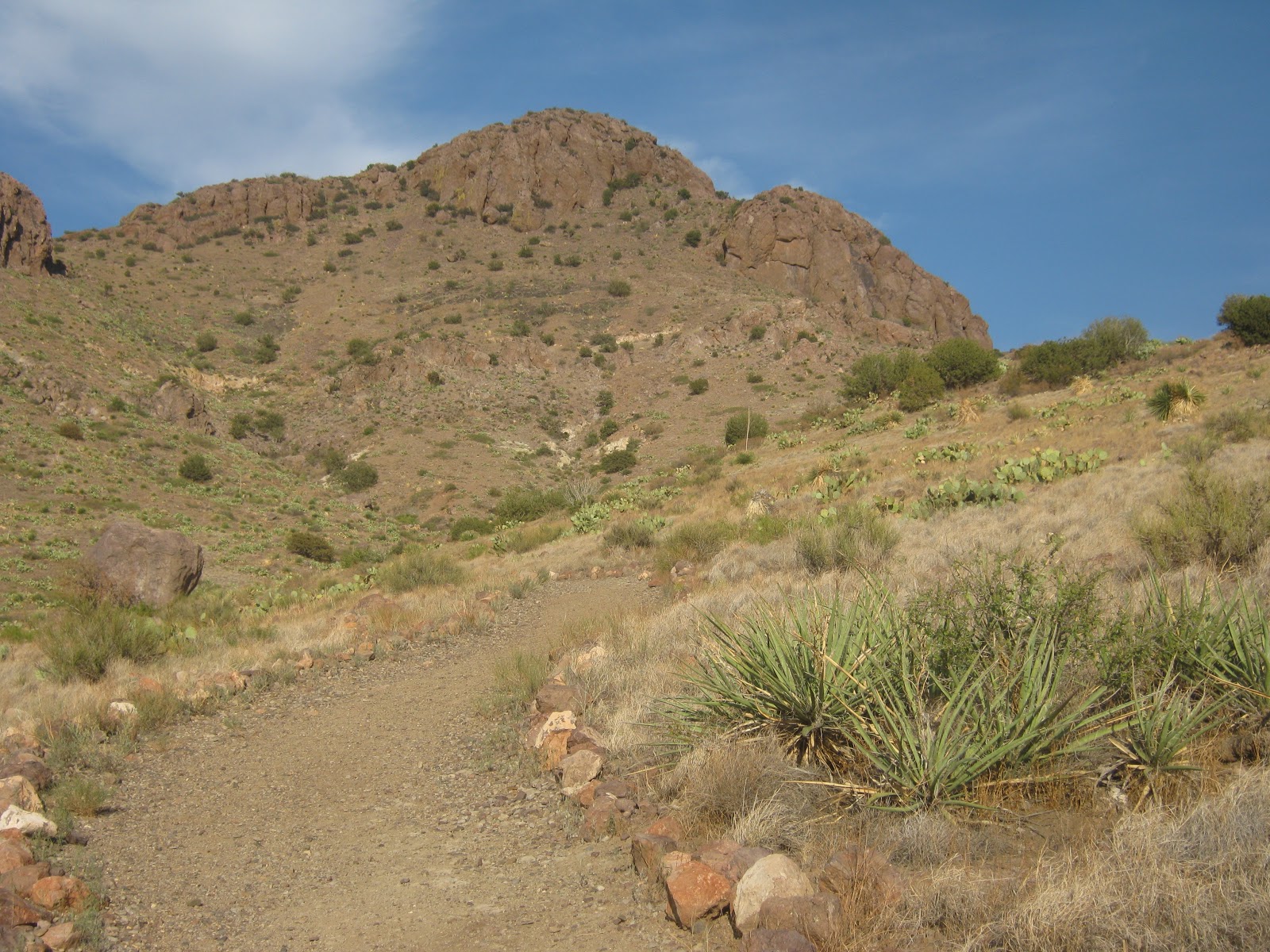
I ate a blueberry muffin for breakfast and then hit the trail, in this case a road. Using the directions that I printed off Summitpost, I followed the road for a bit. I was supposed to find a trail leading off the road, but I never did. Instead, I found a ridge that seemed to lead to the summit of Cooke's Peak and started to ascend it. I saw a toad hopping around as I ascended,
along with this interesting red insect.
Soon I had some really nice views of the Cooke's summit block.

As I arrived at the upper ridge of the range, I found a use trail occasionally marked with cairns. I followed the use trail to the summit
where I signed the summit log and took the obligatory summit photo.
I spent some time relaxing on the summit and decided to see if I could find the route described on my printout and follow it down to the car. And so, that's what I did. I retraced my steps to the ridge I had followed up from the road. This time I continued on the use trail that roughly followed the summit ridge. Before I knew it there was a more substantial trail. It was a bit overgrown, but it appeared that it had at one time been an official trail. There was an obvious, engineered treadway with waterbars and switchbacks.

I followed the obvious trail down further and further. It was a lot faster moving on the trail than it would have been bushwhacking down the ridge. Eventually I came to an intersection. One trail led further down the canyon I had been following, while the other led up the canyon. I decided to take the trail up-canyon for a bit just to see if I could figure out where it led. I thought maybe it would lead to a spring, but after following it for about 5 minuted I could still not determine where it led. I retraced my steps back to the down-canyon portion of trail.

Th hiking continued to go fast. Soon I was at the mouth of the canyon.
There was an overflowing livestock tank with a spigot emptying water into it. I looked back at the canyon I had followed and then set out into the desert. I lost all track of any trail or road at this point and so I just traveled cross-country. I could see what appeared to be a pile of mine tailings in the distance. I figured there must have been a road that led to the mine and so I headed in that direction and passed some fishhook barrel cactus in bloom.
I didn't find a road but I did find an old mine, mining shack,
and even an old rusted car.
After checking out the scene I headed further away from the mountains and soon found the road I had driven on last night. I followed the road back to the car and headed back towards Deming.

Just before I reached highway 26, I saw a rough BLM road headed in the direction of where my atlas indicated the old Fort Cummings ruins were. On a whim I decided to head in that direction. I was not disappointed. The first stop was an overlook of the old fort site.
Then I headed over to the cemetery.
Interestingly, it sounds like there may or may not be some burials in the cemetery. Apparently, fort records indicate those buried here being exhumed and re-interred elsewhere. It sounds similar to what happened at nearby Fort Craig. From the cemetery I headed over to a structure that turned out to be a springhouse.
Then I headed to some unknown adobe ruins
and Butterfield Stage Station ruins
before heading back to the car and into Deming.

Wednesday, August 15, 2012

Living Desert Zoo and Gardens State Park

After making rainbow waffles, we got a bit of a late start in heading out to Living Desert so it was already hot when we pulled into the parking lot. With the heat, the animals were a bit less active than they would have been at a cooler time of the day. Still, I think we all enjoyed our trip to Living Desert.