Monday, April 30, 2018

Superior National Forest: Astrid Lake Trail

I've been chomping at the bit to get the hiking season started in northern Minnesota. My last days off Sierra and I went for a hike (more like a slog through standing water and snow) on the trails at Franz Jevne State Park along the Rainy River. With the warm temperatures of the past week I figured trails should be even more snow free, and so I made the drive through Buyck to the Echo Trail and the Astrid Lake Trail.

The trail begins at the beautiful Lake Jeanette campground on its namesake lake.
While ice-out hasn't happened on any of the lakes in northern Minnesota quite yet (things look pretty close on at least a few lakes), this campground appears to be a wonderful place to spend an evening or two and bring the canoe along. From the trailhead I made my way past 2 walk-in campsites and passed an amusing sign along the side of the trail.
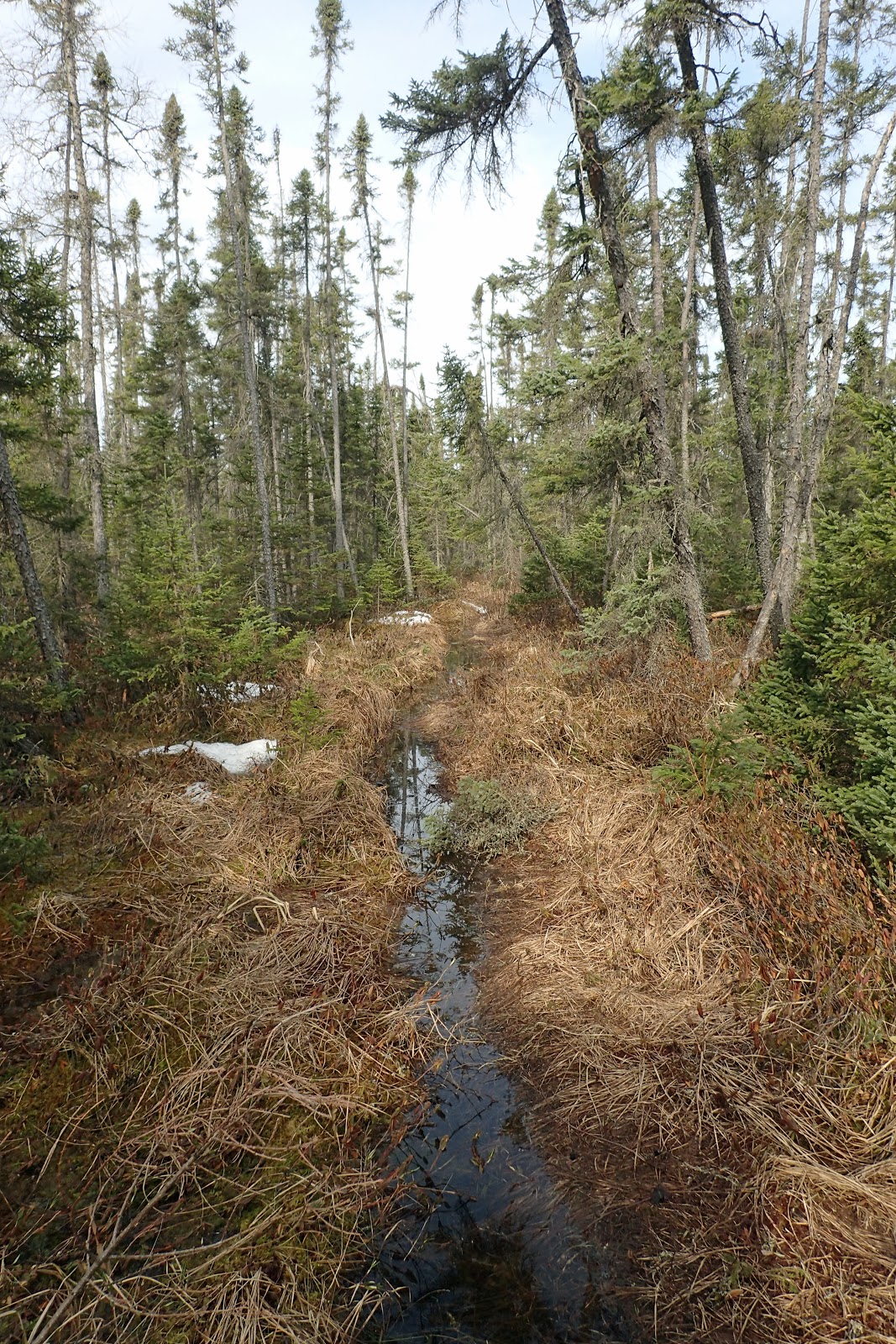
As I expected given the late winter, the trail was very wet in places.
However, given the vegetation growing alongside this section of trail, I wouldn't doubt that parts of the trail are wet year-round. I took some time to observe the pitcher plants growing alongside the trail
and even saw a spider inside one of the pitchers being slowly broken down by acids and enzymes in the water.

Soon enough the trail made its way to Nigh Lake.
The ice on the lake is very dark and I would venture to guess that it will go out on Nigh Lake within the next few days. In one bay of the lake, the ice was melted out and a pair of mergansers swam around. There was also a massive beaver lodge on this section of the lake.
After a few minutes of admiring the view at Night Lake, it was time to move on. I started to see what appeared to be moose tracks in the snow and mud.
When I found the first of many piles of moose scat, my hunch of moose was confirmed.
There was also lots of wolf scat along the trail here and there.
Most of it was probably frozen and buried under the snow all winter.

I trudged through some pretty deep snow in shady, sheltered areas
and made my way up to a level rock ledge. At one point I heard movement in the woods off to my left. I paused and looked around and then saw what had made the sound: it was a wolf! It was brownish in color and about 50 yards off in the distance. I took my camera, zoomed in on the wolf and moved to get as good a shot as I could. Unfortunately, the wolf took off before I was able to get a photo of it. Still, it was an exciting moment. I've seen wolves in the wild before, but all my other sightings had previously been from a car, or from a building (one wolf crossing the ice on Black Bay was visible from inside the Rainy Lake Visitor Center, another we saw crossing the ice on Rainy Lake from our living room when we lived in the lake house). After the wolf sighting I reluctantly moved on. There was a small waterfall on the stream that flows out of Pauline Lake and into Nigh Lake.

I arrived at Pauline Lake via a portage between it and Nigh.
I spent a few minutes there
and then moved on, passing through an area littered with large glacial erratic boulders.
There were also a few really large trees, mostly white pines in this area.
Soon enough I found myself at the beautiful campsite on Astrid Lake.
This site would make a wonderful place to paddle into and spend the night. I rested at the picnic table and tried to dry my socks a bit. After about 15 minutes it was time to move on.
I passed through woods carpeted with bearberry.
The green leaves and red berries provided some of the only color in the mostly-dormant forest.

Soon I noticed a body of water off to the side of the trail that was not marked on my map. It turned out to be a fairly large beaver pond.
There was a large beaver lodge on the pond and one of the highest double-tiered beaver dams I've ever seen.
These two dams must have raised the water level in the basin by at least 5 feet! I retraced my steps back to the campground and the car. On the way back along Echo Trail I stopped at the point where Echo Trail crosses over the Hunting Shack River on a bridge.
There is a 4 mile canoe route back to Astrid Lake that starts here. It's an adventure that I really want to try this coming summer.

Update: May 12, 2018

After my hike at Big Moose Trail earlier in the day I headed over to the trailhead/portage trail on the other side of Astrid Lake
to hike the parts I had missed. What a difference 2 weeks makes! The ice and snow are gone and the forest has started to awaken. I parked alongside the forest road and made my way down the wide, smooth path. As would be evidenced later in my hike, the wide trail here is utilized by ATVs to portage canoes and even small motor boats into Astrid Lake.

Astrid Lake itself looked beautiful with a blue sky reflecting on her liquid waters.
The trail continued past the put-in spot and got decidedly more rugged. Eventually it crossed a small wetland
on a pair of bridges and then headed over to some campsites. There was a short side trail that led down to a sandy spot that could be used as a swimming beach. I noticed some folks paddling canoes on the water.
Soon after continuing on the trail I reached the junction where I had started the return trip back to the trailhead 2 weeks ago. On the way back to my car on this hike I noticed some large, and very square woodpecker holes chiseled into a tree.
Before I knew it I was back to my car for the drive home. Seeing Astrid Lake on this beautiful day really convinced me that Noelle, Sierra and I need to get our canoe out here to paddle the Hunting Shack Canoe Route!

Monday, April 16, 2018

Voyageurs National Park: Skiing Crane Lake to Casaretto Cabin and King Williams Narrows

I had put my skis away for the season about a month ago. But here we are in mid-April with freezing temperatures and some lingering snow on the ground. I decided to make the best of the situation by going for one last ski. There's not quite enough snow on the area trails, but there seems to be plenty on the frozen lake surfaces, and so I thought a trip down to Crane Lake and ski across to Casaretto Cabin might fulfill my need for adventure.

It had snowed about 2 inches in International Falls last night, so I would get to test the new CR-V's capabilities in some snow. In fact, the snow seemed to get deeper and deeper as I headed south. By the time I arrived at Crane Lake there was nearly 8 inches of  wet snow on the ground. I drove through some pretty deep stuff on the unplowed road to the boat ramp. I donned my skis and headed off onto the lake. It was cold, really cold. The temperature wasn't too bad, just below freezing, but the wind made it feel brutal.

For the first part of my trip I followed a staked snowmobile trail into a stiff headwind. I found a forest service campsite and used it to get my bearings. Then I headed to the west side of Indian Island and there was the cabin, decorated with a layer of white snow.
I went inside to explore a little bit and to eat a snack out of the wind.
Then I decided to do some more exploring before heading back to the car. I headed northeast
to the mouth of the King Williams Narrows.
I wasn't sure what the ice conditions would be like, but I arrived to find that there were not any areas of open water and there were even some snowmobile tracks leading up into the narrows,
so I decided to ski into them to explore a bit. I probably made it a quarter mile into the narrows when I started to see some slush and so I turned around and started to make my way back to the car.

Luckily, I had the wind at my back for the return trip. With rising temperatures it made the return ski much more enjoyable. The wind also aided in pushing me back to the car a bit. By the time I arrived back at the boat ramp, rising temperatures had started to melt some of the snow. The plow crew had also been down the road and so I had a pretty easy drive back to International Falls.

Sunday, April 15, 2018

Voyageurs National Park: The Snowy Owl

We've been hearing consistent reports about a snowy owl that has been hanging around Black Bay, less than a mile from the Rainy Lake Visitor Center. Today I called Noelle and asked her if she wanted to come out to the visitor center and we could walk across the ice to see if we could find it.

After I had closed the visitor center, I changed into the clothes Noelle had brought me, we bundled up and headed out on the ice. As we approached the island where a skier had reported seeing the owl earlier in the day there was no sign of the owl and I was starting to worry that we had made the trip for naught. However, simultaneously Noelle and I noticed a form on a mound of snow in the distance. Soon enough the form started flying towards us and we were able to confirm it was the snowy owl!

We spend about 20 minutes in the cold wind observing the owl.
We were able to get pretty close to it and took a few photos.

It was one of the most interesting wildlife encounters I've had in my life; right up there with seeing a wolf walk across a frozen Rainy Lake from our living room when we lived in the lake house, and seeing a black-footed ferret at Wind Cave National Park. Seeing the owl inspired Sierra to add it, and a few other birds to her life list.

Saturday, April 7, 2018

Matthiessen State Park: The Dells

Today was the last day of our Spring 2018 Adventure Road Trip. We're currently staying in Galesville before we drive back up to International Falls on Monday. We began our day in Bloomington/Normal and made the short drive north to Mathiessen State Park where we went on a very interesting hike into the Dells. The area is very close to and very similar to nearby Starved Rock State Park.

We bundled up at the trailhead parking area and hit the trail. Almost immediately we descended to the edge of a canyon, crossed a bridge and then headed into the canyon.
There was a decent amount of water flowing through the canyon, and not wanting to get our feet wet on this cold morning, we opted to turn around where it would have been tricky rock hopping to continue on. We climbed out of the canyon and headed upstream on a trail along the edge. Soon enough we came to a trail and wooden stairs
that led down to Cedar Point. Here we could see a group headed downstream from where we had come.
We opted to follow the trail upstream.

On this section of trail we found an interesting little sandstone arch,
and a small waterfall.

At a viewpoint of Lake Falls,
the trail crossed the stream
and headed up a set of stairs to the top of the canyon. At this point we caught a view of what Sierra described as a "creepy" looking shelter house
overlooking a lake.
We used the restrooms near the shelter and then continued on the trail on the other side of the canyon. Every now and then there were interesting views down into the canyon.

Eventually we made our way to the entrance to the lower part of the canyon,
what they refer to as the "Lower Dells". We made our way down an interesting set of stairs and started to make our way upstream.
There were icicles hanging from the rocks in some areas.
We decided to stop at a point where we probably would have gotten our feet wet trying to make our way upstream. Still, we could see a large waterfall off in the distance.
We made our way back to the staircase, stopping at a rock shelter
and a view of a side canyon on the way.
We returned to the trailhead via a trail on the opposite side of the canyon from where we had come.
There were a few wildflowers blooming on the south facing slopes there. Then, we took one last look of the canyon we had just emerged from
before heading back to the car for the drive to Galesville.