
Friday, December 23, 2016
Tuesday, December 20, 2016
Koochiching State Forest: Tilson Creek Trails
Not the best ski conditions today, but I am really just itching to get out on the trails. Yesterday I went and purchased my Great Minnesota Ski Pass and so today, despite the howling wind, I headed over to Tilson to give skiing a try. It snowed a little bit last night and so when I arrived at the trailhead I found that the classical tracks were a bit filled in.
 Still, it felt good to be outside. The only section that was groomed was the first section of trail. That turned out to be okay though, since the warm weather (it was 31F after a week of temperatures hovering around 0F) made the snow stick to my skis.
The trail was easy and traversed some pleasant scenery.
 The grooming ended at a trail shelter
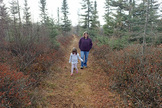
 and so I headed back the way I had come. My curiosity got the best of me at a trail junction and so I took a short section of ungroomed trail into a tamarack bog to have a look around.
 I quickly turned around and then headed back to the car. Not a bad first trail ski for the season, but we are in desperate need of more snow if we want some better conditions.
 which I had skied 10 days ago, and checked the map posted at the shelter before decided to take the Orange Loop. There were some steep hills on the Orange Trail, but nothing that I couldn't handle. Soon enough I made it to the junction with the Blue Trail
 which leads to the Rainy Lake Visitor Center. I opted to save that trail for a different day though.
I continued on the Orange Loop, up and down some nice hills. Eventually I found myself at the top of a steep hill with a chair off to the side of the trail.
 Maybe to sit down and take off your skis if you don't feel comfortable skiing down the hill? After a bit more skiing I made it to the tamarack bog that I had skied a short way into last week,
 and then I was back at the parking lot. A nice ski in light snow and somewhat cold temperatures.

The trail was easy and traversed some pleasant scenery.


Update December 30th:
We were authorized early leave today. Normally I wouldn't be able to take advantage of it, due to the fact that I've got a visitor center to keep open. Today, however, a coworker offered to staff the visitor center and so I headed off to do some skiing. Today I made it around the Orange Loop. I moved pretty fast through the Green Trail,

I continued on the Orange Loop, up and down some nice hills. Eventually I found myself at the top of a steep hill with a chair off to the side of the trail.


Tuesday, December 6, 2016
Voyageurs National Park: Skiing the Rainy Lake Recreation Trail
With snow falling outside,
I figured it was time that I got back on my skinny skis for the first time since I skied extremely marginal conditions on Roan Mountain on the North Carolina/Tennessee border back in January of 2014. It was pretty amazing how quickly the technique came back. While conditions weren't optimal, there was enough snow to make first tracks and glide.
 The views off to the side of the trail were pretty awesome too!
 I think I will make skiing the Recreation Trail a regular activity. That is, just as long as footprints and other uses do not making skiing too hazardous. After all, the trail is open to multiple uses and is not groomed for skiing. This first ski trip for the season has me thinking about future adventures across the frozen surface of Rainy Lake to Oveson's Fish Camp and Cranberry Bay.
I figured it was time that I got back on my skinny skis for the first time since I skied extremely marginal conditions on Roan Mountain on the North Carolina/Tennessee border back in January of 2014. It was pretty amazing how quickly the technique came back. While conditions weren't optimal, there was enough snow to make first tracks and glide.


Monday, November 28, 2016
The Grunwalds' Family Christmas Tree Search 2016
Today was the day for the Grunwalds' annual Christmas Tree search. We made the drive down to Cook, Minnesota where we got a $5 permit
at the Superior National Forest office to cut down our own Christmas Tree.
After lunch in town, we headed into the woods off of Minnesota Highway 1. We parked at the start of a snow covered forest road and starting walking and looking for our tree.

It took a little bit of searching, along with some playing in the snow,

 but after a little while we found our tree.
 I cut it down,
 hauled it back to the car, strapped it to the roof
 and we were on our way back home, ready to decorate!

It took a little bit of searching, along with some playing in the snow,


Tuesday, November 8, 2016
Rainy Lake Bike Trail: International Falls to Ranier
I guess I am a bit of a completionist. I just had to see what I've been missing on the section of the Rainy Lake Bike Trail between International Falls and Ranier; the part of the trail I've not yet explored. So today, election day,
 I set out to explore this section of trail, not on bicycle, but on foot. In fact, my walk today would take me right to my polling place at the community center in Ranier.
It was a clear, brisk morning as I set out. I parked at the chamber of commerce building near the border crossing
 and headed past the sprawl of the log yard.
 I noticed many posts that have been set in place that will one day hold interpretive panels.
 They've been in place for quite a while now. I wonder when the exhibit panels will be attached. I crossed a creek on a snowmobile bridge
 and headed further east, past the Minnesota DNR office.
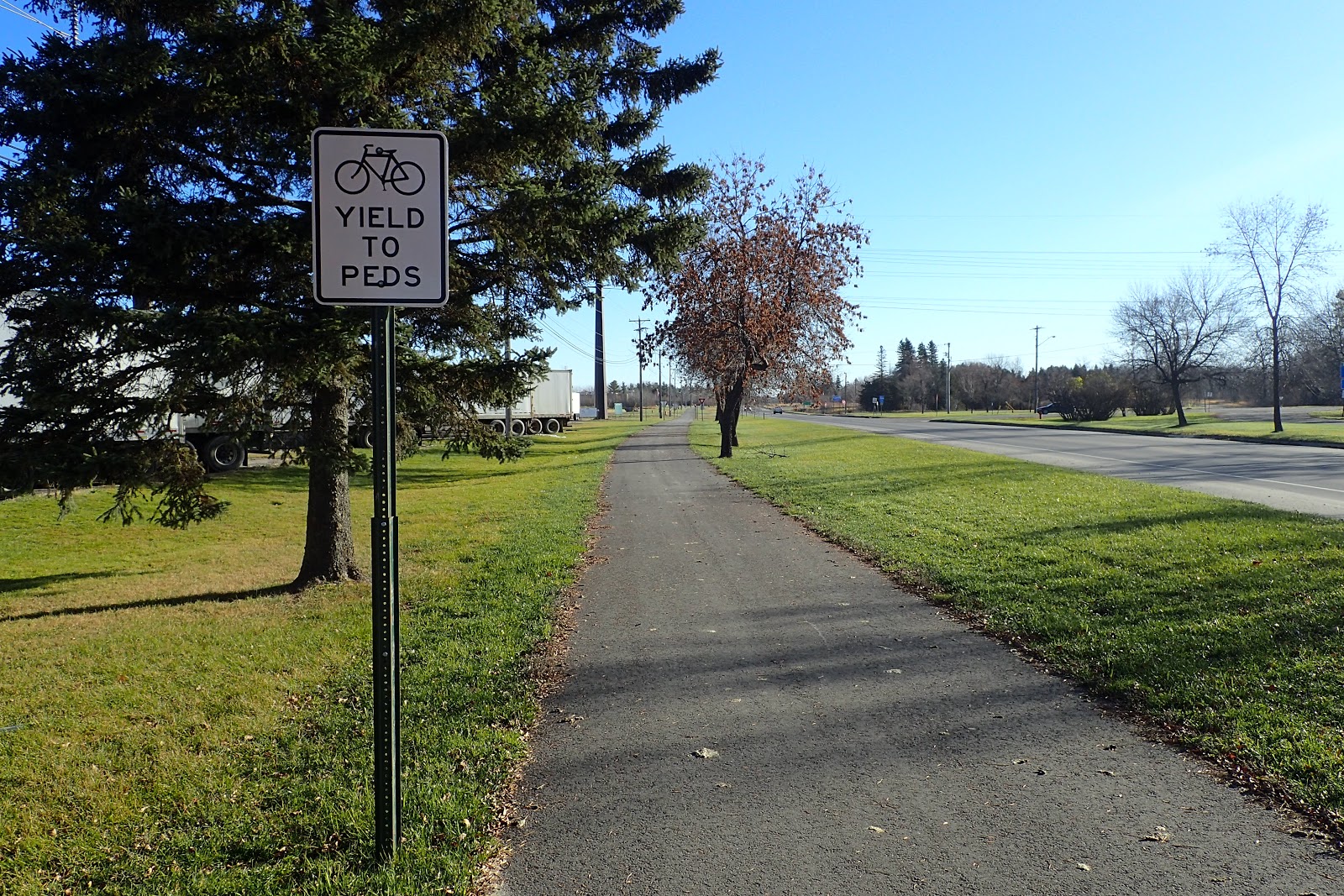
 The next section of trail had many road crossings.
 I then cut through a small patch of woods
 and into Ranier where I cast my vote. It's a secret ballot so I won't divulge who I voted for in the presidential election. I will tell you that I didn't vote for the candidate whose last name begins with T and ends with rump. This election is too yuge to vote for a loser, and besides, that guy's just nasty.
After casting my vote, I started to make my way back to the car. I took a slightly different route back, cutting through some pleasant neighborhoods and following closely to the Rainy River once I got back to the Voyageurs National Park headquarters. There were nice views out across to Fort Frances, including the lookout tower
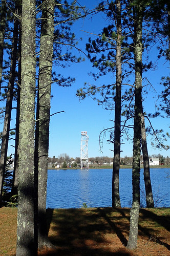 and the abandoned mill complex.
 I arrived back at the car just before noon for the drive back home.

It was a clear, brisk morning as I set out. I parked at the chamber of commerce building near the border crossing


After casting my vote, I started to make my way back to the car. I took a slightly different route back, cutting through some pleasant neighborhoods and following closely to the Rainy River once I got back to the Voyageurs National Park headquarters. There were nice views out across to Fort Frances, including the lookout tower

Monday, November 7, 2016
Fort Frances 8th Street Trail System
With the temperatures forecast to climb into the 60s today we just had to get outside to enjoy the warm weather. With Minnesota rifle deer season going on, hiking in Canada seemed like a logical decision. We packed up the car and headed across the Rainy River into Fort Frances to hike on the 8th Street Trail System. There isn't much information about it and we had a difficult time even finding the trailhead.
After a short time driving around, we finally found the start of the trail. It is on 8th Street like one would assume, but 8th Street is in 2 different sections that are not connected and we went to the wrong (eastern) section first before finding the trailhead.
 Our hike started in a section of woods that did not look promising for hiking.
 To make matters worse, the trail system is not well signed. It's like a maze of grassy trails leading in all different directions. We would find out later, from an older gentleman doing some trail maintenance, that vandalism is a major issue when it comes to trail signage and amenities like benches.
Soon the walk got a little bit more promising with the addition of some conifers to the landscape.
 Then the landscape got even more interesting as we walked through a mossy, wet area with shrubs and scattered spruces.
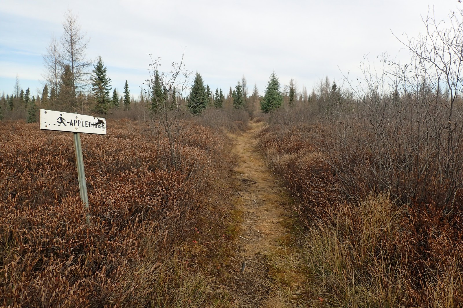
 We hiked a trail that was signed as the Apple Cider Trail.
 The path was littered with tamarack needles.
 My feet got a little bit wet as they squished through the spongy ground. We stopped for a short break in a copse of spruces
 and then continued on,
 circling back to the uninteresting woods of the beginning of the hike and the car.
After returning to the car, we headed over to Tim Horton's for a true, Canadian lunch!
After a short time driving around, we finally found the start of the trail. It is on 8th Street like one would assume, but 8th Street is in 2 different sections that are not connected and we went to the wrong (eastern) section first before finding the trailhead.


Soon the walk got a little bit more promising with the addition of some conifers to the landscape.


After returning to the car, we headed over to Tim Horton's for a true, Canadian lunch!
Tuesday, November 1, 2016
Voyageurs National Park: Hiking the Echo Bay Trail
This hike ended up being more interesting than I had anticipated. It wasn't the wildlife or scenery that made it interesting, but something else altogether. After a windy and drizzly start to the day, I decided that I had to get out of the house. With a late start I didn't have a lot of time for a hike and so I opted to head over to the Echo Bay Trail because it is not too long and not too far away.
The hike began on the wide grassy trail which is groomed for skiing once the snow accumulates.
 It was a bit wet like I had expected, but not too bad. Soon I found a side trail that led to an overlook of a beaver pond and heron rookery.
 The heron nests were high up in the trees and pretty far away, so one doesn't get the best view of the rookery from the overlook. After a short time admiring the view
 I returned to the trail intersection and got the Hike to Health rubbing which was, appropriately, a great blue heron.

My trail today was a figure-8 section of trail. I continued through the forest of firs and bare aspens
 to a section of trail that is open only to skiers. I took the hiker portion
 and soon enough found myself at the junction with the middle part of the figure-8. Now I had a decision to make. Should I walk the short section of trail that I had previously skipped, or simply finish my hike by continuing on the the parking lot? I opted to explore the middle section of trail and I'm glad I did. It turned out to be the most interesting part of the hike.
The trail quickly got swampy and it was obvious why. A beaver was in the process of building a new dam
 and inundating a new section of forest with water. There were beaver-felled trees everywhere.
I soon came to a view of the beaver pond and could again see the heron rookery in the distance.
There was a pretty substantial beaver lodge as well.
 As I continued along the trail something caught my attention just off to the side of path. It was a car and it was in pretty rough shape with all the windows blasted out of it and bullets holes decorating the doors.
 I continued on and saw an unusual object on the trail ahead. It was an old Hoover vacuum cleaner.
 While the trail made a sharp right turn at the vacuum, it looked like an old, overgrown road continued straight ahead. It led to a huge dump site filled with, among other things, lots of beer cans.


After checking out the dump site I returned to the trail and soon found myself at the first junction. I retraced my steps back to the last junction and walked a section of trail that crossed over a substantial bridge.
 Soon enough I was back at the parking area where I had started.
The hike began on the wide grassy trail which is groomed for skiing once the snow accumulates.


My trail today was a figure-8 section of trail. I continued through the forest of firs and bare aspens


The trail quickly got swampy and it was obvious why. A beaver was in the process of building a new dam

I soon came to a view of the beaver pond and could again see the heron rookery in the distance.
There was a pretty substantial beaver lodge as well.


After checking out the dump site I returned to the trail and soon found myself at the first junction. I retraced my steps back to the last junction and walked a section of trail that crossed over a substantial bridge.

Monday, October 24, 2016
Decorah, Iowa
We headed south into Iowa for our little adventure today; Noelle, Sierra, Mom and I. Our first stop, when we had reached the quaint town of Decorah, was for lunch at a barbecue place. Then we set off to find the famous Decorah Ice Cave on Ice Cave Road. We parked the car in a small gravel lot
 and then headed up a flight of stone stairs to the ice cave.

 I was the only one who went very far inside. I used the flashlight on my cell phone to see inside, but there was no ice to be seen. I quickly made my way back out to a waiting Noelle and Sierra
 and we headed back down the stairs
 and moved on to our next destination: Dunning's Springs.
We parked the car along a creek,
 crossed the road near an old root cellar
 and walked a closed road to the cascading waterfall at Dunning's Springs.
 A metal plaque on a rock told a little bit about the history of the place.
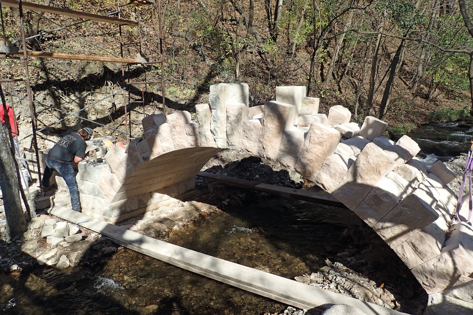
 Wanting to see a little bit more, Noelle, Sierra an I walked past some gentlemen working on a neat looking stone bridge
 and headed up some stairs
 to get a different view of the cascade.
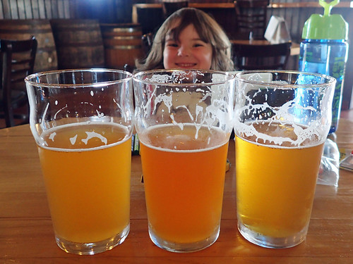
 At the top of the stairs the water emerges from a crack in the rock. We admired the view and then headed back down to Grandma and the last stop of our trip: the Toppling Goliath Brewery.


We parked the car along a creek,


Subscribe to:
Posts (Atom)