Tuesday, June 26, 2012

Cumbres and Toltec Scenic Railroad

The whole reason why Noelle and I decided to head to Chama was not just because of the higher elevation and cooler temperatures, but because of the chance to ride the Cumbres and Toltec Scenic Railroad. We are very happy with our decision to change our plans. The train ride was awesome, probably even better than the Durango and Silverton Scenic Railroad ride which we took back in October of 2003.  

This morning we packed up camp and headed back up to Chama. We arrived early and ate our breakfast in the parking lot then picked up our tickets.


After about an hour a bus arrived to take us to the other end of the line in Antonito, Colorado. It was a slow, winding, and scenic drive into Colorful Colorado. We arrived in Antonito, used the restroom, and I got a free coffee in the gift shop. We then boarded the train

and found our seats in the coach section.

Within minutes we started up the rails in the dusty sagebrush desert.


It was hot and dry down there, but the train constantly ascended higher and higher up into the mountains and back and forth between New Mexico and Colorado.

We crossed over the Hangman's Trestle.

Since there aren't any trees in Antonito, this was the only place for the townsfolk to hang a criminal back in the day. Soon we were up into the junipers and pinyons.

We even saw some wildlife: a couple of elk. later on we got even higher and up into some spruces and mountain meadows.


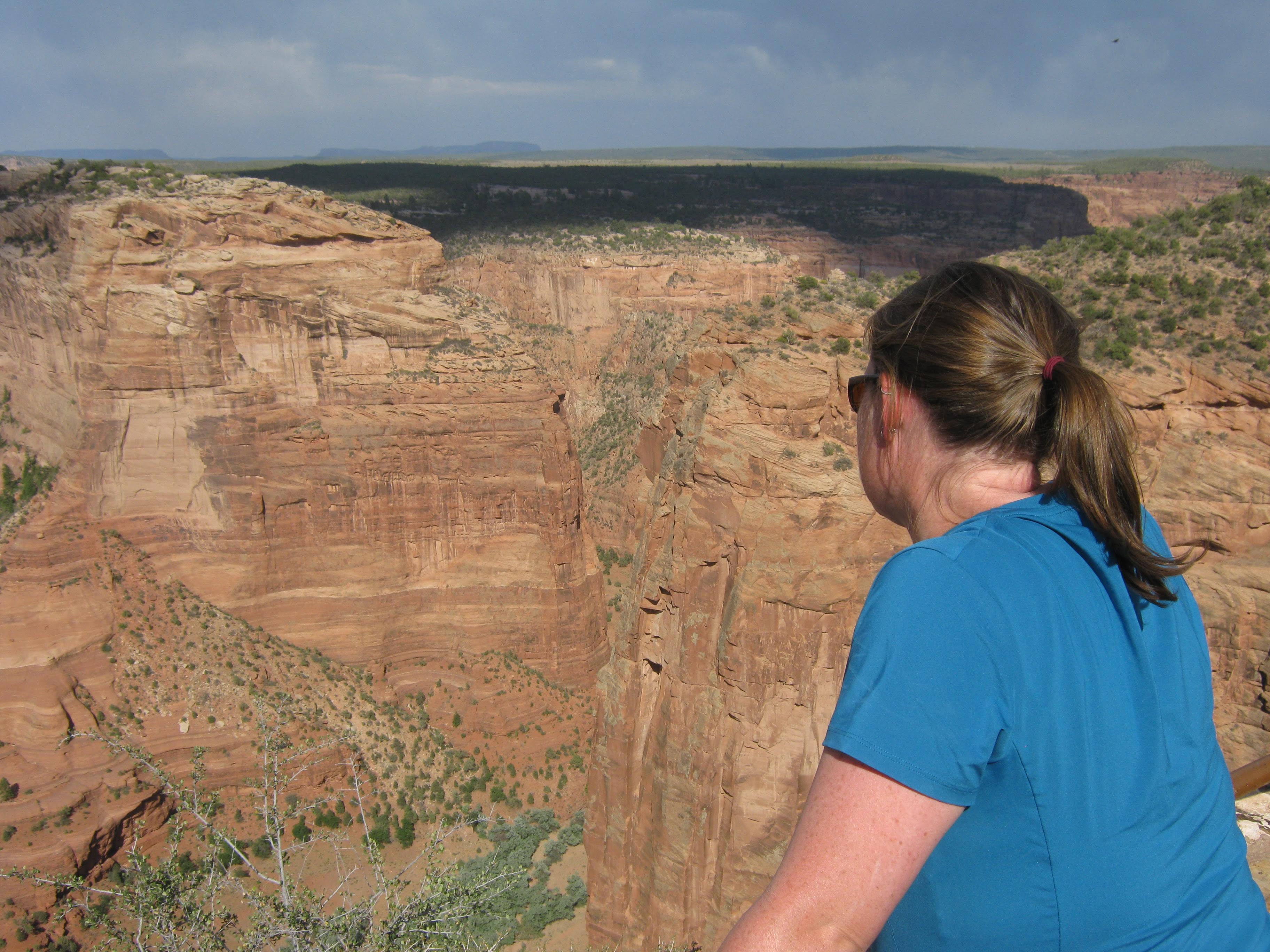
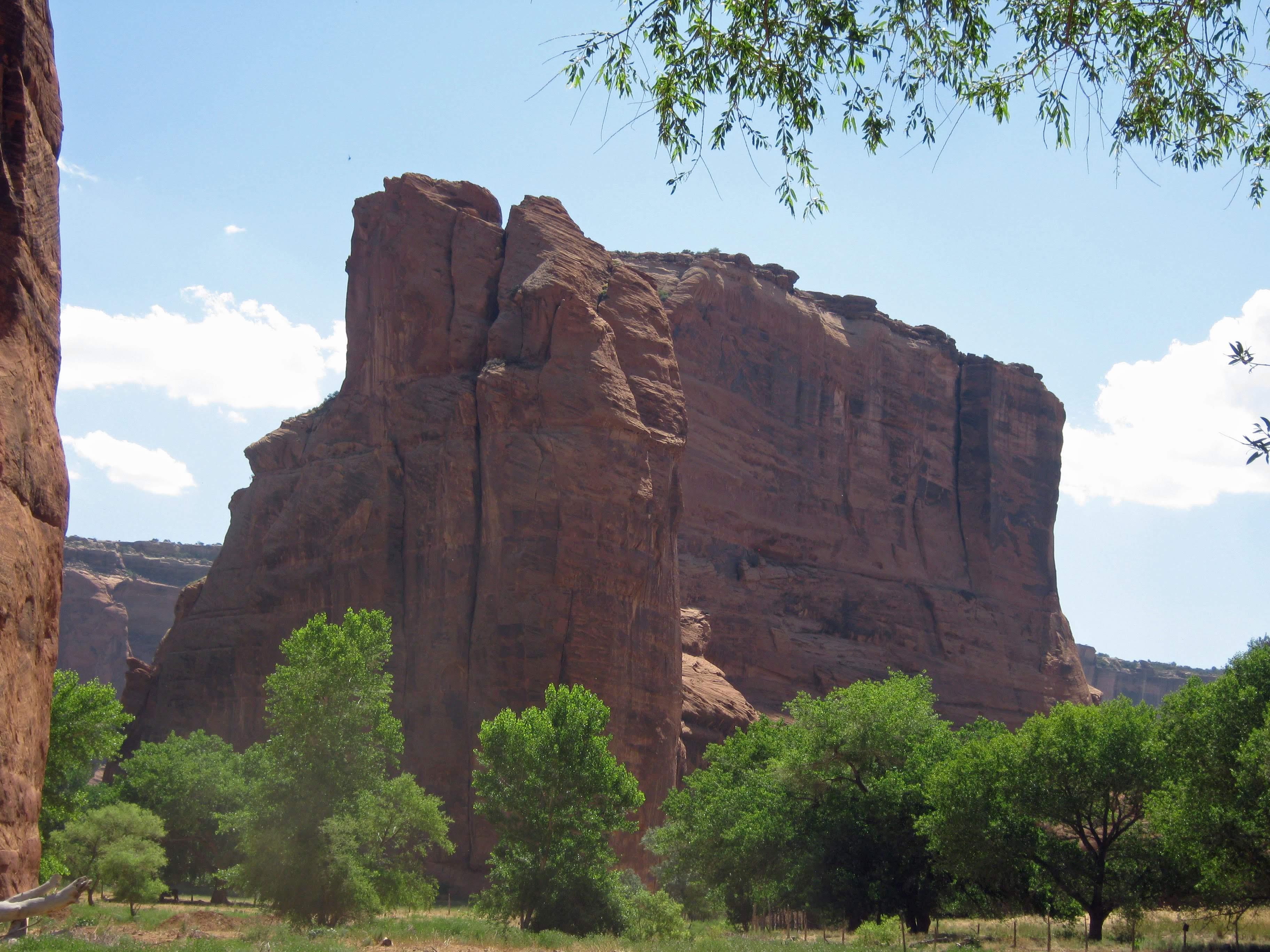
There was lots of beautiful scenery. 


We stopped for water and we had a great view of the engineer filling up the tank from our seats at the front of the first passenger car.


We also caught a view of one of the crew oiling some of the locomotive parts.


When we got into Osier, Colorado we stopped for lunch.


Noelle and I both got the turkey lunch and it was delicious. It was like a full Thanksgiving dinner with stuffing, mashed potatoes, cranberry sauce, green beans, dinner rolls and lots of deserts. For dessert we both got the buttermilk pie and it was delicious. After lunch we wandered around the "town' a bit and then got in line to board the train.


There was a problem though. They had overbooked the train from this point. A school group from Dulce, New Mexico boarded at Chama and was to take our train back instead of riding all the way to Antonito. They took up the entire car Noelle and I had ridden to this point. We would get a free upgrade to the super-fancy Parlor Class!


The chairs in parlor class faced the windows and the car itself was decked out in ornate tin work with African mahogany woodwork. The tourist class car was the last car of the train.

We got to watch the firemen follow behind and got to go out at the back of the car. We also got better views of the engine and front cars of the train as it snaked its way up to Toltec Gorge and the Cumbres Pass.


There were again lots of great views and even some more wildlife: a bunch of mule deer. The mountain meadows we traveled through were just gorgeous! After Cumbres Pass we started to descend.

Our descent to Chama was much quicker than a our ascent from Antonito. Before we knew it we were back to the car and ready for the long drive back to Carlsbad. It was the perfect end to an awesome vacation!

Monday, June 25, 2012

Aztec Ruins National Monument

Last night Noelle and I stayed in a hotel in Farmington. It was nice to take a shower and eat at a restaurant. We were really excited to swim in the hotel swimming pool but were disappointed when the water temperature felt like it had to have been in the 90s. It was not at all refreshing; more like swimming in a vat of tepid soup.

When we awoke this morning we showered again, ate breakfast and hit the road headed for nearby Aztec, New Mexico and Aztec Ruins National Monument. We toured the interesting ruins, Noelle for the first time, me for the second.


It was reconstructed and you can go inside and see what it may have been like for the Ancestral Puebloans who lived there hundreds of years ago.


After touring the ruins it was still rather early. We had intended to head south to check out the Bisti Badlands, but 100+ degree temperatures would not make for fun conditions in the shadeless badlands. We looked in our DeLorme New Mexico Atlas and both decided that Chama, NM would be a logical alternative because it is higher and presumably cooler. We then headed east to Chama.

Once we got to town we ate lunch and checked out three commercial campgrounds in town. They were all either too buggy, too hot, or offered no flat ground to pitch a tent. Noelle looked in the atlas again and found a state park nearby. And so we headed south to Heron Lake State Park. The state park offered the added bonus of the possibility of swimming in cool water.

Heron Lake did not disappoint. We found a campsite in a relatively shady spot and after setting up camp headed down to the lake for a swim in the cool, refreshing water.


After swimming and lounging on the rocks we headed back to camp for dinner and bed.       

Sunday, June 24, 2012

Shiprock


Canyon de Chelly National Monument

After our visit to Navajo National Monument yesterday, we drove south east through the reservation to the town of Chinle and Canyon de Chelly National Monument. We stopped in the visitor center and then got a campsite at the Cottonwood Campground. We set up camp and relaxed for a bit and then set out to drive the South Rim Road. I had driven the road before on a visit in 2005, but still it was nice to guide Noelle around and see things again.

Our first stop was Tunnel Overlook. We admired the view and then checked out some of the wares some of the locals were peddling in the parking lot. We then moved on to the other overlooks.


Finally we stopped at Spider Rock, one of the most impressive rock formations found anywhere.


From Spider Rock we headed back along the South Rim to the campground.

Staying in the campground turned out to be a mistake. I know last time I visited Canyon de Chelly I decided not to camp there when I saw the barbed-wire that encircles the campground like a prison. This time I decided to stay anyway and I highly regret it. We did not get very much sleep. Random people would drive into and out of the campground at all hours of the night. What they were up to I have no idea. In addition, there were lots of barking, stray dogs and at about 2 am a guy in a pickup decided to blare music just outside the campground. I would not recommend staying at the Cottonwood campground if you ever find yourself visiting Canyon de Chelly.

This morning, Noelle and I awoke not-so-well-rested. We packed up our stuff and headed over to the Thunderbird Lodge for our truck tour into Canyon de Chelly. The tours had been suspended for a few weeks due to a fatal accident that happened there on May 29th.   Luckily, the park service has investigated and it seems that all is safe now. Still, it is disconcerting to hear that someone lost their life on the same type of tour we were embarking on.


Our tour embarked a few minutes late and headed into the canyon. We passed a group exploring on horseback and the vehicle crawled through the deep sand as the canyon walls rose higher and higher.

We stopped at some interesting white pictographs and then moved further up the canyon.


Soon we could see the aptly named First Ruins.


From there more ruins came into view.


We would stop briefly to see the major ruins and our guide talked briefly about each.

We got out at Antelope House Ruins to peruse the ruins,


the rock art


and shop for Navajo crafts. From Antelope House we headed even further up Canyon del Muerto past Fortress Rock


to Standing Cow Ruins, part of which had been adapted for modern use by some Navajos living in the canyon.


At the canyon junctions we headed up Canyon de Chelly to White House Ruins. Again we stopped and got out to explore and shop.


After that we headed back down and out of the canyon to return to Thunderbird Lodge. Altogether it was an interesting experience, but our guide did not seem as knowledgeable as Bill Little, our guide at Navajo National Monument. I think having a better guide would have added tremendously to our experience.


Saturday, June 23, 2012

Navajo National Monument: Betatakin Ruins

Yesterday evening Noelle and I made our way to Navajo National Monument. The monument terrain is a great contrast to the surrounding landscape. Right away we were impressed. 


We found a site at the clean, well-maintained, and free Sunset View Campground. We set up camp, ate dinner and then I went for a little walk on the Canyon Rim Trail. The walk was interesting. It started at the visitor center near an old hogan and Navajo cart 


and led to an old visitor contact station left over from the 60s.


I retraced my way back to camp and settled in for the night.

In the morning we headed over to the visitor center for our guided hike to the Betatakin Ruins. We met our guide at about 8:15. His name was Bill Little and we followed him in his truck to the trailhead.  The hike started out on an old road with lots of great views looking out over the Tsegi Canyon system.

Bill explained some of the Navajo uses of some of the plants that we saw as we hiked. Soon the road ended and we were on a trail. The trail we followed left the monument and later reentered it. The trail was built back in the 30s by the CCC. The boys even left a few marks on the sandstone along the trail.


We descended into the canyon and made our way up to the ruins.
The ruins were impressive.
In my opinion they are just as interesting as any other cliff dwellings anywhere and said to be amongst the best preserved. We walked to a spot just outside the ruin complex and Bill told us about some of the archeology and discussed how life may have been for the Ancestral Puebloans who lived there. Then he took us to see some interesting pictographs and petroglyphs.
After admiring the ruins and rock art, Noelle and I were on our own to hike back to the car.
The views were spectacular, but the temperature was rising and there wasn't much shade on the trail. It was hard work trudging through some of the loose sand in the noontime sun,>The tough, sandy section of trail. but eventually we made it back up to the canyon rim, and shortly thereafter to the car.

Friday, June 22, 2012

Grand Canyon National Park: Rim Trail Mather Point to Bright Angel Trailhead

Last night Noelle and I decided that waking up early was the way to see the Grand Canyon. We packed up camp early and drove over to Mather Point. This morning, unlike the other day, there was just a handful of people there.
Noelle at Mather Point
We admired the view for a while and then headed west on the Rim Trail.
Eric and Noelle near Mather Point
As usual we got lots of great views.
Rim Trail Overlook
We also hooked up with another portion of the Trail of Time and looked through little spotting scopes to see the different types of rocks layered upon one another.
Noelle and Scope


Soon we were in the Grand Canyon Village historic district. Here we admired the many historic buildings like the El Tovar Hotel,
El Tovar Hotel
Kolb Brothers' Studio and Lookout Studio.
Studio
Before we knew it we were back to the Bright Angel Trailhead where we caught the bus back to our car. From there we drove back to the campground to get a shower and then headed to the store for some supplies and ice before hitting the road.

We drove the Desert View Drive out to the Desert View Watchtower. There were again lots of nice views along the way.
Lipan Point
The watchtower itself was really interesting too.
Desert View Watchtower
Interesting art painted inside and a great view from the top.
Watchtower Art
Art Inside Tower
View from Watchtower
After a bit of exploring at the tower we headed out of the park and over to Navajo National Monument.