On my way back home from Boulder, I wanted to drive a different route and opted to check out the ghost town of Keota in the Pawnee National Grasslands. This is what I saw:


On my way back home from Boulder, I wanted to drive a different route and opted to check out the ghost town of Keota in the Pawnee National Grasslands. This is what I saw:
Last night Kris and I camped just outside of Nederland at the Kelly Dahl campground. It was a chilly evening and I don't think either of us slept particularly well. I awoke to check out the wonderful view of the high peaks just to the west.

The trail climbs steeply right off the bat. However, the first section of trail is a wide, smooth road with great views of the Flatirons.

With as wet as it's been this spring/summer, there are a lot of wildflowers blooming, including one of my favorites: Sego Lily.

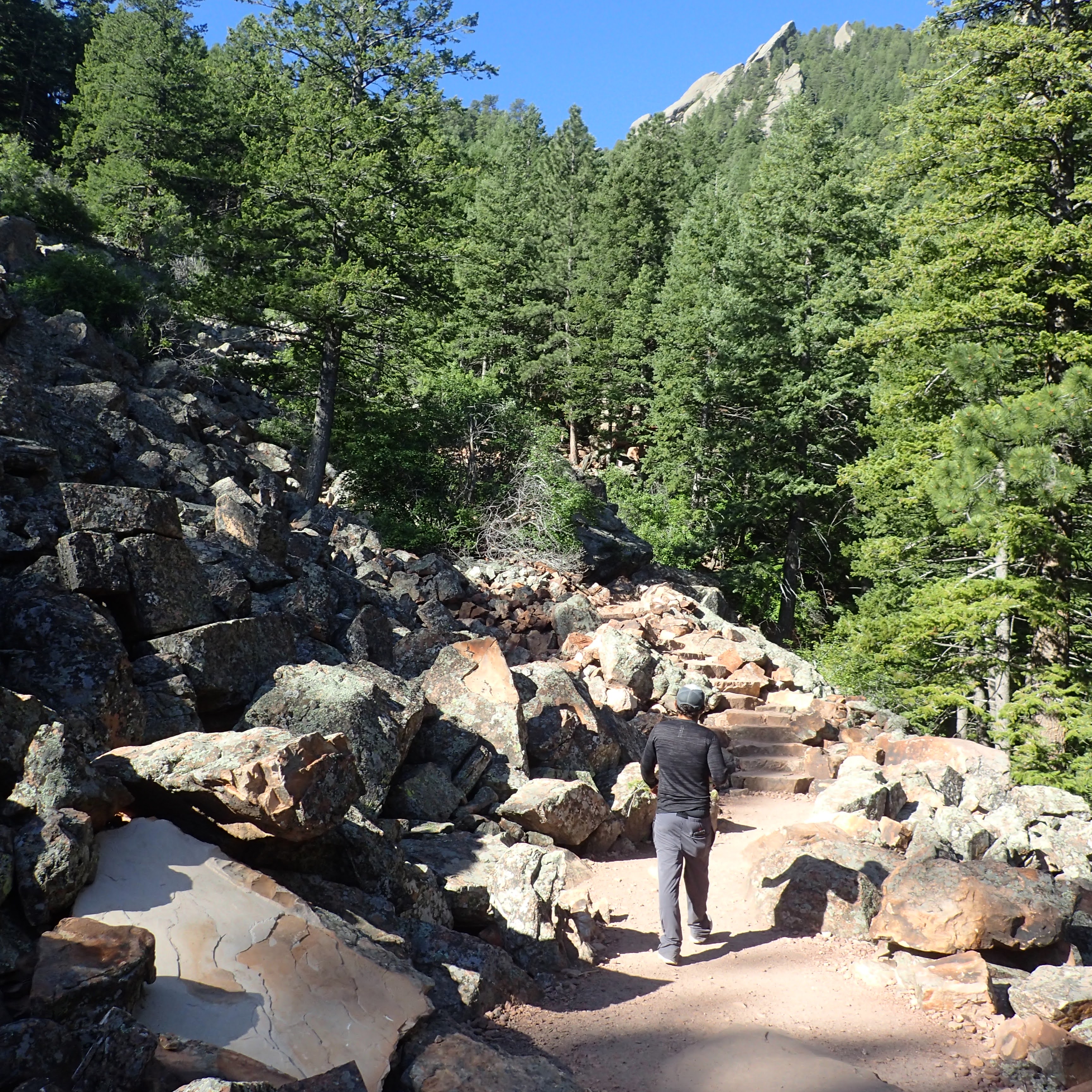
We climbed through varied landscapes.


Eventually we reached a ridge and then started to descend, before ascending again to our destination: Royal Arch.

We spent quite a bit of time relaxing and enjoying the view at the arch.


After talking with some folks who are originally from Pennsylvania, we started to make our way down. There were great views into Boulder and the CU campus.

The hike back to the cars went quickly. We said our goodbyes and then I started to make my way back home, stopping in Greeley to get lunch and some beer at Weld Werks.
My brother Kris is out West and so I made plans to meet up with him. Boulder, Colorado was our chosen meeting place, and with all the great hiking right outside of town, I think we picked a good one. I left home at about 4:15 a.m. and hit the road with a stop in Wellington, CO for breakfast at McDonalds. I reached our agreed upon meeting place, the South Mesa Trailhead a little bit before 8 a.m. to find the lot completely full. I drove to the Shell station at the entrance to Eldorado Canyon and met Kris there. Our plan B was to start our hike up Bear Peak and South Boulder Peak from the NCAR Trailhead.
The NCAR (National Center for Atmospheric Research) Trailhead is great in that it is free to park and there is plenty of parking. We prepped and hit the trail with wonderful views of the beautiful Flatirons.

The hike started out fairly easy. Lots of great views


Once we reached the Fern Canyon Trail, the climbing began in earnest. It was quite rocky as well. This portion of the trail was mostly forested with a few rock outcroppings.

We climbed to a relatively flat spot where the turn off to Nebel Horn

We stopped at this flat area to take a break, and to admire the views of Green Mountain which lies across a canyon.

After our break, the climb got really steep. Every now and then views opened up to the south and west to the higher peaks of the Indian Peaks Wilderness.


From the summit we could see our next destination, South Bouler Peak which is the highest peak in Boulder.

It was a relatively easy hike from Bear Peak over to South Boulder Peak.


We took a pretty long break on the summit, admiring the views.


As we rested, we were visited by a friend, a small chipmunk.

We had our photo taken by a woman at the summit


Once back to the cars, we made the short drive to Sanitas Brewing for some delicious beers and tacos.

Today was the first really hot day so far this summer. (It's been unseasonably cool and wet.) We made the short drive up to Lake Minatare to cool off. Our destination was the swimming beach, but honestly there's not any beach there right now. All the rain we've gotten means that the reservoir is full. Still, we found a nice spot along the edge of the water with some nice cottonwood trees for jumping off of.


It's Father's Day and Sierra and I decided to head down to Cheyenne to hike and explore. Looking for a suitable hike, I perused my copy of "Hiking Wyoming's Medicine Bow National Forest" by Marc Smith and settled on the Reynolds Hill hike in the Vedauwoo area. It was an uneventful drive down to Cheyenne and over into the mountains. The biggest issue we had was finding the trailhead. After a brief consultation with the guidebook, we found it and set off on our hike.

The hike started off with a gentle descent along an old, closed two track road down to Crow Creek. The road was pretty badly eroded in sections.

Wildflowers bloomed in profusion along the route.

Soon, the trail entered a stand of aspens.


After our short climbing break, we set out to hiking again, headed towards the hike's namesake rock formations at Reynolds Hill.


The trail crosses two tributaries of Crow Creek at some sketchy wood bridges.

One on the other side, the trail traversed a meadow along the edge of Reynolds Hill


This next section of trail alternated between thick aspen forest and sagebrush meadows.

At an intersection with another trail, we made a sharp right turn and started to make our way to the opposite side of Reynolds Hill. Views opened up to the surrounding Vedauwoo rock formations.


I made a wrong turn at one point and quickly realized my mistake. We stopped to take a look at the guidebook
and then


It bottomed out at another section of Crow Creek.

