Tuesday, June 28, 2016

Voyageurs National Park: Little American Island

Two days in a row, out on the water! Today, after a short trip to town, we headed over to the boat ramp at Dove Island
and put in headed for Little American Island.

Little American Island is a detached unit of Voyageurs National Park and is best known for the gold mining that happened there in the 1890s. There are some old mining adits located on the island,
along with some mining shafts, equipment
and tailings piles. We explored the roughly 1/4 mile long trail and saw lots of evidence of the mining era, along with some wildflowers
and berries
(and a few mosquitoes).

We walked to an overlook of Rainy Lake
on the east side of the island and found the Hike to Health rubbing plate.
Sierra and I worked to make a rubbing in our book,
and then walked quickly back to the canoe
to get away from the mosquitoes. It had been a short paddle and hike, and we were not yet ready to take the canoe out of the water. Instead, we paddled west to the small island the lies just off the mainland from our house. Really, we wanted to see what our house looks like from the water.
We paddled around the island and then headed back, passing relatively closely to the old fire tower that makes a good reference point out on the lake.
It was perfect weather for a paddle.
Warm, but not too hot. There was little breeze, but the little bit we had helped to push us gently back to our put-in at Dove Island.

Monday, June 27, 2016

Koochiching State Forest: Paddling Tilson Creek

Today was the maiden voyage of the Grunwald Family's new canoe. We finally had a nice day without extremely high winds to take the canoe out and do a little exploring. We opted to stay close to home and paddle Tilson Creek.

We made the short drive to the Tilson Bay Boat Ramp and unloaded the canoe.
I parked the car on the other side of Highway 11 and we pushed off.
We headed under the highway bridge and into the relatively calm waters of Tilson Creek.
Tilson Creek is a bit shallow with lots of aquatic vegetation poking out of the tannin stained water here and there. We saw a little bit of wildlife, including some red winged blackbirds, mallards, and other ducks. Sierra enjoyed putting her hands in the water
or taking a relaxing nap on the floor of the canoe.
I would say it was a good first trip. If tomorrow's forecast holds, I think we will be back out on the water again very soon!

Monday, June 20, 2016

Superior National Forest: Herriman Lake Trail

Echo River Loop

Today, I was given permission to go off on a solo hike. I would rather be out in our new canoe with Noelle and Sierra, but extremely high winds were forecast for the day. I figured that at least the high winds would blow the mosquitoes away, and so I headed out towards Crane Lake, where I turned at the large voyageur statue,
for a hike on the Herriman Lake Trail system.

The trailhead parking lot is pretty large, but there isn't a sign there. I ended up driving past it to the end of County Road 424. When I reached a resort at the end of the road I realized my mistake and headed back to the parking area. The trailhead itself is just across the road.
I filled out a wilderness permit since a very small portion of my hike would be inside the Boundary Waters Canoe Area Wilderness. The trail was immediately pretty wet. We've had a lot of rain lately. However, unless it has been really dry lately, I would expect to hike through some mud and swampy areas on this trail.

There were lots of wildflowers in bloom along the trail. There was the standard bunchberry,
but also lots of buttercup,
columbine,
and Canada anemone.


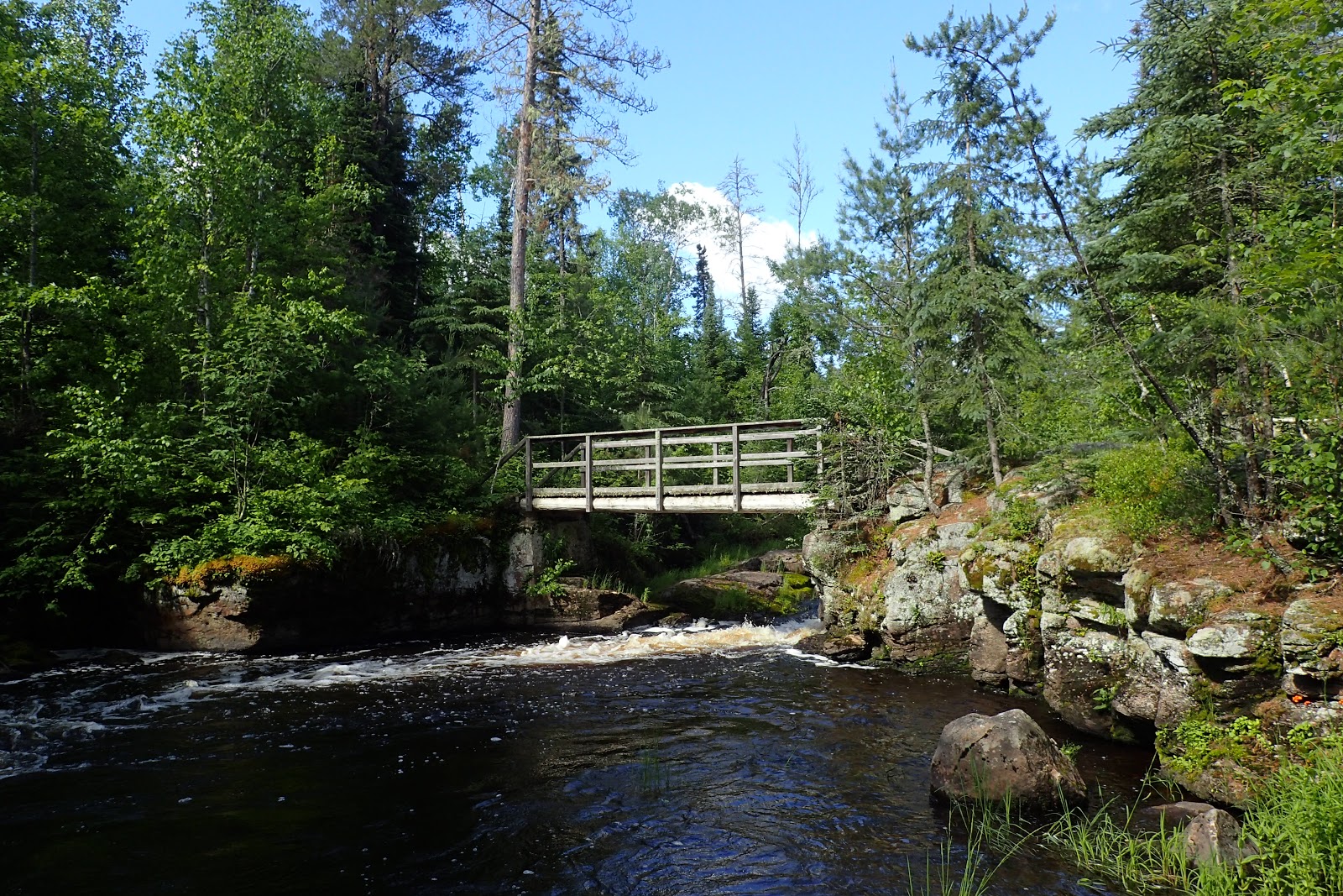
After .3 mile I reached a picnic site at a cascading section of the Echo River.

I crossed the river on a sturdy footbridge
and soon found the a trail junction. At the junction I made a right turn. It is signed for Herriman Lake. This section of trail closely followed the Echo River, though due to thick vegetation you could rarely see the river. There was, however, one really nice but overgrown path that led down to the bank of the beautiful river.
Soon enough I found myself at another trail junction, a left hand turn led to Herriman Lake. However, for this hike I headed straight ahead on the trail signed as the Echo River Loop.
Soon I found myself at an opening in the forest and a large beaver pond.
The trail crossed on the dam here which had burst at some point in the past and left very steep and slippery banks to descend and climb back up. There was some blue flag iris in bloom along the banks of the beaver pond.
As I headed back into the woods, the trail became more overgrown. Luckily there were some cairns marking the route every now and then.
I even found a few ripe wild raspberry fruits.
I didn't take them, but instead left them for the wildlife. I soon found myself climbing some rock outcroppings to a really nice view of the Echo River down below.
In one section of trail there were close to 20 wood lilies in bloom!
I took a few photos of these very photogenic plants. I than entered into the BWCAW for a short time.
From this point the trail traversed lots of exposed bedrock.
There were lots of blueberry shrubs growing in along the sunny exposed rocks and few looked like they were just about ripe!
There were some views out to the Echo River here and there.
In one area I found a few white flowers that looked to be some type of morning glory.
Wildlife sightings included a small hawk, I'm thinking a Cooper's Hawk.
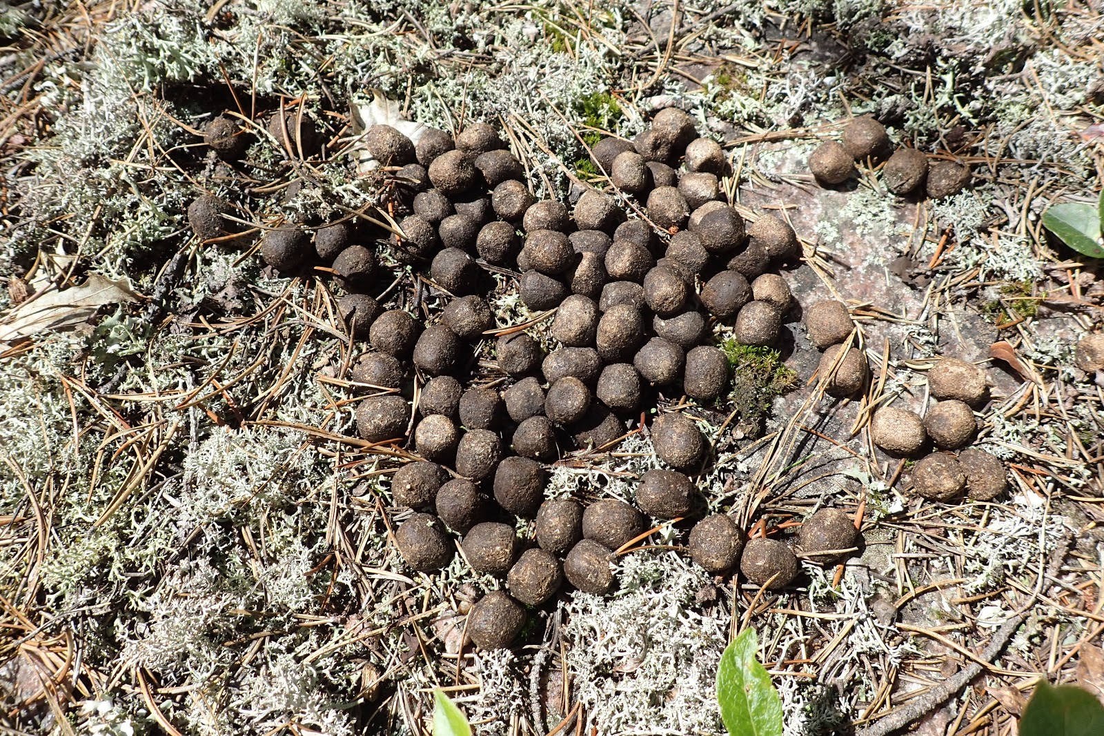
While I didn't see any moose, I did see evidence that there still are a few moose in northern Minnesota.
At one point I found a nice table and chair constructed out of rock to take a rest on.
Shortly after my rest the trail get difficult to follow. The cairns were spaced very far apart, and were sometimes covered with vegetation. Several time I found myself backtracking to the last cairn I had seen to try and figure out where I was going. It was a bit frustrating, but eventually I found my way. I made pretty quick time on my return trip to the car. Overall, I would say this was a pretty good hike. I got a few mosquito bites, but if anything the deer flies were the worst part of the experience.

Tuesday, June 14, 2016

Voyageurs National Park: Blind Ash Bay Trail

This morning we got our new canoe registration at the DMV in town. Unfortunately, the forecast today was for high winds, and so we put off our first adventure out on the water. Instead we headed down to Ash River to do some hiking on the Blind Ash Bay Trail.

Our first stop was the Ash River Visitor Center at the old Meadwood Lodge.
We explored the building a bit
and then headed down to the lake for lunch at the wonderful picnic area there. Besides lunch, we found some turtle eggs that had recently been dug out of the soft, sandy soil by a hungry animal.
After lunch we headed back to the car and got our gear ready to hit the trail.

We immediately passed some yellow flowers
and red-osier dogwood in bloom.
Sierra decided she wanted to hike on her own which was fine with me.
However, she didn't want any help on the rocky or slippery spots.
She told us that she is a "big girl' and that she didn't need any help. After some arguments, we finally convinced her that everyone needs a hand now and then. Soon, a view opened up just below the Kabetogama Lake Overlook.
We quickly admired the view (the mosquitoes were starting to bite) and then started moving again.
There was bunchberry scattered here and there along the trail.
Besides the wildflowers, there was fungus scattered along the trail
and a few big white pine trees.


Eventually we made it to the loop intersection

where we found the Hike to Health rubbing plate. This one was an owl
which Sierra did an excellent job of making a rubbing of.
After having made the rubbing we started the loop portion of the hike, moving in a clockwise direction.
Some nice views opened up out to Blind Ash Bay and Kabetogama Lake.
After completing the loop, we retraced our steps on the trail. We saw three garter snakes
at the base of a white pine tree and after Sierra had pointed out  a pink lady slipper, we noticed a small, well camoflauged tree frog
hopping along the forest floor. Good eyes Sierra! By the time we returned to the car we were all quite tired. After a short hike on the Beaver Pond Overlook Trail to get the rubbing, (we had forgotten our Hike to Health book when we hiked it a few weeks ago) 
we returned to the car and Sierra promptly fell asleep!