Monday, July 28, 2014

Cherokee National Forest: Wolf Creek Falls

Today is the last day of my furlough and my first time out for a solo adventure in a while. I took inspiration from our family outing on Saturday to head into a part of the woods I've never been in before. I headed to Wolf Creek. On Saturday, while driving to the Betty Place Trailhead, we passed a sign for the Wolf Creek Trailhead. This trailhead was not marked on my map and so I did a little bit of research on it when I got home. It turns out that it is the starting point for a horse/ATV trail up an old carriage road to Wolf Creek Falls. I was intrigued and today had the opportunity to explore the area a little.

The drive to the trailhead seemed long, but the air was cool enough this morning to drive with the windows down. I turned off of US 25/70 and onto the marked road.
It was paved for a short distance but turned to gravel near a church. The road was also quite rutted and muddy. Still, it was not too rough for my Honda Civic. I parked at the end of the road in a big gravel lot and then hit the trail. Almost immediately the trail forded Wolf Creek. I headed back to the car for my sandals, put them on my feet and tied my boots together to hang around my neck.

I forded the creek for the first time. The water felt good and cool, but the stream was moving pretty swiftly due to last night's rain. Once across I decided to leave my sandals on, as I figured there would probably be another ford of the creek. This turned out to be a good decision, as shortly after crossing the creek for the first time, I re-crossed it again. After the second crossing I decided to stick with sandals. I would have two more crossings, but both of them would come much later in the hike. The sandals were handy though for slogging through the muddy trail.

The trail closely followed Wolf Creek for much of its length,
although the trail left the creek for a steep climb towards the waterfall. Along the way I was treated to views of a few species of wildflowers
including Indian pipe.
There were also lots of mushrooms out.
Soon after the steep climb, the trail met a more muddy road. I turned right at this junction because the road led downhill. This turned out to be the correct decision as the road soon ended at a campsite from which raging water could be heard.

I took a faint path from the campsite to the top of the falls. There was not much of a view from there and so I looked around and found another trail that led down to the base of the falls. With last night's rain there was a good flow of water falling over the ledge and the view was impressive. The spray from the falls was refreshing. I spent a few minutes eating a snack and enjoying the quiet, secluded spot.
wolf creek falls
I took some photos and then started to head back to the car. On the return trip I decided to wear my boots as I knew when to expect creek crossings and the little grains of rock that got caught in my sandals were rubbing my feet raw. I made good time on the return hike and was back to the car in no time at all.

Saturday, July 26, 2014

Pisgah National Forest: Betty Place Trail

Today Sierra, Noelle and I headed out for a short hike near Hot Springs on the Betty Place Trail. We followed US25/70 to Upper Shut-in Road and followed the road up the hollow until we saw a sign marking the Betty Place Trail. Here we turned left onto a muddy dirt road and headed steeply uphill until the road ended at a pair of secluded homes. We found no trailhead for our intended hiking trail and so we turned around disappointed that the attempt had been a failure. It wasn't until we had nearly returned to the Upper Shut-in Road, at a wide spot that we saw a small kiosk (covered with vegetation) and the sign for our trail. It looked like we would be making our hike after all!

We ate a snack at the car
and then hit the trail. The trail was a bit overgrown and followed a series of old roads through the woods. We saw a few interesting mushrooms along the way,
but no animal life. The trail climbed higher and higher and crossed a few small streams until finally,
it left the old road bed and turned into singletrack. We followed this tread along a ridge for a bit and then rejoined another old road. Eventually we came to a fairly flat, open area that I'm guessing was the site of the Betty Place. If there's anything left of it, we did not see it. Of course the winter would be a better time of the year to explore an old home site. Even though we did not see any signs of the former habitation, we did see some pretty wildflowers in bloom.

From the flat we started downhill on the old road and before we knew it we were crossing a small creek on a substantial wooden bridge near the trailhead.
We returned to the car and then headed into Hot Springs for lunch. Overall, it was a rather underwhelming hike. Still, any time spent out in the woods with family is a good time.

Friday, July 25, 2014

Virginia Creeper Trail: Abingdon to Damascus

Today I made it back to the Virginia Creeper Trail with a bicycle for the first time since my AT thru-hike in 2000. Unlike last time, however, I would be riding the Abingdon to Damascus section, and unlike last time I would not be riding it alone. I had my friend Burke along to ride with.

We met in Kingsport and drove up into Virginia in Burke's vehicle. We arrived at the trailhead, readied our gear and hit the trail. We passed a large steam locomotive at the trailhead
and soon after passed an enormous oak tree.
The cycling started out fairly easy, being a slightly downhill ride.

We crossed over several bridges,
including one that had recently been rebuilt due to the fact that it had been destroyed by a tornado.
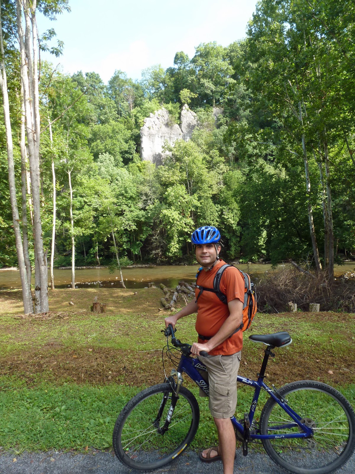
Soon the old rail bed followed along the Middle Fork of the Holston River. There were lots of pleasant views out across the water.

We crossed over the river and found ourselves pedaling uphill. Still, the riding never got too difficult. We passed through lots of pasture land and had to open and close many gates across the trail to keep cattle from getting loose.
I found riding through the old road cuts that were blasted out in the early 1900s to be very interesting!
About two hours after we started our ride, we were in Damascus. It was my first visit to the famed trail town since Trail Days 2000. My memory paints a very different picture of the town that what actually exists, but perhaps that is because the town has changed a bit in 14 years.

We walked around town a bit and got lunch at the Blue Blaze Cafe. They claim to have the "best cheesesteak south of Philly" and they might just be right. I got the Pat and Geno with cheese and grilled onions and it tasted pretty authentic. It actually tasted better than anything Pat's or Geno's might serve (those are the two most overrated steak joints in Philly).

After eating our large cheesesteak lunch we were reluctantly able to get back on the bikes for the the 15 mile ride back to Abingdon.
We were definitely a bit slower on the return, but it was partly because we stopped to check out some of the sights we had passed earlier on our ride including a nice riverside view
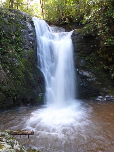
and a limestone cave that went deeper than we were willing to go.
By the end of the ride we were both a bit saddle sore as neither of us had ridden in a while. Still we had a great time and have already decided that we need to meet up again to ride the Damascus to Whitetop section some day.

Thursday, July 17, 2014

A Little Taste of Owensboro, Kentucky

Along our travels today, we made a quick stop in Owensboro, Kentucky. Our first stop was the famous Moonlight Barbeque. We got some barbeque to go and ate it at a pleasant city park.
Then we headed a short distance to the world's largest sassafras tree.
It was a short visit, but I think we covered the most interesting aspects of the town in our short visit.

Lincoln Boyhood National Memorial

This is another site that I had been to before, but it was a first time visit for Noelle and Sierra. We started at the visitor center which also serves as a memorial to Abraham Lincoln. The memorial court features five panels that were sculpted to feature significant periods in Lincoln's life.
From the visitor center we headed through the Allee and into the woods for a short hike to the Pioneer Cemetery where Lincoln's mother Nancy Hanks is buried.
Then we moved on to the Lincoln Living Historical Farm. There were animals there which Sierra enjoyed.
There were also demonstrations. Sierra liked watching some interpreters bake cookies and wanted to sit and listen to a talk on pioneer life.
We made a short side trip to the Lincoln Spring
and then headed back to the visitor center on the Trail of the Twelve Stones.
Back at the car we ate a snack and then hit the road again, headed further south into Kentucky.

Lincoln State Park

We camped at Lincoln State Park last night and it turned out to be the least buggy camping experience of our trip. It would also be our last night camping on the trip as we arrived home after a long day of driving. The park was pleasant, if not too impressive. This morning we packed up camp and went on for a short hike on the Mr Lincoln's Neighborhood Walk. The description made it sound more interesting than it turned out to be, but we still enjoyed our walk through the woods
and saw the grave of Lincoln's sister Sarah.

After our hike we checked out the Abraham Lincoln Bicentennial Plaza
which was a memorial to Lincoln's time in Indiana.
From the plaza we got back in the car and headed across the street to the Lincoln Boyhood National Memorial.

Wednesday, July 16, 2014

George Rogers Clark National Historical Park

From Normal, where we spent last night, we drove through the seemingly endless cornfields of Illinois south and east. We crossed the Wabash River and entered Indiana at Vincennes. Along the last leg of our drive we saw modified school bus after school bus carrying watermelons into Indiana.

Vincennes is the site of George Rogers Clark National Historical Park.
This would be my second visit to the site, but the first for Noelle and Sierra. We spent some time walking around the site which honors the contributions of George Rogers Clark,
a Revolutionary War hero who captured the British Fort Sackville
at Vincennes in February 1779. Interestingly, there is also an Abraham Lincoln connection at the site. There is a memorial bridge that now spans the Wabash River at the site where Lincoln is said to have crossed from Indiana into Illinois for the first time.
The bridge offers great views of the Wabash River and the George Rogers Clark Memorial.

Sierra was not as interested in the history of the site as she was in picking clover flowers off the lawns.
After about an hour and a half walking around we hit the road headed further southeast to Lincoln State Park where we are camped for the night.

Tuesday, July 15, 2014

Starved Rock State Park: Starved Rock and French Canyon

Starved Rock State Park is a place that Noelle and I have been talking about visiting for years. We pass it nearly every time we visit Noelle's parent's house as it is just off of two major interstate highways. Today we finally got our opportunity to explore the park a bit, though due to recent weather we would not be able to explore as much as we would have liked.

We pulled into the large parking area at the visitor center only to discover that the VC was closed for the day. Still we were able to find the information that we needed, the most important being that all the park's trails except for two were closed due to downed trees blocking the trails.
This information made choosing a hike easy: we would be headed to Starved Rock and nearby French Canyon.

We started our hike passing several buildings (and monuments)
in the visitor center area. Then we headed up Starved Rock on wooden stairs. At the top we had wonderful views of the Illinois River
and a whole lot of pelicans. We walked the short loop on top of the rock and then descended the way we had come. We then made the hike to French Canyon.
I have to say that I was quite impressed by what we found in the canyon.
It was a box canyon with sheer sides. Because it was so shady in the canyon, moss covered the walls, giving them a green hue. We took some photos there
and then retraced our steps back towards the parking area. Seeing French Canyon has certainly whet my appetite for wanting to see more of Starved Rock State Park! While Noelle used the restroom near the visitor center, Sierra and I looked at the birds feeding at the bird feeders.

Because our hike was short and there were no other areas for us to explore that are currently open, we decided against camping in the state park tonight. We decided to make some more miles and so we drove on to Normal, Illinois where we are spending the night.