Saturday, March 6, 2021

Gateway Natural Area: Black Powder Trail and Seaman Reservoir

 With a forecast of beautiful, warm weather we decided to head out of town today and made our way down to Fort Collins, Colorado. Our first stop, the fun Sugar Beet Park 


just outside of Old Town. Sierra enjoyed this park with its train car, moveable benches 


and lots of play elements to climb on. 


After playing at the playground for about an hour or so, we headed over to O'Dell Brewing for a couple of beers 


and lunch from a food truck. Today's food truck was Mac 'n, and we all enjoyed their mac and cheese.

After lunch we headed into the mountains. We didn't head too far up the Poudre Canyon though. Today we visited Gateway Natural Area to do a little hiking. We started with a hike up the Black Powder Trail. It is short, at about .8 mile, but pretty steep. The hike starts with a crossing of the two forks of the Cache la Poudre River.


Then, you follow a dirt road for a short distance, 

before heading out on a narrow footpath that steeply ascends the mountain immediately.

With recent snow and warm temperatures, the trail was a bit slick with both snow and mud. The views of the surrounding mountains and the Seaman Reservoir were excellent.


We continued climbing, 


with views out over the Poudre River, Highway 14 and the surrounding mountains. We stopped a few times to admire the views from various unofficial overlooks and even Rosie seemed to enjoy the view.


On our descent, we hiked a short spur trail to an overlook. To be honest, the views were better on the main trail.


After a short stop at the overlook, we made our way back to the dirt road. We followed the dirt road to the Seaman Reservoir, admire the view (and the graffiti left by Rosie) 

and then headed back to the car. 

It was a great way to spend a warm, late-winter day in the mountains!

Sunday, February 14, 2021

Skiing Scotts Bluff National Monument

Despite extremely cold temperatures, we got some really good snow over the past 2 days and I decided to dust off the skis and take them for a spin in the monument. The roads are still a bit slick, and so I made the short drive over the U Street carefully, parked the car and hit the trail. I would estimate about 10 inches of snow on the ground and a temperature of -3 at the time of my ski. I would be skiing the Prairie View Trail, which is really the only skiable trail in the monument.


The scenery looking towards Mitchell Pass was extraordinary.


It was nice to see the monument look like winter. We can really use all the moisture too, as its been a really dry winter so far. Setting tracks was hard work and slow going. Still, it felt great to have the skis strapped to my feet again. My first time on skis since winter of 2019 in Minnesota! I made my way west to the visitor center parking lot, then turned around and skied in the tracks I had made, stopping every now and then to take a look back at the scenery to the west.


I saw some wildlife as I skied back to the car: a large herd of mule deer,

and a solitary coyote trudging through the snow covered prairie.

It was cold, but a good day to get out for a bit.

Sunday, January 31, 2021

Roosevelt National Forest: Round Mountain Trail with a Side-Trip to Stone Mountain

I got permission to go for a solo hike today. With a forecast of nice weather, I decided that a trip down into Colorado to hike the Round Mountain National Recreation Trail might be in order. I awoke at 5 am this morning, took the dog for a walk and then grabbed my gear for the drive. I was on the road by 5:30. I stopped at McDonalds in Cheyenne to grab breakfast to go and, after stopping for gas in Wellington, made it to the trailhead just west of Loveland by a little after 8 am. There were 3 other vehicles in the lot upon my arrival. I quickly readied my gear and then hit the trail.

The trail starts out as a wide, closed road. 


There are some pretty nice views right off the bat. 


I quickly turned off the nature trail and onto the "Summit Trail". 


It seems the Round Mountain trail goes by two names; it's also known as the Summit Adventure Trail. Interestingly, it doesn't lead to the summit of Round Mountain, but instead Sheep Mountain. Talk about confusing. The trail starts on land that I assume is owned by the City of Loveland, but pretty quickly passes into Roosevelt National Forest. 

The trail is 4.75 miles to the summit of Sheep Mountain and each mile is marked with a post.

I would say that the first two miles of the trail are the steepest. Beyond the first mile, views opened up west to the high, snow-covered peaks.


At mile 3, the trail gets a bit rockier and you pass this interesting rock formation that sits right on the trail. Toilet rock?


Beyond the rocky section the trail heads into the woods on the way to the summit. There are not any views from the summit proper. There is a benchmark at the summit 

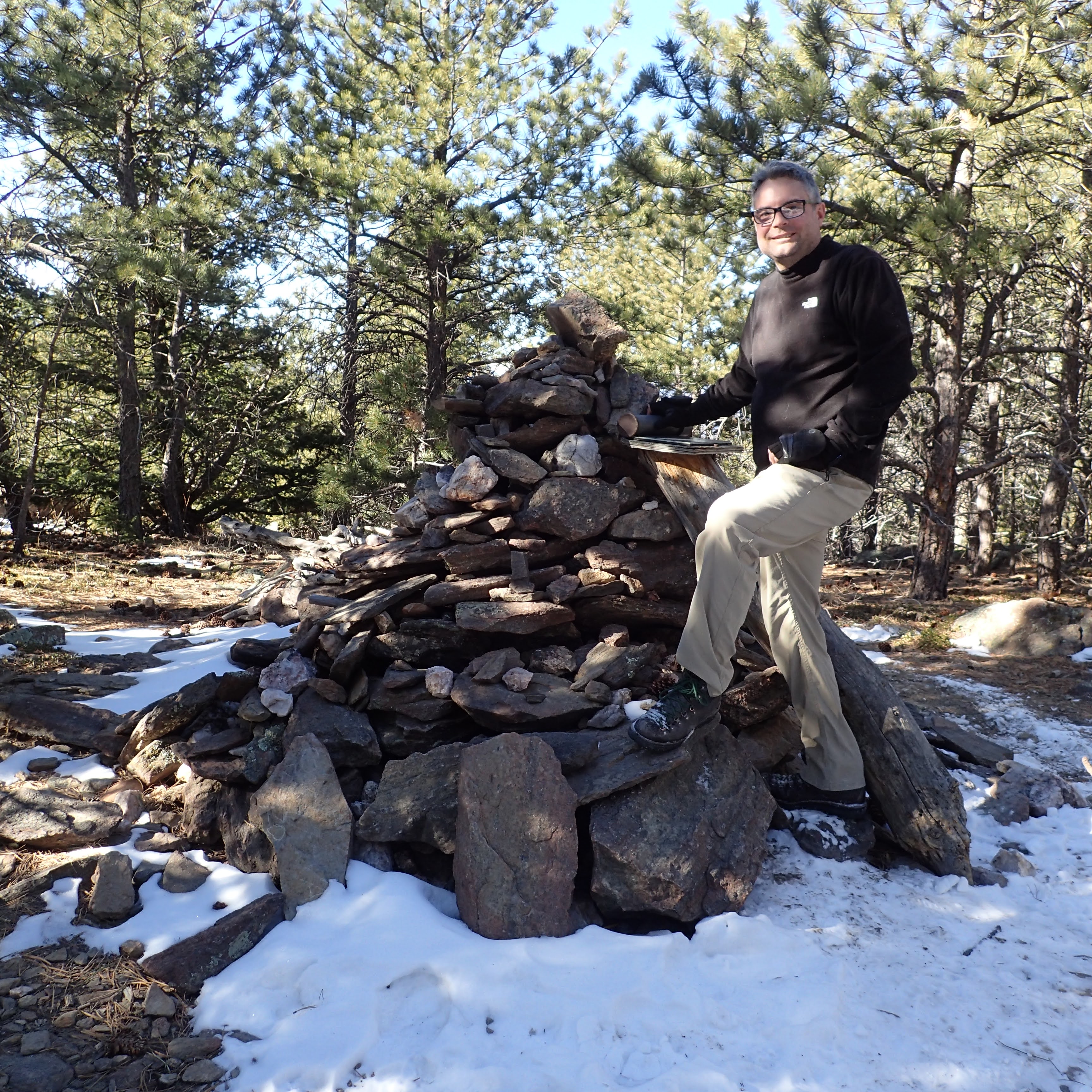
and a large cairn that I took a selfie at. 

Embedded in the cairn is a metal cannister that contains the summit register. 

I signed the register 

and ate a snack, and then headed back towards the way I had come. 

On the way down, I felt I had enough energy to take a bit of a detour. In between miles markers 4 and 3 there is a faint path that leads east. Just beyond the trail junction is a tree with a metal marker embedded in it. 

The unofficial trail leads south of a ridge and you can catch intermittent views of Longs Peak and Mount Meeker through the trees.

After a short walk a view of Stone Mountain comes into view. That would be my objective for this part of the hike.
There is a bit of an easy scramble to get the the summit of Stone Mountain. Once up at the top, the view is amazing. You can see Longs and Meeker, Horsetooth Rock, Loveland, Fort Collins, and my favorite view, out to the Mummy Range.

I met two guys from Greeley up there. I talked to them for a bit, had one of them take my photo, and then I set off to hike back to the car. The hike down went pretty fast, but I did take some time to enjoy the views down the Big Thompson River Canyon.
I arrived back at my car to find a packed parking lot ready for the long drive back to Gering.

Monday, January 25, 2021

Buffalo Creek Wildlife Management Area

I've been to Buffalo Creek Wildlife Management Area three times now. Each time looking for an elusive moose that supposedly lives there. 


Each time I've left without any luck of seeing the moose, but lots of fun adventure in a very interesting area.

Back in September, just before Sierra's birthday, Noelle, Sierra and Mom T had gone there to look for the moose. We arrived to find fire trucks in the parking area for the Western Nebraska Engine Academy wildland firefighting training. Surprisingly, they allowed us to hike and as we made our way along the old road, 


we saw lots of action in the sky!

A plane and multiple helicopters were flying around dumping water on a fire. 

We had actually seen them close to home before we left. Maybe they were filling up at the canal near Five Rocks Amphitheater? 

The scenery was beautiful, 

but when we arrived at the wetlands area, 

the most likely area to see a moose, no luck! 

We turned around and headed back to the car just in time to be rushed out of the area by some of the firefighters. 

On New Year's Day I returned with a coworker. There was a little bit of snow on the ground and so I figured if the moose was around, we would see evidence of it in the form of tracks. We walked back to the wetland area and around the south side of it. Then we decided to climb up on a ridge for a view of the surrounding lands.


The views were great, but there were no moose to be seen. We descended from the ridge and then headed into the densely wooded riparian area along the creek. 


Hiking along the creek was like hiking in a different world. It was shady and snowy with ice along the sides of the creek. In places the creek formed a surprisingly deep ravine. 

Today, Noelle, Sierra, Rosie and I returned. We hiked through a cold wind along the road to the wetland


to have a quick look for the moose. Without any moose in sight, we decided to climb the ridge of some bluffs to the south of the wetland.

The climb up to the ridge was fairly easy. The views were awesome!

Sierra posed for a photo 

and then we decided to try to climb higher up the ridge. Unfortunately, there was a lot of cactus and Rosie got some spines in her paw. We retreated down the east side of the bluff, out of the wind. 

The views to the north were pretty spectacular!

Once down in the flats the hiking went quickly.
Soon enough we were back to the road 

and shortly thereafter back to the car and out of the wind. It was a pleasant little hike. We will definitely have to return to Buffalo Creek to do some more exploring!