I headed off on the rough road that follows Horse Creek and followed the road to the horse trail that leads to the Pete's Branch Trail. This time instead of taking the Pete's Branch Trail I followed the horse trail to Sarvis Cove Trail.
I didn't see much wildlife as I hiked, except for an interesting centipede.
At one point I lost the trail completely and was almost ready to give up on my adventure when I saw the trail made a hard left and started to switchback up the mountain.
Once the trail started to switchback up the ridge it was still overgrown, but at least I could follow it. Towards the top of the ridge the trail intersected the highest portion of the Horse Creek Road and then made its way to the ridgeline. I found a road that I suspected was the Appalachian Trail. It was not, but it did lead to the AT after a short distance at an intersection complete with an old, rusty, folding chair.
Once on the AT I headed north towards Big Butt Mountain and my objective for the day; the highest point in Greene County, Tennessee: Gravel Knob.
Going was fast on this portion of the Appalachian Trail. It was relatively level and followed both old road and footpath. It is starting to look a bit like fall, as the mountain ash berries are big and red.
I quickly made it to Big Butt. The summit was a rock outcropping with a benchmark embedded in it.
The benchmark called the summit "Big Rock".
From Big Rock I got back on the AT and headed further north still. I passed a monument to a deceased hiker as I descended a short distance.
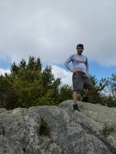
I bashed through the thick brush. The lower portions weren't too difficult, but as I ascended the higher portions were nothing but thorns and brambles. My legs got quite a thrashing, but I was able to find the highest point on the ridge. While I did not find a benchmark there, I used my GPS unit to confirm that it was indeed the summit. I spent a few minutes at a relatively clear area near the summit and took a photo there.
back to the AT where I retraced my steps by heading south. I quickly made my way to the Sarvis Cove Trail
and followed it just a short distance through some thick jewelweed
to the Horse Creek Road. I figured the road would be easier to follow than the overgrown trail.
The upper reaches of the road turned out to be interesting. There was a nice overlook of Greeneville and the surrounding countryside near a monument to a soldier whose last name was Powell.
I decided that I will call this the Powell Overlook.
From the Powell Overlook the road switchbacked down to the upper reaches of Horse Creek. The road passed some interesting cascades
and then descended for what seemed forever. For most of my hike I did not see another person. It wasn't until the road reached the intersection with the horse trail that I saw a family our walking and soon after saw a group on horseback. It was a long hike, but I'm glad to be able to say I've been to the highest point in my new home county.


1 comment:
I live in Greenville. This was amazing to see. I’d love to go up there one day.
Post a Comment