I drove Interstate 40 east into North Carolina in fog and a light rain. The day was not shaping up the way I had hoped. The forecast for today called for partly sunny skies. Yet there I was close to my hiking destination in the Cataloochee section of Great Smoky Mountains National Park, in the dark, pre-dawn rain, second-guessing my decision to make this hike.
I arrived at the trailhead for the Cataloochee Divide Trail before it was even light, and so I opted to relax in the car for a bit. At 7:33 I finally hit the trail in the fog and mist and made my way west along the Cataloochee Divide.
It was cool enough that I hiked in my fleece sweatshirt. I even contemplated donning my rain jacket, not because of rain, but because of the constantly dripping water falling from the leaves and branches of the trees. Things finally brightened a bit when I had reached Taylor's Turnaround,
a bus shelter-like structure located just off the trail and outside the national park boundary. There were no views from the structure though, and so I would continue west, never venturing far from the park boundary.
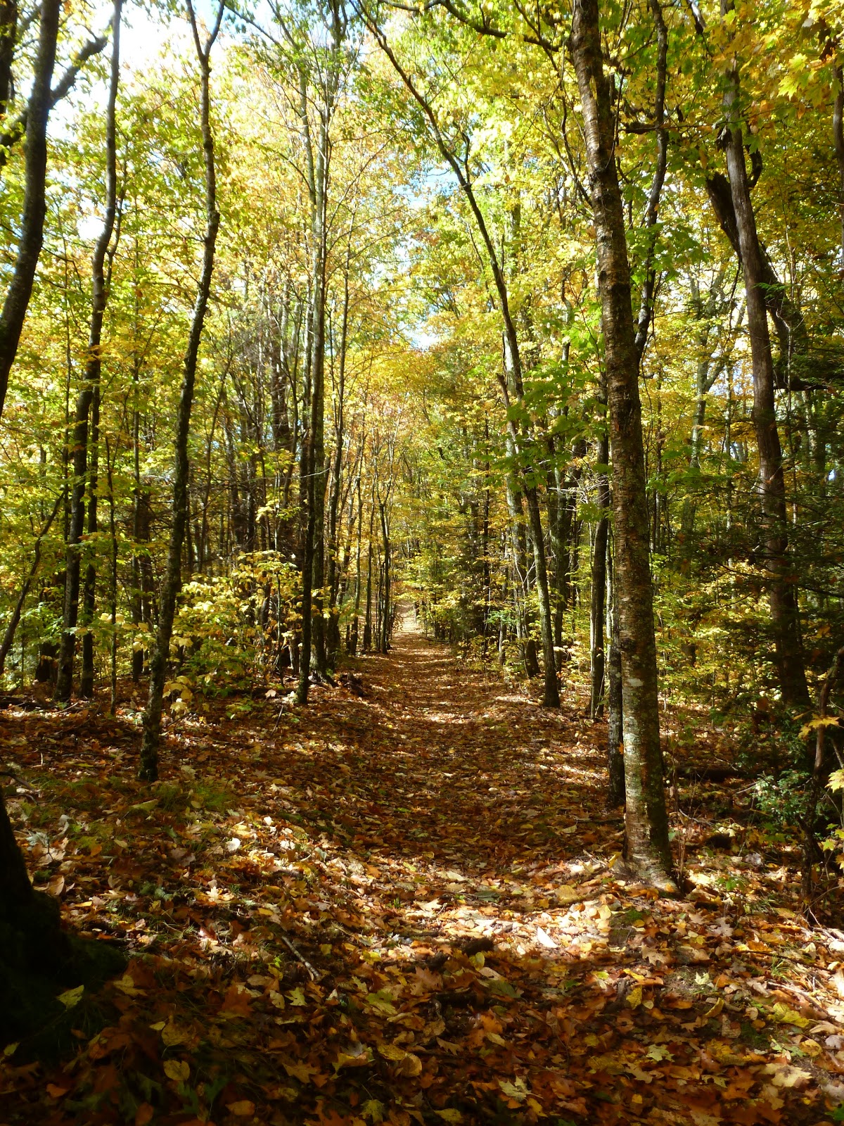
I passed through open forest and tunnels of rhododendron,
eventually finding an unmarked trail that led to the left. Soon I found a sign explaining that I was headed to the Purchase Knob Science Learning Center.
I made my way out of the woods and into some old fields and there it was, the former residence which has since been converted into a center for education and scientific research.
The view from the porch of the building was pretty spectacular, especially the view of the center's namesake Purchase Knob.
By now the sky was trying to clear a bit.
Still, it would be a while until I would see blue sky.
I soon found another trail that was signed as leading to Cataloochee Divide and so I took it. Then I saw a trail signed for Ferguson Cabin
and decided that I just had to see the cabin. The trail, an old road, led across a small stream and then into a clearing where the cabin sits.
The grass all around the cabin was torn up, I'm guessing from wild hogs in a search for food. I went inside to have a look around.
There's not much to the old cabin, just one room. There is, however, a sign inside on the wall that gives more information about it. Apparently, the cabin was built back around 1874 and lived in until 1902. It is the highest elevation historic cabin in the Great Smoky Mountains National Park. After exploring for a few minutes I hit the trail and headed back up to the Cataloochee Divide.
Almost immediately I found the junction with the McKee Branch Trail.
I decided to head down the 2.3 mile trail to fill in this section of my hiking map. The trail was mostly unmemorable. It was an eroded, rocky, muddy mess in many places. Towards the trail's intersection with the Caldwell Fork Trail it finally gets interesting. There is an old cabin site, with a crumbling chimney
and foundation. Relics of the cabin are scattered around on the foundation: shards of broken glass,
a piece of an old pot and other detritus. The trail then crosses a small stream, then McKee Branch,
and approaches another cabin site, supposedly the site of Ira McGee's cabin. I didn't see any remaining structures, but some yucca marks the site.
It is near here that a side trail leads back across McKee Branch and over to a cemetery. Most of the graves are marked only with stones, but there are a few that are identified, including Jessie McGee's.
After checking out the cemetery, I headed back to the McKee Branch Trail and soon thereafter found myself at its intersection with Caldwell Fork Trail.
I ate a snack near the trail sign and then started to make my way back up to Cataloochee Divide. It was a pretty steep ascent. Back at the Cataloochee Divide Trail I turned right and continued west. Again the trail followed the park boundary closely, marked by an old CCC-built fence.
By now, some sun broke through the clouds every now and then.
Soon I reached the site of Gooseberry Knob on the Swag Resort.
Gooseberry Knob is an exceedingly pleasant spot. There is a gazebo (complete with a hammock inside),
some picnic tables and chairs lined up for people to relax in an take in the expansive view.
I particularly enjoyed Roger's Hideaway, a secluded little spot with a wonderful view, that's elevated above the surroundings and looks like something that might have been built by Ewoks.
I relaxed in a chair there for a while
and then continued back on the Cataloochee Divide. I made my way over to the intersection with the Hemphill Bald Trail where I turned around near a tree that was supposedly used as a "marker tree"
by the Cherokees.
On the way back I decided to detour through the Swag grounds to have a look around a bit. I walked past the pleasant garden
and the Swag House, which is a restaurant I believe. Along the way a lady saw me and said hello. She asked me about my hike and told me that she was the owner and to take an ice cream sandwich for free. That really impressed me. At $495 per night for the least expensive lodging option, the Swag is a place I will probably never be able to afford, yet the owner treated me with respect and kindness.
After eating my ice cream sandwich, I made my way along the park boundary on the Swag side for a bit.
At Gooseberry Knob I moved back into the park and started the long return to the car. The hiking went relatively fast. The wet leaves and ball-bearing like acorns did make the footing a bit slippery,
but it was never too bad. When I had arrived at Taylor's Turnaround there was a view this time!
I also enjoyed the goldenrod and aster in bloom.
Another view opened up into the park
and before I knew it I was back at the trailhead
and my car at the Cataloochee park entrance.
Despite my trepidation on the drive, today turned out to be a wonderful day for hiking.


No comments:
Post a Comment