I took advantage of my day off today by heading out for a solo hike to the highest point in Voyageurs National Park. I hit the road at about 10 am and arrived at the trailhead for the Beaver Pond Overlook and Kab Ash Trail a little bit before 11 am. It was relatively cool and windy this morning, but the trees of the boreal forest blocked most of the wind and allowed me to hike in short sleeves.
As an added bonus there were virtually no bugs!
The section of the Kab Ash Trail that I hiked today is seldom hiked. In fact, judging by the copious amount of scat lining the trail, I would say it is used by wolves more often than people. There is not always a dirt treadway.
Instead, the trail is often marked by flagging
and cairns,
and less often by trail markers nailed into the trees.
The trail followed close to the park boundary
and passed by a survey benchmark,
then climbed the wet slippery rock through scattered blueberry bushes
to the vicinity of a communications tower.
As I approached the tower, I knew to leave the official trail and bushwhack to the tower site where the highest point in Voyageurs National Park is located. I wandered around a bit and eventually found a cairn
with the summit register located inside.
I signed the register and posed for a photo
before heading back to the trail to complete the loop.
The second half of the hike was filled with wildflowers. There were lots of bunchberry,
starflowers,
Canada mayflower,
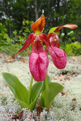
and pink lady's slippers which are also known as moccasin flower.
(I couldn't help but photograph each one I saw.)
I also saw lots of blue bead lily or Clintonia, but only found one with flowers in bloom.
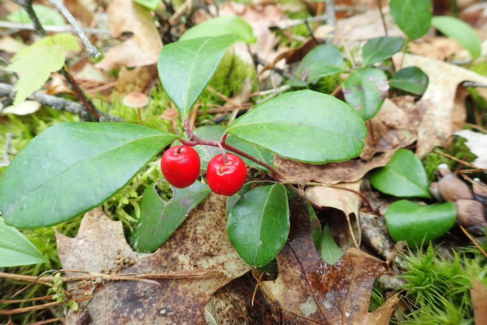
Besides flowers, the wintergreen had berries on it.
Soon enough I found a signpost marking the end of my loop. It had the Hike to Health rubbing plate on it.
It was a short walk from that point back to my car.


1 comment:
I have spent some time,(a full winter), hiking and camping the backwoods of the Kab Ash Trail,(Beginning at Salmi road). Most of the trails at this end are rustic at best, Not much maintenance going on in this section of Voyageurs. This sort of off trail hiking is for the real "wilderness" enthusiast. No real way to get lost out here, All you really have to do to get back to civilization is to head north till you reach the Ash River, Depending on which end you are at, you can follow the river either east or south to find relatively close roads, Following the river west you will run into Gamma road, NW and you will run into either Gamma or Gappa road, and South/ SE you will run into HWY 53.Very fun and solitary area, There are bears, moose, deer and what I am pretty sure are either wild dogs or coyotes,(You will likely hear them in the distance)....None of which ever gave me any worry. One rather large moose followed me around for about an hour before becoming bored.
I'll suggest that any food or scraps be either well burned or taken with you whereas there are those animals who will take advantage of anything left out....Never had to worry about the large predators...but had to constantly watch out for the thieving chipmunks or the field mice...They are rather pesky and insistent little creatures....I had chipmunks dropping things on my tent all of the time...and once found a half dozen dead field mice crammed into my boots stuffed into my boots by a clever little weasel. All in all I very much enjoyed my time out at Kab Ash...Will be going back in a few weeks.
I'd like to add, PLEASE leave the area in as good or better condition than you found it Please do not leave your litter...and if you can, please pick up any litter that you see....I and every other outdoor enthusiast thank you for preserving this beauty for everyone else.
I would like to add, Though rivers and small lakes are plentiful, you'll want to either carry your own water, or bring a filter with you, The water quality here is drinkable, but definitely needs filtering to be safe.
Post a Comment