We got the Wenonah Canoe out for her first paddle trip of 2019 today. We put in at the Dove Island boat ramp
and headed under the causeway into Krause Bay. We stopped at the Black Bay Beaver Pond Trailhead for lunch
and to admire some of the blooming wildflowers.
Then we hit the water again headed east on Rainy Lake.
Our first stop was a small unnamed bay just east of where Black Bay spills into the lake. We found a pretty substantial beaver lodge in the bay
and a tranquil spot away from other boat traffic.
Then we headed back out in the choppy, unprotected lake. We crossed the navigation channel as quickly as we could and headed back into protected waters at Harrison Bay.
It is a pleasant spot with low rock cliffs and, at the mouth of the bay, a grassy wetland.
We paddled back into the bay as far as we could and then turned around to head west to the Day Use Site.
We relaxed and admired the view there and also admired the blue flag iris in bloom.
Eventually we got back into the canoe for the paddle back to the boat ramp at Dove Island.
Sunday, June 23, 2019
Sunday, June 16, 2019
Kawishiwi Falls Trail
After our hike of the Secret/Blackstone Trails, we still wanted a little bit more adventure. We decided to hike the short trail to Kawishiwi Falls on the way back to Ely. The hike started off near a large boulder at the parking lot. Sierra decided that she just had to climb it.
Then we headed further into the woods on a well-worn path.
There were some interesting trees along the way. One was like a fortress of roots,
while another seemed to grow right on top of a rock.
We traversed a section of boardwalk,
and shortly thereafter we could hear the rushing water of the falls.
We posed for a few photos
and enjoyed the scene from a bench, before passing a portage
for the return hike to the car. After dinner in Ely, we made the drive back to International Falls.
Superior National Forest: Secret/Blackstone Lakes Trail
Today Noelle, Sierra and I decided to get out of town by making a trip over to Ely. We drove through town and east to the Secret/Blackstone Trail System. We ate a snack in the trailhead parking lot
and then hit the trail.
Almost immediately we had to stop to put on some bug spray. Sierra hiked with her hood on to keep the biting insects at bay.
Flowers in bloom included wild rose,
nodding trillium,
bunchberry,
and pink lady's slipper.
The trail traversed several high ledges which afforded overlooks of several lakes including Secret Lake,
some small unnamed ones, and Ennis Lake.
We enjoyed the view at each overlook and inspected the campsite along the shores of Blackstone Lake
before returning to the car.
Monday, June 10, 2019
Superior Hiking Trail: Jay Cooke State Park Visitor Center to Wild Valley Road
For the start of today's hike, I didn't have far to go. I made the quick drive from my campsite over to the River Inn Visitor Center and hit the trail by immediately crossing the swinging bridge
over the St. Louis River.
Once on the other side of the river, I followed the combination Silver Creek/Hiking Club/Superior Hiking Trail.
Parts of the trail, which mostly traversed a wide grassy tread, were quite muddy.
Eventually I found myself at an area where the Superior Hiking Trail left the ski trails and headed into the woods on a singletrack, dirt path. There were a few areas of views overlooking the St. Louis River valley.
Another view looked out to a train trestle.
Soon enough I had made it to the Highway and Wild Valley Road.
I took a short snack break in the sun (there weren't as many bugs there) and then turned around for the return trip. I saw a few slugs and snails along the way.
For a little variety, I decided to hike the part of the Silver Creek Loop I had missed earlier and was treated to a display of yellow lady's slippers.
Then I was back at the car to take camp down and run some errands in Duluth.
Sunday, June 9, 2019
Superior Hiking Trail: Martin Road to Lismore Road
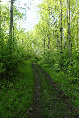
This morning I awoke early, packed my camping gear into the car, and made the drive down into Duluth. After making my way through part of town, I headed out to Martin Road and one of the trailheads for the Superior Hiking Trail in the section between Duluth and Two Harbors. I had attempted to hike this section of trail before, only to arrive at the trailhead after a major storm with many trees down all over town. I figured I would have had to climb over and under fallen trees and so I opted to save the hike for a different day. That day turned out to be today.
I arrived at a full parking area (most of it seems to be closed) and parked along the side of the road near some lupine for my hike.
The start of the hike followed snowmobile trails.
They were grassy and often quite wet.
There were lots of wildflowers in bloom,
including marsh marigold in the frequent wet sections.
I passed some property belonging to the University of Minnesota Duluth
and eventually made my way onto a section of singletrack trail off the snowmobile trail.
I endured one short rain shower,
but mostly the rain held off while I hiked the trail.
There were a few beaver ponds here and there.
The trail traversed some sections of woods that had been logged,
included one section that had been logged very recently. The trail through the logged sections was marked with posts.
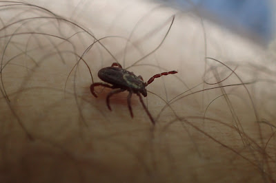
Interestingly, I didn't find many ticks. Just two over the course of the entire hike!
Shortly after a break at the White Pine campsite,
the trail made its way to a road, Lismore Road. The trail closely paralleled the road here. At Lismore Roads intersection with Jean Duluth Road I made a right for the long road walk back to the trailhead. Of course it started raining as I walked the road. The rain was quite hard at times. While you often hear Minnesotans brag about "Minnesota Nice", nobody stopped to offer me a ride. I was soaked and cold by the time I arrived back at my car for the drive to my campsite at Jay Cooke State Park.
Subscribe to:
Comments (Atom)


