Monday, June 17, 2024

Hermit Park Open Space: Kruger Rock Trail

My days off have been changing a lot, due to a lack of staff at work. This week I have off Monday/Tuesday. Unfortunately, Noelle does not have the same days off. Still, I felt I needed to get out for some time outdoors. Sierra and I opted to head down to Estes Park to do some hiking, camping, and mountain coaster riding.

This morning we made the drive down to Cheyenne where we stopped for breakfast at Perkins. After a short interview for work, we made the rest of the drive down to Estes Park. We drove up Highway 36 to the Hermit Park Open Space, operated by Larimer County. We parked at the Kruger Rock Trailhead and started our hike.


It's a pleasant area with well-maintained trails and nice views. 


Our trail traversed some meadows dotted with wildflowers like fleabane.


Soon, we crossed into Roosevelt National Forest and followed a ridgeline with awesome views west into Estes Park and Rocky Mountain National Park.


The trail was not difficult, but we still stopped to take plenty of breaks.


As we continued on the views, especially of Long's Peak, continued to get better and better.


Towards the summit is a chute that you scramble up.


And then, you have the views from the summit itself.


We relaxed and enjoyed the views for a bit before making our way back down the chute.


Then, it was a pretty easy hike back down to the car. Once back to the car we were pretty hungry. We opted to go into Estes Park for lunch (ice cream for Sierra and a beer from Rock Cut Brewery for me). As we walked around town we strolled along the Big Thompson River and even dipped our toes into the icy cold water.

Then, we headed back to Hermit Park to set up our campsite in the Bobcat Loop.

There's a nice big rock we can climb from our campsite.

It offers nice views of Kruger Rock and the surrounding area.

It's a nice campground, and I would love to return with Noelle at some point!

Thursday, June 6, 2024

Roosevelt National Forest: Roaring Creek Trail

Noelle and Sierra are in Costa Rica right now. I opted to take Rosie out to the Poudre Canyon to hike a trail that's been closed since the Cameron Peak Fire in 2020. Only recently has the Roaring Creek Trail been reopened. We made the drive into Colorado, and up Highway 14 to the Big Bend Campground. We set up camp there at one of the walk-in sites and then headed just a little further up the canyon to the Roaring Creek Trailhead. 


We hit the trail, traversing a sunny, hot, open area that had burned in the fire back in 2020.


Soon, we encountered the trail's namesake: Roaring Creek. 


I guess the creek doesn't always live up to its name. However, with all the melting snow in the high country, Roaring Creek is roaring right now!

Since we only saw one vehicle parked at the trailhead, I figured it would be okay to let Rosie hike off leash. She really enjoyed her freedom!


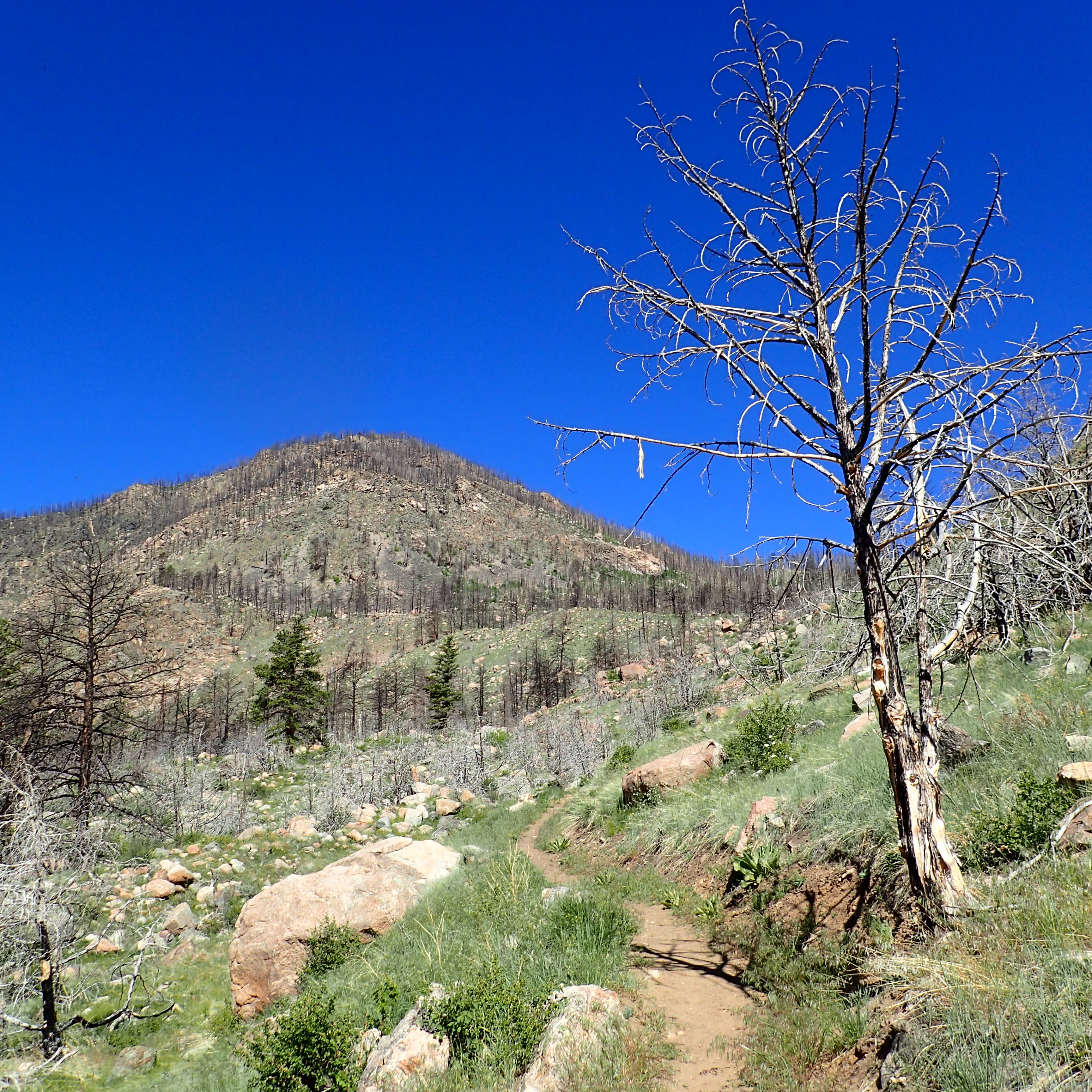
Despite the fire-scarred landscape, the views were pretty nice as we continued to climb. 


Wildflowers bloomed along the trail,


and while we didn't see a lot of wildlife, we did catch a glimpse of a marmot spying on us from its rocky perch. 


About 2/3 of the way up the trail, we finally left the burn behind and headed into the trees. The shade was welcomed, as were the scattered patches of snow.


We continued to climb along Roaring Creek, though the upper portions of the stream were a bit less "roaring".


Rosie decided to hop in the water for a swim. I think the current was a bit stronger than she had anticipated.


The trail entered a meadow,


then appeared to cross the stream before terminating at a road. The stream was moving too deep and swift for us to cross at this point, so we opted to take a break and turn around. That's when I figured the bridge of branches where Rosie had opted to go for her swim earlier would give us access to the other side of the creek. We crossed and made our way to the trail's terminus at the road.


We immediately turned around and started our way back to the trailhead. The downhill hike went relatively quickly.


Unfortunately, about a mile before the trailhead, Rosie really started slowing down. She would stop and sit down in the middle of the trail and refused to move. I thought she was hot and/or thirsty so I offered her plenty of water. It didn't seem to help though. It took a while and a lot of coaxing, but I was slowly able to get Rosie to hike back to the car. Back at camp I discovered why she was moving so slowly: the pads of her paws were worn raw. 


I felt terrible. I did not intend to injure my faithful hiking companion in this way. Rather than go for another hike tomorrow, we would be headed back home to allow Rosie to heal and recover. 

Friday, May 31, 2024

Pine Ridge Trail: East Ash to Roberts Loop

It was a cool, overcast morning and I wanted to get out to do some hiking. I opted to head back to the Pine Ridge Trail. Today I would hike a new section: East Ash Road to the Roberts Loop. Last time I hiked the Pine Ridge Trail I had brought Rosie along and we pulled over 30 ticks off of her. I opted to go without her today. Even without her, ticks would be the theme of the day.

I parked my car just to the west of East Ash Road and hit the trail. Immediately, I found my first tick of the day.


I crossed East Ash Road and headed east.


I would be headed 7.3 miles to the Robert's Trail and then back again; 14.6 miles round-trip. Almost immediately I passed into the Pine Ridge National Recreation Area.


The trail here followed the bottom of a small canyon, 

filled with Eastern Red Columbine!


Besides columbine, there was spiderwort, pussytoes, and death Camas.


The trail climbed up out of the canyon and there were awesome, though overcast views.

Later in the day, I would pass the same scene, but with blue skies!

Up in the highlands, the trail followed a road for a short period and intersected with the Great Plains Trail.


Then the trail descended into another canyon. This one with some pretty steep drop-offs.


I traversed the slightly overgrown trail at the bottom of the canyon and enjoyed more columbines.


While the lush canyon was beautiful, the ticks were plentiful.

The spots on my pants are ticks!


Near the mouth of the canyon, a group of cattle watched me warily from a distance.

A sign located at the point where the trail leaves the canyon indicated the creek I had been following is called Cunningham Creek.


Here the trail followed a fence line for a bit.


Then, I started to climb up to the junction with the Roberts Loop. Views were pretty awesome!


I stopped at the junction with the Roberts Trail to take a break.


I pulled up the legs of my pants to do a tick check and did not appreciate what I found.


After pulling almost 60 ticks off of my legs, back, head, and other body parts, I turned around to make my way back to the start of my hike. Flowers observed on the way back included sego lily an white penstemon.


The sky cleared by the time I was in the homestretch of the hike and the views I had seen earlier seemed a bit cheerier with blue sky. 


I made it back to the car for the drive home. Along the way I pulled probably over 50 ticks off my body. It had been an enjoyable hike, but I probably won't return to the Pine Ridge until fall. There's just too many ticks right now.