The Great Grunwald Roadtrip of 2013 begins! This morning I took the garbage to the waste transfer station as soon as it opened and we hit the road. Our destination is eventually Philadelphia, but on the way we plan stops in Greensboro, the Outer Banks and Wilmington, Delaware. Today we would be headed to the famous rhododendron gardens on Roan Mountain.
We made the circuitous drive through Erwin and the mountains to Carver's Gap. From Carver's Gap we took the road that leads directly to the gardens. We parked the car and got out to some cool temperatures and light fog. We hadn't even packed jackets!
Luckily we had a nice warm sweatshirt for Sierra. We all enjoyed walking among the blooming flowers,
though I overheard people say that this year's display is not as good as in years past.
Still we saw plenty of pink flowers in bloom
and got a few nice family photos amongst the rhododendron and spruce.
Besides the rhododendron we also found a jack-in-the-Pulpit and some interesting purple columbine.
Friday, June 21, 2013
Wednesday, June 19, 2013
Cherokee National Forest: Chuckey Mountain
I was given permission to go on a solo adventure this morning! I decided I would stay close to home and head over to Chuckey Mountain. The hike required me to drive on the Cedar Creek Caves Road and I was anxious to see if I could find the caves in reference. I made the drive to the trailhead and did not find any caves. Perhaps I would see them on the way back though.
The hike started on an old rough road. It was quite wet and muddy given all the recent rains. I just kept following the road until it petered out. At the point where it vanished I got a bit confused. I started bushwacking where I thought maybe a trail had been but gotten overgrown. I went in several different directions, but each time the vegetation got so thick that I decided to just turn around. Finally I gave up and started to head back to the car. It looked like my mission for the day, to summit Chuckey Mountain, would be a failure. At least I found some interesting wildflowers to look at.
Just when I had given up all hope on the return to the car, I saw a brown carsonite post for the trail.
The mission was back on! I followed the well-defined trail up to the ridge and then I lost any resemblance of a trail.
If I wanted to stand on the summit of this mountain, it looked like I would have to do some bushwacking after all.
Of course I had worn shorts and so the bashing through the tangled brash was a little bit painful and made the going slow. After about 3/4 mile of ridgeline bushwacking I saw a small cylinder of concrete with the benchmark set in it.
I took a photo at the summit
and then retraced my steps back to the car. It was an uneventful return trip. I did, however, find some mushrooms alongside the trail.
Once back to the car I drove the rest of the Cedar Creek Caves loop and did not find the caves.
The hike started on an old rough road. It was quite wet and muddy given all the recent rains. I just kept following the road until it petered out. At the point where it vanished I got a bit confused. I started bushwacking where I thought maybe a trail had been but gotten overgrown. I went in several different directions, but each time the vegetation got so thick that I decided to just turn around. Finally I gave up and started to head back to the car. It looked like my mission for the day, to summit Chuckey Mountain, would be a failure. At least I found some interesting wildflowers to look at.
Just when I had given up all hope on the return to the car, I saw a brown carsonite post for the trail.
The mission was back on! I followed the well-defined trail up to the ridge and then I lost any resemblance of a trail.
If I wanted to stand on the summit of this mountain, it looked like I would have to do some bushwacking after all.
Of course I had worn shorts and so the bashing through the tangled brash was a little bit painful and made the going slow. After about 3/4 mile of ridgeline bushwacking I saw a small cylinder of concrete with the benchmark set in it.
I took a photo at the summit
and then retraced my steps back to the car. It was an uneventful return trip. I did, however, find some mushrooms alongside the trail.
Once back to the car I drove the rest of the Cedar Creek Caves loop and did not find the caves.
Sunday, June 16, 2013
Father's Day in Black Mountain, North Carolina
I spent my first Father's Day as a dad with my family in beautiful Black Mountain, North Carolina. Our first stop was a German restaurant called Berliner Kindl.
The food was pretty good. The best part was getting to eat German food which doesn't happen too often. After our German lunch we walked around town
and then headed over to the Pisgah Brewery to sample some of their delicious ales. Sierra seemed to enjoy the vibe and was intrigued by the beer.
After two pints we headed back towards town and the beautiful Lake Tomahawk Park. We strolled around the lake a few times and enjoyed the views and ambiance.
Then it was back to Greeneville.
The food was pretty good. The best part was getting to eat German food which doesn't happen too often. After our German lunch we walked around town
and then headed over to the Pisgah Brewery to sample some of their delicious ales. Sierra seemed to enjoy the vibe and was intrigued by the beer.
After two pints we headed back towards town and the beautiful Lake Tomahawk Park. We strolled around the lake a few times and enjoyed the views and ambiance.
Then it was back to Greeneville.
Saturday, June 15, 2013
Roans Beyond 6,000 Feet
What a beautiful morning! I packed my day-pack and headed out to Carver's Gap on the North Carolina/Tennessee border to hike all the peaks in the Roan Range above 6,000 feet. There are three of them: Grassy Ridge Bald which I hiked a few weeks ago, Roan High Knob on which is the highest shelter on the Appalachian Trail, and Roan High Bluff which I have never been to.
It was a pleasant drive into North Carolina through Allen Gap and up Franklin Mountain Road, through the Shelton Laurel area, and back into Tennessee at Devil Fork Gap. Then I drove through Erwin to the town of Roan Mountain and up, up, up to Carver's Gap. I parked along the road at Carver's Gap. I arrived early enough that the trail was not too crowded as I followed the Appalachian Trail south into the spruce forest.
The hiking was extremely pleasant. The trail was not too steep and the air was nice and cool. I made good time as I climbed to the spur trail that led to Roan High Knob Shelter and the summit of Roan High Knob itself. The last time I was up there was during my AT thru-hike in 2000. A dog barked at me as I approached the shelter, an old firewarden's cabin.
Someone was staying in the upper bunk are of the shelter, but I did not see them. I did find it a bit odd that they slept in so late on the trail. After signing the shelter register,
I made my way to a small outcrop, the highest point in the Roans. I took my photo on the summit and then headed back to the AT.
On the AT I headed south towards Roan High Bluff. I passed the remains of an old chimney
and then found myself at the site of the old Cloudland Hotel. There's not much left of the old hotel, just a few stone foundations and walls. From the hotel site I passed through a massive parking lot and found the trailhead for the Cloudland Trail at the other side.
The Cloudland Trail was a pleasant, mostly level hiking experience.
I pretty much had the trail to myself as I gently ascended on the sometimes gravel and sometimes paved trail. There was a small overlook shortly after leaving the parking lot and I enjoyed the view out over the surrounding area.
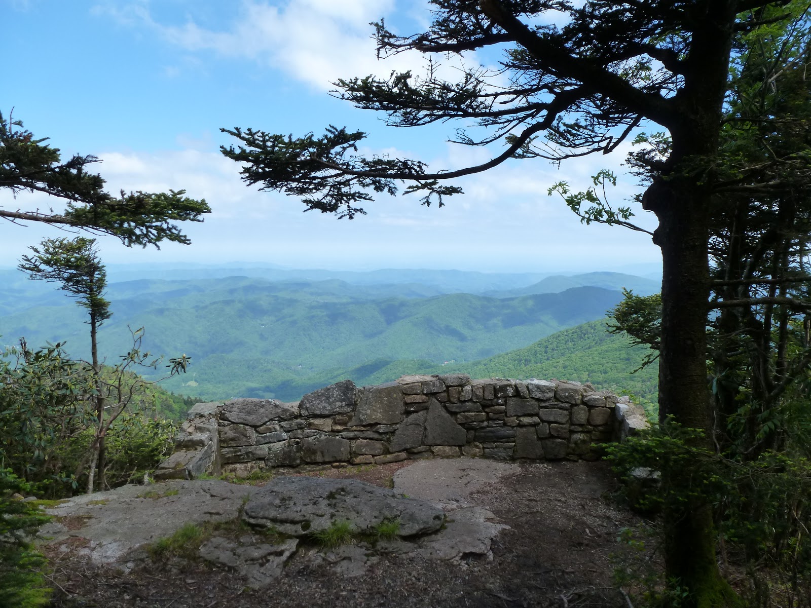
Eventually I made my up to an overlook at Roan High Bluff. There were sheer cliffs below the overlook.
It was apparent, however, that the overlook was not the true high point. I followed a ridge of rock just a bit higher to a benchmark and the true highpoint
which laid just outside of a restricted area of rare plants.
I rested a bit on the highpoint. A black slug paid me a visit.
Then I noticed some out of place looking pieces of white gravelly looking rocks, as I presumed them to be. As I looked at them harder I realized it was not rock I was seeing, but small pieces of bone. I think I may have stumbled upon some scattered human cremains. After that revelation I headed back to the trail for the return trip to Carver's Gap.
The hike to Carver's Gap went pretty quickly. I was surprised to learn that the Cloudland Trail is a designated ski trail, probably the only XC-ski trail in North Carolina.
Once I arrived there my hike was not over though. I headed north on the Appalachian Trail
into the grassy balds to return to Grassy Ridge Bald. I was returning because my previous hike to the peak was not long enough to count for the official South Beyond 6k recognition. I made my way up some now familiar area including Jane Bald. The views were just spectacular!
Eventually I made my way to the side trail that leads to Grassy Ridge Bald.
I quickly made my way up the trail, tagged the summit, ate a snack there, and then headed back down towards my car at Carver's Gap.
The hiking back to the gap went fairly quickly. I did, however, stop several times to admire the wonderful views and take some photos.
I just love it up there in the Roans.
I think I may bring Sierra and Noelle up here before we leave for our road trip to the Outer Banks and Philadelphia. While there were some rhododendron flowers in bloom,
I think the rhododendron should be peak right before we leave for our road trip.
It was a pleasant drive into North Carolina through Allen Gap and up Franklin Mountain Road, through the Shelton Laurel area, and back into Tennessee at Devil Fork Gap. Then I drove through Erwin to the town of Roan Mountain and up, up, up to Carver's Gap. I parked along the road at Carver's Gap. I arrived early enough that the trail was not too crowded as I followed the Appalachian Trail south into the spruce forest.
The hiking was extremely pleasant. The trail was not too steep and the air was nice and cool. I made good time as I climbed to the spur trail that led to Roan High Knob Shelter and the summit of Roan High Knob itself. The last time I was up there was during my AT thru-hike in 2000. A dog barked at me as I approached the shelter, an old firewarden's cabin.
Someone was staying in the upper bunk are of the shelter, but I did not see them. I did find it a bit odd that they slept in so late on the trail. After signing the shelter register,
I made my way to a small outcrop, the highest point in the Roans. I took my photo on the summit and then headed back to the AT.
On the AT I headed south towards Roan High Bluff. I passed the remains of an old chimney
and then found myself at the site of the old Cloudland Hotel. There's not much left of the old hotel, just a few stone foundations and walls. From the hotel site I passed through a massive parking lot and found the trailhead for the Cloudland Trail at the other side.
The Cloudland Trail was a pleasant, mostly level hiking experience.
I pretty much had the trail to myself as I gently ascended on the sometimes gravel and sometimes paved trail. There was a small overlook shortly after leaving the parking lot and I enjoyed the view out over the surrounding area.
Eventually I made my up to an overlook at Roan High Bluff. There were sheer cliffs below the overlook.
It was apparent, however, that the overlook was not the true high point. I followed a ridge of rock just a bit higher to a benchmark and the true highpoint
which laid just outside of a restricted area of rare plants.
I rested a bit on the highpoint. A black slug paid me a visit.
Then I noticed some out of place looking pieces of white gravelly looking rocks, as I presumed them to be. As I looked at them harder I realized it was not rock I was seeing, but small pieces of bone. I think I may have stumbled upon some scattered human cremains. After that revelation I headed back to the trail for the return trip to Carver's Gap.
The hike to Carver's Gap went pretty quickly. I was surprised to learn that the Cloudland Trail is a designated ski trail, probably the only XC-ski trail in North Carolina.
Once I arrived there my hike was not over though. I headed north on the Appalachian Trail
into the grassy balds to return to Grassy Ridge Bald. I was returning because my previous hike to the peak was not long enough to count for the official South Beyond 6k recognition. I made my way up some now familiar area including Jane Bald. The views were just spectacular!
Eventually I made my way to the side trail that leads to Grassy Ridge Bald.
I quickly made my way up the trail, tagged the summit, ate a snack there, and then headed back down towards my car at Carver's Gap.
The hiking back to the gap went fairly quickly. I did, however, stop several times to admire the wonderful views and take some photos.
I just love it up there in the Roans.
I think I may bring Sierra and Noelle up here before we leave for our road trip to the Outer Banks and Philadelphia. While there were some rhododendron flowers in bloom,
I think the rhododendron should be peak right before we leave for our road trip.
Friday, June 14, 2013
Pisgah National Forest: Spring Creek Loop Trail
A beautiful morning and so Noelle, Sierra, Parker and I headed out through Hot Springs to the Rocky Bluff Campground and the trailhead for a short hike on the Spring Creek Nature Trail. The hike started with a pretty steep descent on a very wet trail.
Eventually we found ourselves at a little overlook on Spring Creek.
The creek was flowing pretty good given all the recent rains. Once at the creek the trail closely paralleled the stream and its many small cascades.
We stopped several times to admire the flowing water.
After the trail left the creekside it was a steep ascent back to the campground. We fed Sierra her lunch there and admired the flowers blooming. There was some white rhododendron
and some of what they call bubby bush in bloom.
Eventually we found ourselves at a little overlook on Spring Creek.
The creek was flowing pretty good given all the recent rains. Once at the creek the trail closely paralleled the stream and its many small cascades.
We stopped several times to admire the flowing water.
After the trail left the creekside it was a steep ascent back to the campground. We fed Sierra her lunch there and admired the flowers blooming. There was some white rhododendron
and some of what they call bubby bush in bloom.
Subscribe to:
Posts (Atom)