Sunday, October 31, 2010

Spring Lake Park Reserve: Schaar's Bluff

After visiting with family and friends in the Twin Cities, Noelle and I wanted to do a little bit of exploring in the outdoors. After consulting our handy hiking guide, 50 Hikes in Minnesota, it looked like the closest hike to where we spent the weekend would be the a short 3 mile hike in Dakota County Parks' Spring Lake Park Reserve.

The drive to the park was pleasant and led through some of the more agricultural areas of the Twin Cities suburbs. The park itself was very pleasant as well. The hike started near a picnic pavilion and soon entered into some nice deciduous woods. The trail gently wound through the woods and eventually we made our way to the top of the bluff with some sheer limestone cliffs on the river side.


We got some good views of the mighty Mississippi River through the bare trees.

Soon the trail led us down into a small ravine where we crossed a concrete bridge before making our way up and back onto the bluff top.

It was a very pleasant way to spend a Sunday afternoon and we were quite surprised that we didn't see any other hikers while we were out on the trail.

Friday, October 29, 2010

The "DWP Trail": Ely's Peak to 93rd Avenue West

My temp job for the week ended a day early and so I had a free day today. I decided that I wanted to do some hiking and see something new, but wanted to stay relatively close to home. After some thought, I settled on a hike along a portion of the unofficial "DWP Trail", the abandoned railroad bed of the Duluth, Winnipeg and Pacific Railway. I figured I would start my hike at the Ely's Peak Climbers' Parking area and head towards Spirit Mountain. Noelle would not be able to go with me, but I still had a hiking partner in Parker.

At around 10 a.m. I grabbed some dog treats and a poop bag and we headed out to the car for the drive to the trail-head. I decided to take the road less traveled, in this case the far western section of Skyline Parkway. The drive, although bumpy, was very scenic. We arrived at the trail-head off of Becks Road by 11 a.m.

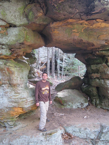
The hike started out a bit wet. The trail from the parking area to the old DWP railroad bed was like a small stream. When we reached to railroad bed the trail got a bit drier, but anytime the trail encountered a rock cut where there was not much drainage it got wet again. We walked through the dark, damp tunnel and headed east.

There were some nice views of Ely's Peak and some of the other high ridges.

Eventually the trail crossed several small streams on berms before crossing a more substantial stream on a condemned bridge.

While that first small bridge was scary to cross, the second bridge, a long steel trestle high over Stewart Creek was even scarier.

We made it across and then hiked until we reached a road, 93rd Avenue West. This would be our turnaround point. We started to retrace our steps at this point to the high bridge. I wanted to check out the creek the bridge crossed and found a faint trail leading down below. There were some small cascades on the creek and we enjoyed exploring below the bridge for a bit before hiking back up to the trail.

Once back on the trail, we carefully crossed the bridge and then found another faint path leading away from the main trail. It was an intriguing path and I decided we would follow it for a bit. It closely paralleled Stewart Creek and led to an encampment area that looked like a small version of the Ewok Village in Return of the Jedi. From the camp we walked down the slippery moss covered rocks to the bank of the creek and some small waterfalls.

We then headed up stream to see what lay ahead. We found some more small waterfalls and decided to follow the path even farther up the hill. Inevitably we ended up on Skyline Parkway which we followed for about 50 yards before finding another path which led back downhill and to the DWP Trail.

Once we were back on the DWP Trail we retraced our steps back through the tunnel and to the car. Our hike ended up being over 7.5 miles long, one of Parker's longest hikes ever. He did great!

View "DWP Trail" Hike in a larger map

Friday, October 22, 2010

Lake County Demonstration Forest

Last week at the Duluth Grill, I picked up the latest issue of Northern Wilds, a free newspaper with stories about the North Shore of Lake Superior. One of the stories was an article about grouse hunting in the Lake County Demonstration Forest, and the writer made it sound like an interesting place for a hike. This morning being a beautiful one, Noelle, Parker, and myself headed up the North Shore to Two Harbors to pay the Demonstration Forest a visit.

Once we made it to Two Harbors we headed north on County Highway 2 for a bit before we twisted and turned our way to the Drummond Grade and the forest. The trail-head area was nice, with toilets and a fire pit area, but we couldn't quite figure out where the Old Camp/Pepperlin Trail started. We followed an old gravel road for a bit to gravel pit and then figured out our bearings. Soon we had made our way to the homestead of the Pepperlin Family. The cabin there, now rotting into the ground, was built in the 1930 out of timbers Mr. Pepperlin salvaged from old railroad lines. It was in pretty bad shape but it was interesting to poke around  a bit and look for relics.


From the homestead cabin we traveled further on through a large stand of aspen trees, crossed another gravel road, and then made our way to the Knife River which our trail paralleled for a short time.

Eventually we found our way back to the parking lot, but we wanted to see the parts of the Old Camp trail that we missed and so we looked for the start of the trail again and this time we were successful. The trail led through an abandoned camp of the Duluth and Iron Range Railroad. Not much remained, but I did find and old dump site where there was some rusting metal and broken glass and pottery.

From the camp site the trail led to a fairly large wetland and then returned us to the gravel pit where we started our hike on trails.

We followed the road back to the parking lot.

After returning to the car, we drove to Two Harbors where we got lunch and gasoline. We then headed back to Duluth via the Scenic North Shore Highway instead of the Expressway. We stopped at Stony Point where we looked for agates and explored a bit. Parker was once again mesmerized by the small waves gurgling in the rock crevices. 

Sunday, October 17, 2010

Log Creek Arches

This morning I headed down highway 23 through some sleepy Minnesota towns like Duquette, Kerrick, and Bruno. I was on a mission to find a group of natural arches described in the Banning State Park map and brochure. By around 11 am I found myself in Askov, Minnesota and I drove to where I thought the trail would be based on what I found labeled on my Banning State Park map. Unfortunately, it looked like the trail-head was located on private property and so I moved on to the park office to talk to one of the park employees about the trail's location.

This employee gave me some vague information and drew a few lines on my map that followed the park boundary for a bit. She also put a mark on the map that to me suggested the location of the arches. So with my newly gained information I set out to find the fabled Log Creek Arches. I crossed the Kettle River, made a left on Banning Boundary Road and set out on foot on some recently mowed snowmobile trails.

I followed the grassy trails to near the point marked on my map but found nothing resembling an arch or even an outcropping of sandstone. I followed the park boundary back to the car and drove back to the information center. Luckily, there was another employee there when I returned and he gave much better directions.

I returned to Banning Boundary Road and followed my new directions to a sandstone gorge unlike anything I've seen before in the state of Minnesota. In fact, the gorge here looked like something someone unearthed out of the Red River Gorge in Kentucky and transported to Minnesota on a large flatbed truck. There were sheer sandstone walls, rockshelters, and yes, some arches.
Log Creek Arch


When I had heard about the arches I had no idea what to expect. I couldn't even find any photos or information about them on the internet. I figured they would be some really small potholes that had eroded through a layer of sandstone to form a small arch. I was pleasantly surprised then the arches I found were quite significant; larger than some of the ones I had hiked to in the Red River Gorge.

I spent quite a bit of time walking along the sandstone walls and on some ledges searching for arches, inspecting the rock shelters, and inspecting the few inscriptions I found in the soft sandstone seeing if they could be petroglyphs.

Saturday, October 16, 2010

Harvest Run


Today Noelle and I walked down to the Fitger's Complex for a train ride to the starting line of Harvest Run 5K. This is the first race I've ever urn in that I had to take a train to the starting line. It was a fun way to start the race, though the ride made it difficult to get warmed up. When the race started I felt pretty slow for the first mile. I felt like I picked up the pace a bit for mile two, but felt really exhausted for the third mile. I ended up running a 19:44 5K with Noelle finishing with a clock time of 33:26.  Because she started far back at the start though, Noelle's time in reality was a bit better.

Wednesday, October 13, 2010

Duluth's Graffiti Graveyard

Wow! The Noid!
 This time of the year visitors to Duluth like to get a scary thrill out of visiting the Haunted Ship or the Haunted Shack. I say save your money and visit another site that's also a bit spooky but free! This free, spooky site is the Graffiti Graveyard. It's located just a short walk from other tourist attractions like Canal Park and the Depot, yet few tourists have ever visited it.

Since Noelle and I moved to Duluth over a year ago I had heard rumors of the Graffiti Graveyard and even read about it on Perfect Duluth Day. However, the location was never made clear to me, I always heard its location described as under I-35 off of Railroad Street. Well, yesterday on my way from the library to Canal Park to buy my mother a little Minnesota souvenir (which I never had time to do back in August when she was actually in Duluth visiting) I noticed a small creek that entered a concrete trough and flowed under the interstate. I decided to have a closer look.
Remember the .......

I hugged the concrete wall of an abutment on a narrow ledge, found some rocks on which to place my feet for fording a small section of creek, then climbed up an old metal piece that made a good, if unofficial, ladder. When I climbed the section of wall holding the creek in its artificial banks I entered a man-made canyon of concrete just covered on its sides by graffiti.

There's something about graffiti that has always fascinated me. Growing up near Philadelphia, I would always see the scrawlings on the walls of buildings in the city and was mesmerized. I think the graffiti represented a different world to me. A place that was so close to where I lived and grew up, yet so different. I just didn't see much graffiti in my neighborhood. Lord knows there was plenty of graffiti in Philly to look at while riding in the car. In fact, Philadelphia is often credited with being the birthplace of modern graffiti. While some graffiti is just plain ugly and destructive, I believe that some graffiti can be artistic and even beautiful.

I think there is definitely an artistic factor to most of the graffiti in the Graffiti Graveyard. You can tell a lot of time and planning went into some of it. The other factor that the Graveyard has in its favor is the fact that it is basically a hidden world where the graffiti does not desecrate someone's private property. There's really no reason to go back into the graveyard unless you're there to see the graffiti or create it. Therefore, I don't think that anyone should really be offended or bothered by it.
Guns don't kill people,

spooky spray-painted skulls do.

Finally, the graffiti in the Graffiti Graveyard is constantly changing. It is like a gallery that is constantly bringing in new exhibitions. Yet, I get the feeling that some of the works contained in the Graffiti Graveyard are such works of art that the artists who come after respect the skill and work that has gone into creating it and as a result leave it for others to appreciate. I know I look forward to visiting again in a few months to see how the display has changed.
What an inviting campsite!

As I mentioned earlier though, the Graffiti Graveyard is a bit of a spooky place. I'm not really sure what it is about the place, but it kind of gave me the creeps. Part of the feeling is no doubt generated by the low sections of highway which form a roof over a few of the galleries. The ones that are really low are impossible to look into to see what's going on. I got the impression there could be some deranged derelict waiting for me to approach so that he could grab my ankles and drag me under with hum. However, the real creepiness factor comes from knowing that the gallery is illegal, and if this much illegal graffiti activity goes on down there seemingly undetected, who knows what other illegal activities take place there.
Yum, Left hand Milk Stoudt

Sunday, October 10, 2010

Willard Munger Trail: Alex Laveau Section


It was another beautiful fall morning and despite the forecast of rain showers, I just had to get outside and do something. I figured this might be a great time to get in a last bicycle ride for the year. I didn't want to have to drive too far and so I decided to ride the Alex Laveau segment of the Munger Trail, which in actuality is a spur of the main trail that goes from Carlton, through Wrenshall and ends at Highway 23.

The first mile and half of the trail are quite spectacular, passing through a jumble of tilted rocks that are familiar to those who have been to Jay Cooke State Park or even the Carlton area.

The trail also passed through some old rock cuts that were pretty interesting. Despite the fact that most of the leaves are already down in the area, there were still plenty of golden needles left on the tamarack trees.

The trail then passed through some farm land in the Wrenshall area, and an interesting monument in a city park in Wrenshall is a large statue of an albino deer jumping over some logs.


At highway 23 I made a left and followed the road for a while before turning around and heading back to Carlton. Once I had arrived in Carlton, I had not had enough cycling and so I followed a sign for the St. Louis River Trail (a different one than the one Noelle and I had hike two days previously). This trail went through some Carlton neighborhoods and then paralleled the road that leads from I-35 to Carlton, ending at a park and ride. The interesting thing about the short trail is the rocks carved with what appear to be petroglyphs that are found alongside the trail in various spots.

Saturday, October 9, 2010

Bear and Bean Lakes


Another beautiful autumn day had Noelle and I ready to get out and do some more hiking. We decided to hike to what I believe is one of the most beautiful spots in Minnesota: Bear and Bean Lakes which lie in a remote part of Tettegouche State Park near Silver Bay.

Our drive to Silver Bay was uneventful and by the time we got to the trail-head at the visitor center in town we were pretty hungry. We decided to head over to the nearby grocery store Zup's, to get some sandwiches and snacks. We then returned to the trail-head and started our hike. The beginning was not so interesting, weaving through town on some ATV trails. When we got out of town and off the ATV trails the hike took us through a section of clear-cut forest before we climbed and headed into some more pristine territory.

When we got to the loop section of the trail we decided to hike it counter-clockwise. Soon we got our first view of the very pretty Bear Lake.

The trail then followed a ridge to the best overlook in Minnesota, the overlook of both Bear and Bean Lakes.

We spent some time lounging in the sun and relaxing there before we continued on our way.

The trail then dropped into a ravine before returning to a rocky, open ridge above the lakes. Here we obtained numerous spectacular views of both Bear and Bean lakes.

Eventually, the trail veered away from the lakes and we headed into the forest. The hiking was still pleasant and we were soon treated to another overlook, this time looking out over Silver Bay and Lake Superior on Elam's Knob.

From the knob we descended in earnest and arrived back at the car.

Friday, October 8, 2010

The St. Louis River Trail


A beautiful Friday had Noelle and I itching to get outside and do some exploring. Noelle thought that a trip to Jay Cooke State Park to do some hiking would be a good idea and I agreed. However, I remembered that a few weeks ago I had stopped at Chambers Grove Park on Duluth's far western edge and seen a sign for the St. Louis River Trail. After doing some internet research, I could turn up no information on this trail and so I decided that we would go on a reconnaissance mission to find out for ourselves what the trail is all about.

We packed a pack, grabbed Parker some treats, and hit the road. We made it to the park after a short drive through Gary/New Duluth and the other neighborhoods on the west side of town. Chambers Grove park itself while small is very pleasant with a nice little boardwalk and fishing piers along the St. Louis River. We strolled along the boardwalk and then headed to the corner of the park where the trail-head sign is. There also happened to be a big, stinky dead buck deer there. Parker was quite interested in the carcass but we quickly moved past it.

The trail itself is a bit strange. Other than the large sign at its beginning the trail is not marked or blazed and appears to get very little maintenance. In some areas the trail is swampy, in others it is overgrown, and in other areas large fallen trees block the path. Most of the trail seems to follow an old rail line. At one point there is a short spur trail which leads to a nice overlook of the St. Louis River.

There are also many utility poles that have been cut down along the corridor.

Towards the halfway point of our hike we came to the remains of an old railroad trestle now rotting an being reclaimed by the forest.

At this point we turned around. On our way back to the car we found a spur trail and decided to take it. It led up a ridge and past some large white pines, then to highway 23 which we followed back to the car.